Uploads by FWAGSW-H2L
Jump to navigation
Jump to search
This special page shows all uploaded files.
| Date | Name | Thumbnail | Size | Description | Versions |
|---|---|---|---|---|---|
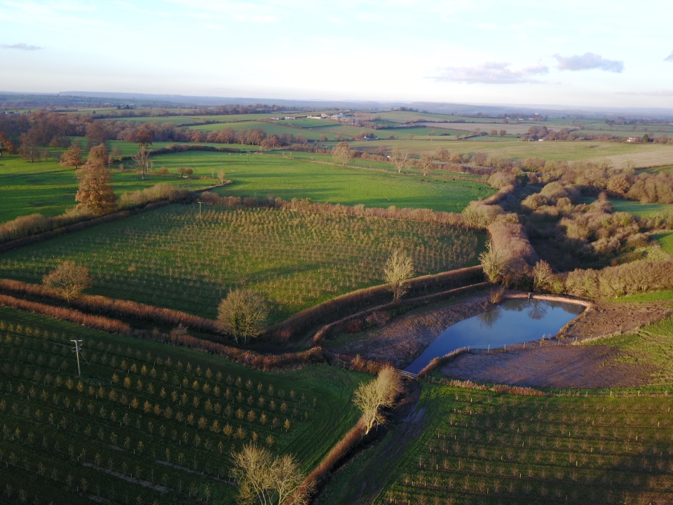
| 19:41, 16 February 2018 | Photo - Leaky Pond.jpg (file) |  |
360 KB | One method that Hills to Levels is constructing leaky ponds and adapting existing ponds to improve flodowater storage capacity. This leaky pond in South Somerset has both a passive and controlled outlet. | 1 |
| 20:13, 16 February 2018 | H2L Catchments.pdf (file) | 1.06 MB | Hills to Levels is a county-wide initiative, working in all of Somerset's river catchments. | 1 | |
| 20:17, 16 February 2018 | HILLStoLEVELScmyk (2).tif (file) | 786 KB | Hills to Levels | 1 | |
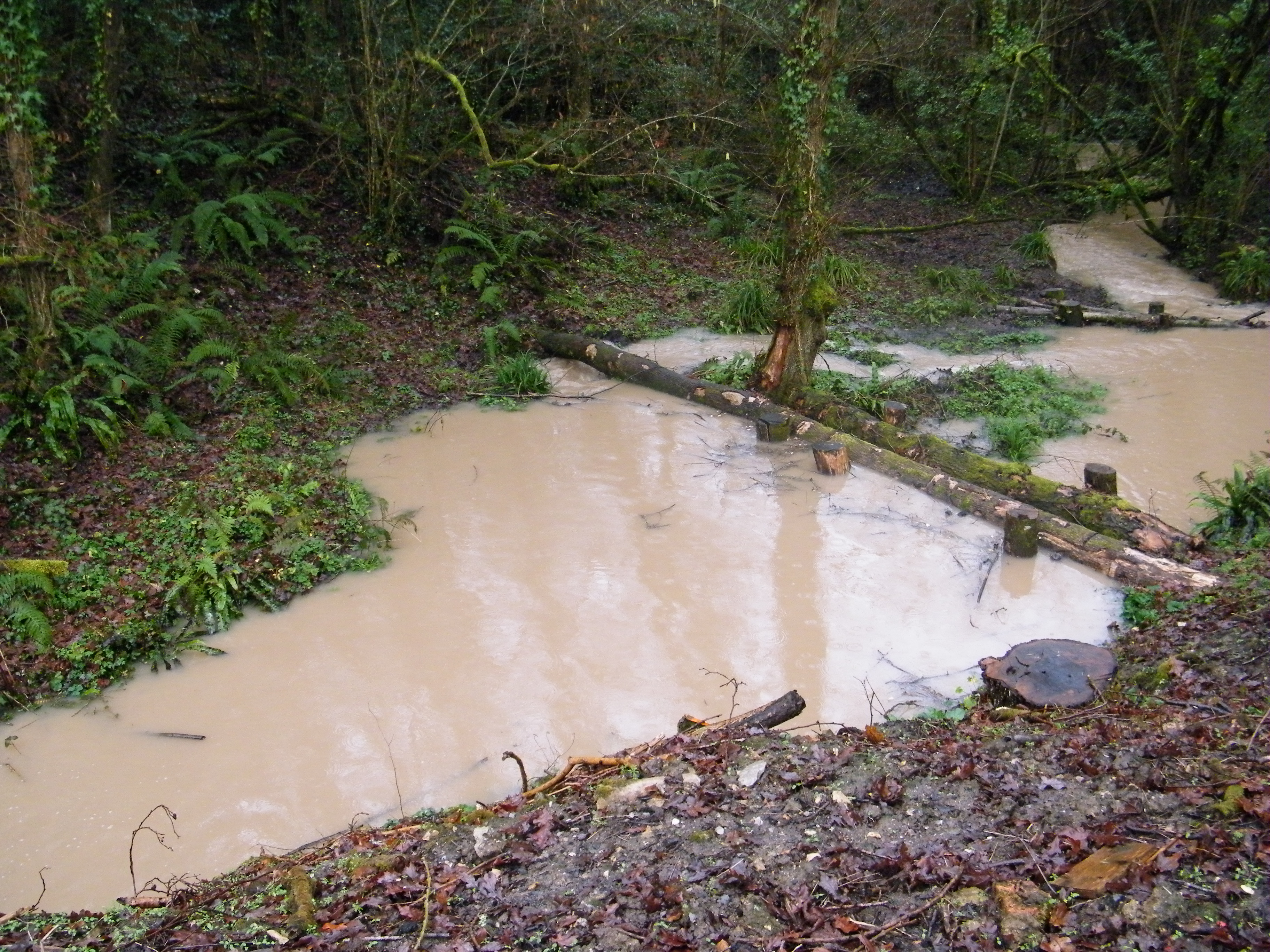
| 20:20, 16 February 2018 | Photo - Leaky Dams in Flood (24.1.18).jpg (file) | .jpg) |
3.48 MB | Leaky woody dams slow the flow and temporarily store water on proto-floodplains | 1 |
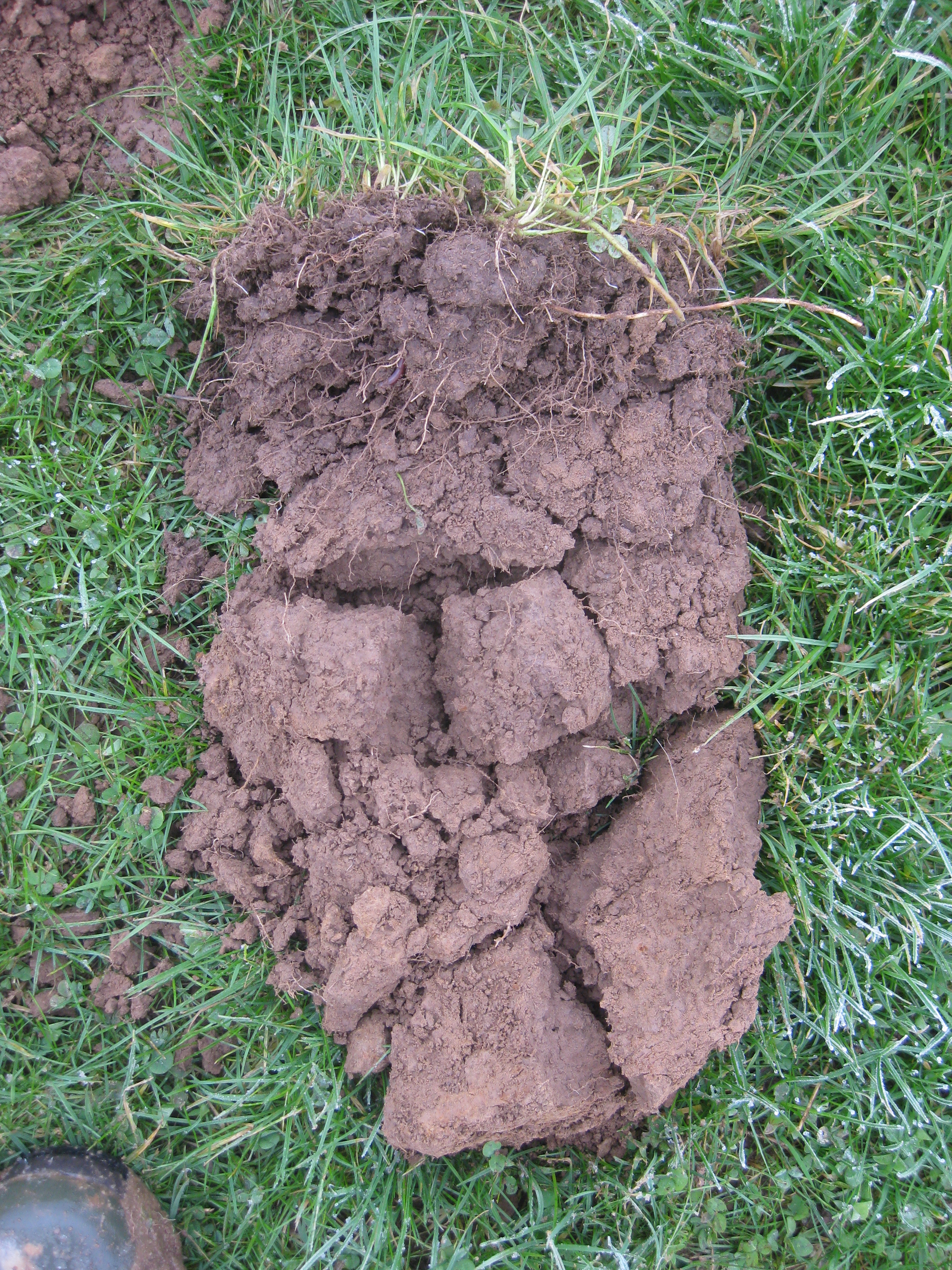
| 20:22, 16 February 2018 | Photo - Soil.jpg (file) |  |
5.85 MB | Soil structure assessments aid farm-specific soil husbandry advice to improve infiltration (reduce run-off and erosion), build soil organic matter and improve soil health while benefiting farm businesses. | 1 |
| 14:31, 23 March 2018 | Monitoring Summary.pdf (file) | 3.68 MB | Hills to Levels - summary of leaky woody dam monitoring results | 1 |