Unused files
Jump to navigation
Jump to search
The following files exist but are not embedded in any page. Please note that other web sites may link to a file with a direct URL, and so may still be listed here despite being in active use.
Showing below up to 50 results in range #551 to #600.
 OA Ennerdale Weir Full Rep.pdf ; 9.64 MB
 Don.png 299 × 422; 133 KB
- Site 2 The Dene.pdf ; 911 KB
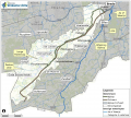
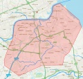 Map showing Don Catchment.jpeg 883 × 837; 223 KB
 WP 20190131 11 05 45 Pro.jpg 1,632 × 920; 727 KB
 0001.jpg 3,507 × 4,960; 3.04 MB
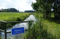 Tongelreep-door-akkerland.jpg 640 × 415; 66 KB
- Manual Restauracion.pdf ; 33.33 MB
 Cultivated.jpg 960 × 720; 175 KB
 Alien sp vs Endemic sp.jpg 960 × 720; 126 KB
 LIFE RIVERLINK.jpg 960 × 720; 150 KB
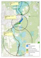
 Keersop Project Map.PNG 611 × 864; 529 KB
 Buurserbeek-2015 SSwidde+(43).jpg 710 × 460; 105 KB
 Schermata 2019-10-24 alle 15.27.11.png 839 × 160; 165 KB
 Schermata 2019-12-06 alle 16.06.27.png 345 × 254; 76 KB
 Logo-fondazione-ok.png 434 × 522; 46 KB
- Weirs Laudal.pdf ; 324 KB
 Borselva after restoration measures.tif 1,683 × 1,049; 3.94 MB
 Sediment capture.JPG 4,032 × 3,024; 5.8 MB
 Leaky Dam.jpg 4,557 × 2,567; 6.35 MB
 20200114 095026.jpg 4,730 × 2,660; 10.22 MB
 Merin work area.png 1,212 × 624; 1.8 MB
 19 09 02 Fordmouth ECOW 1.JPG 4,032 × 3,024; 4.39 MB
 Fordmouth log revetment 1.jpeg 4,032 × 3,024; 2.35 MB
 Fordmouth log revetment 2.jpeg 4,032 × 3,024; 4.39 MB
- 8761-36790-1-PB.pdf ; 2.29 MB
 Graving 2 fangdam avsnitt G .JPG 2,848 × 2,136; 3.13 MB
 Utgraving Avsnitt 2A.JPG 2,848 × 2,136; 3.01 MB
 After measures in the lower part of river.jpeg 3,840 × 2,160; 5.2 MB
 Excavation of sediment ponds.jpeg 2,848 × 2,136; 3.03 MB
 Sediment pond.jpeg 2,848 × 2,136; 3.08 MB
 Sediment pond in the middel part.jpeg 2,848 × 2,136; 3.17 MB
 Sediment pond in the middel part after measure.jpeg 4,032 × 1,960; 5.11 MB
 Cherry Holme scheme18-9-20.jpg 2,304 × 1,536; 2.37 MB
- Catton Palaeo Reconnection Final2015.pdf ; 2.94 MB
- Catton Palaeo Reconnection 2015.pdf ; 2.94 MB
 Bijloop turfvaart Brabantse Delta.png 1,294 × 1,164; 2.14 MB
 MHA 1005398.jpg 2,160 × 1,440; 3.25 MB
 JS2008190174.jpg 5,254 × 3,503; 1.83 MB
 200819 SMcK3.jpg 640 × 480; 106 KB
 Glenballoch.jpg 1,024 × 683; 256 KB
 Life-traisen.jpg 165 × 124; 36 KB
 Waterlichamen Hunze en Aa's.png 1,152 × 1,136; 404 KB
 Pre-restoration location B showing straight incised channel with high banks.jpg 3,264 × 2,448; 7.27 MB
 Pre-restoration location B.jpg 3,264 × 2,448; 7.27 MB
 RiverWiki TEST image.jpg 310 × 236; 19 KB
 0515.jpg 4,000 × 6,000; 5.67 MB
- Monitoring report NIVA 7485-2020.pdf ; 61.6 MB
- Djupsund stream before and after.pdf ; 277 KB


.jpg)


