File list
Jump to navigation
Jump to search
This special page shows all uploaded files.
| Date | Name | Thumbnail | Size | User | Description | Versions |
|---|---|---|---|---|---|---|
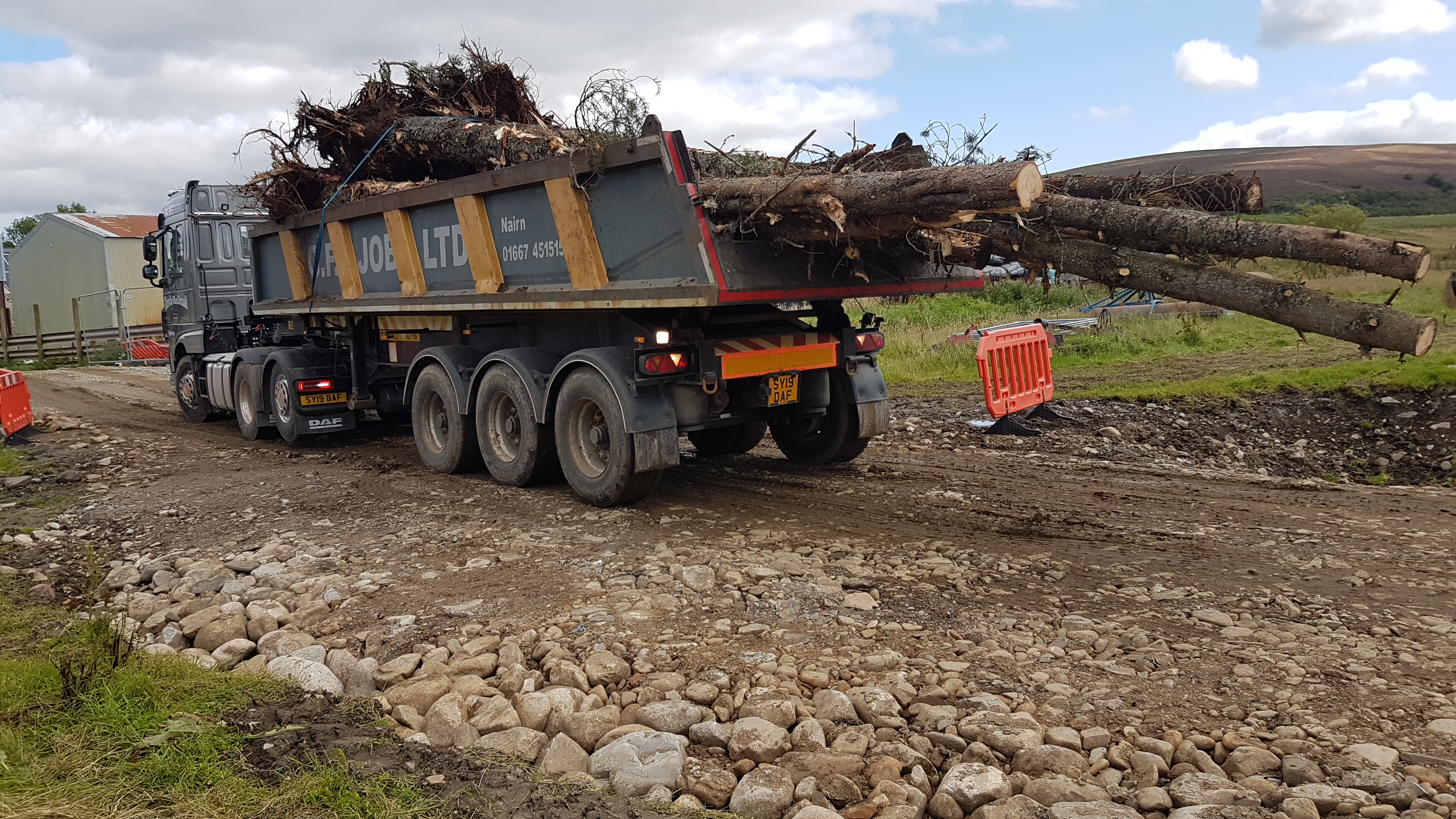
| 12:36, 17 December 2020 | 20190815 151130.jpg (file) |  |
2.16 MB | JosMilner | Log delivery | 1 |
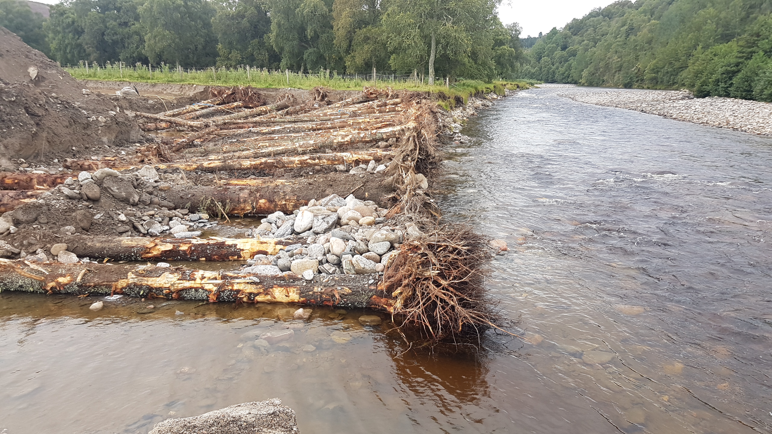
| 12:32, 17 December 2020 | 20190904 101536.jpg (file) |  |
2.69 MB | JosMilner | Tiered logs | 1 |
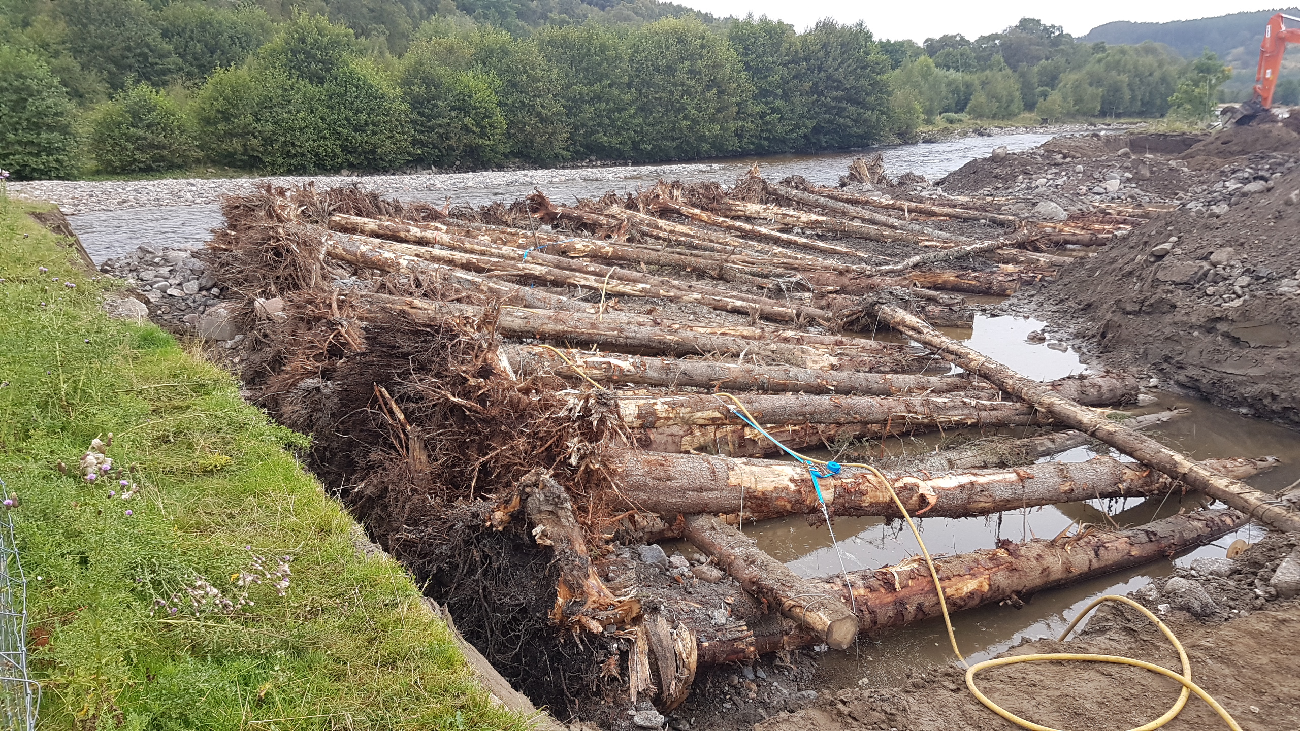
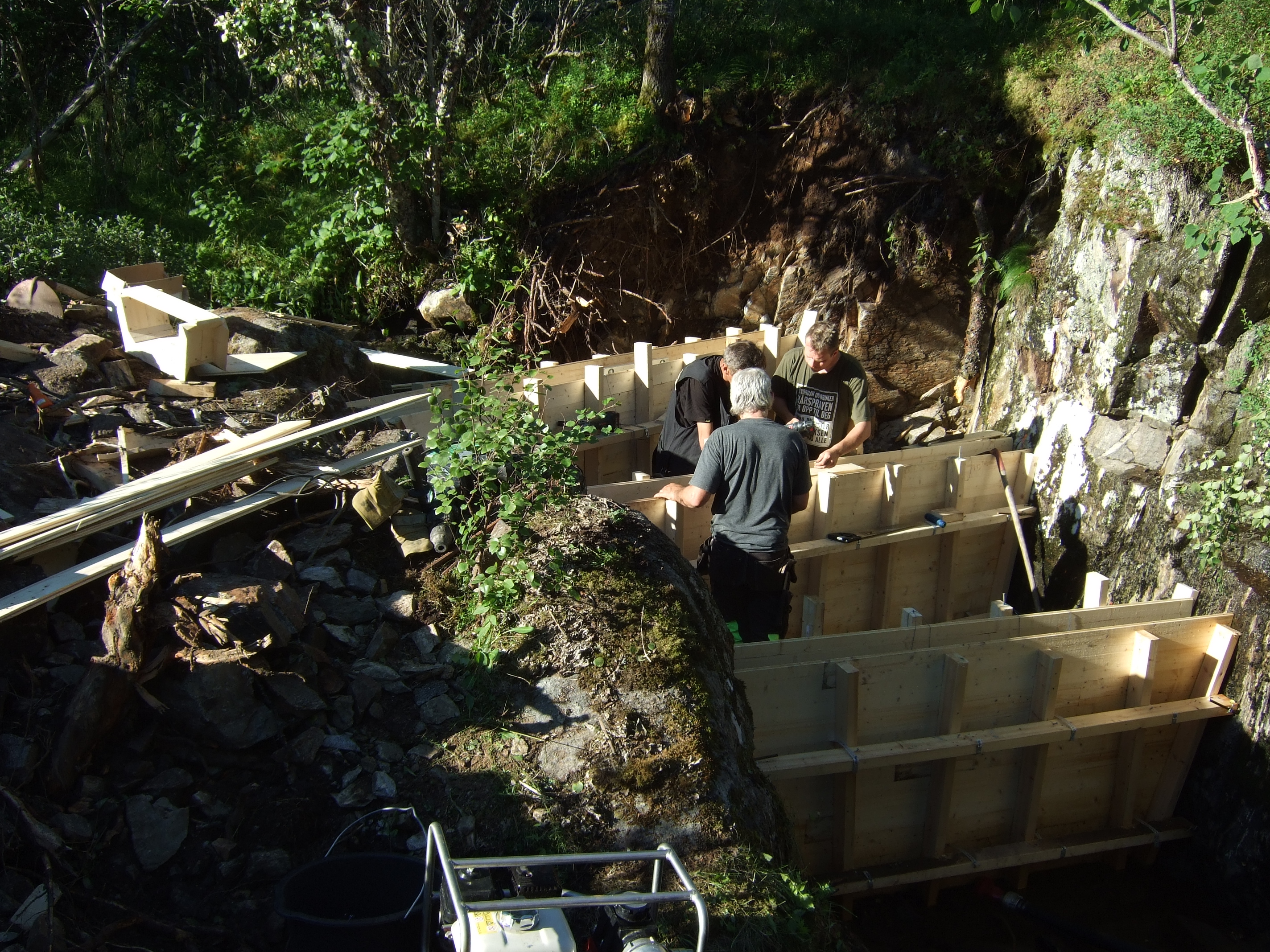
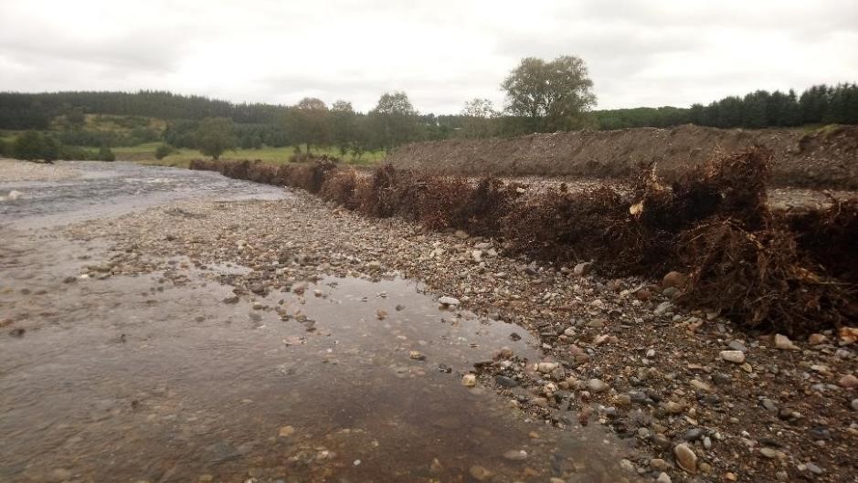
| 12:29, 17 December 2020 | 20190904 101057.jpg (file) |  |
2.27 MB | JosMilner | Installation of logs with root plates at bank toe line. Note excavated material to left & stones used for infill between logs (K.McDougall - EnviroCentre) | 1 |
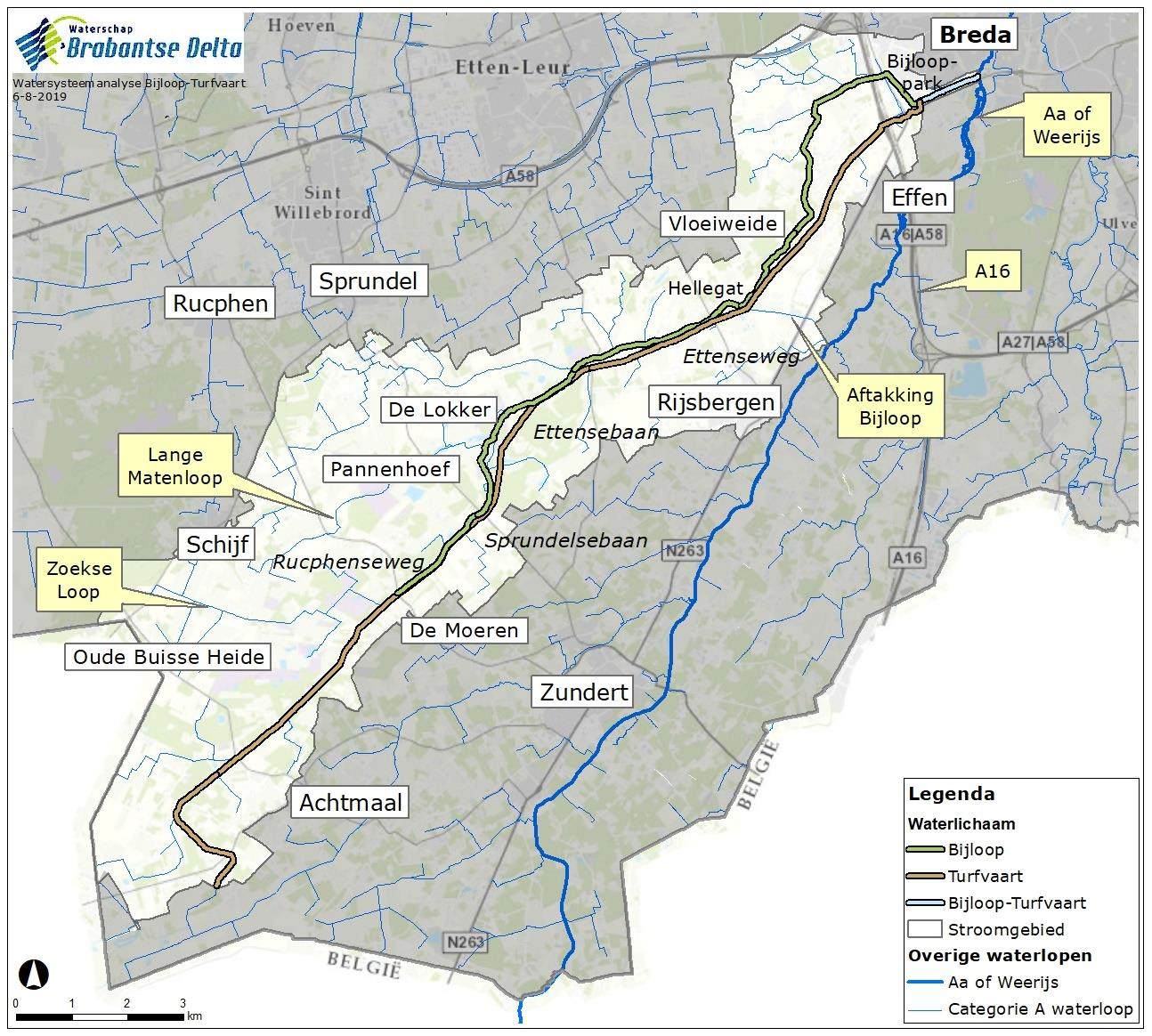
| 13:29, 23 November 2020 | Bijloop turfvaart Brabantse Delta.png (file) |  |
2.14 MB | Bas Wullems | Map of the Bijloop/Turfvaart rivers. This case study takes place near the location marked Vloeiweide. Image source: Watersysteemanalyse Bijloop-Turfvaart, Waterschap Brabantse Delta. https://www.brabantsedelta.nl/_flysystem/media/watersysteemanalyse-b... | 1 |
| 13:39, 12 November 2020 | Catton Palaeo Reconnection 2015.pdf (file) | 2.94 MB | Nick Mott | 1 | ||
| 13:20, 12 November 2020 | Catton Palaeo Reconnection Final2015.pdf (file) | 2.94 MB | Nick Mott | 1 | ||
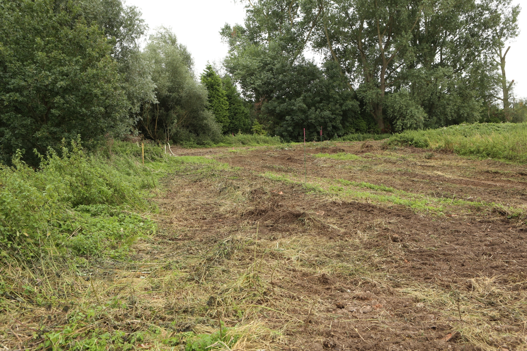
| 12:46, 12 November 2020 | Cherry Holme 22-9-20.jpg (file) |  |
7.6 MB | Nick Mott | 1 | |
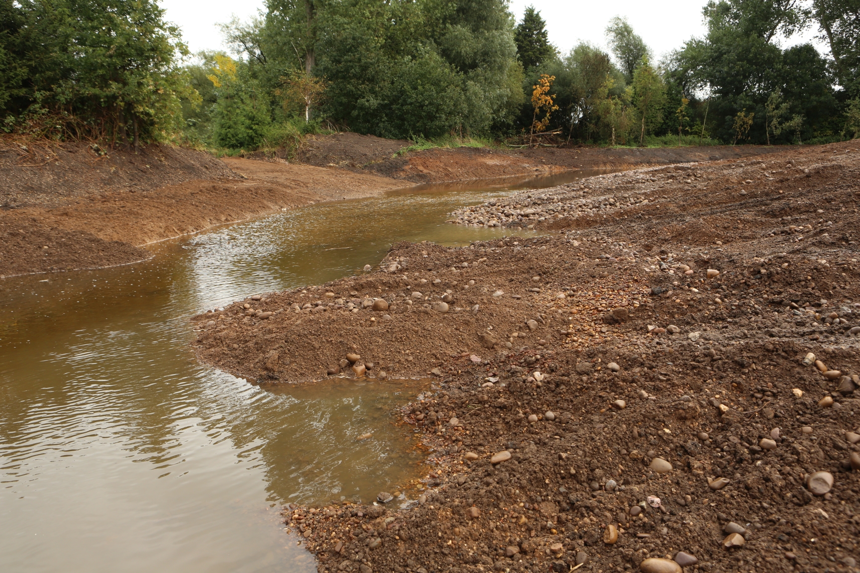
| 12:45, 12 November 2020 | Cherry Holme 23-09-20.jpg (file) |  |
1.85 MB | Nick Mott | 1 | |
| 12:40, 12 November 2020 | 691A1908 Cherry Holme Day 1 10 September 2020 lr BEFORE.jpg (file) |  |
2.01 MB | Nick Mott | 1 | |
| 12:37, 12 November 2020 | 691A1889 Cherry Holme Day 1 10 September 2020 lr BEFORE.jpg (file) |  |
1.68 MB | Nick Mott | 1 | |
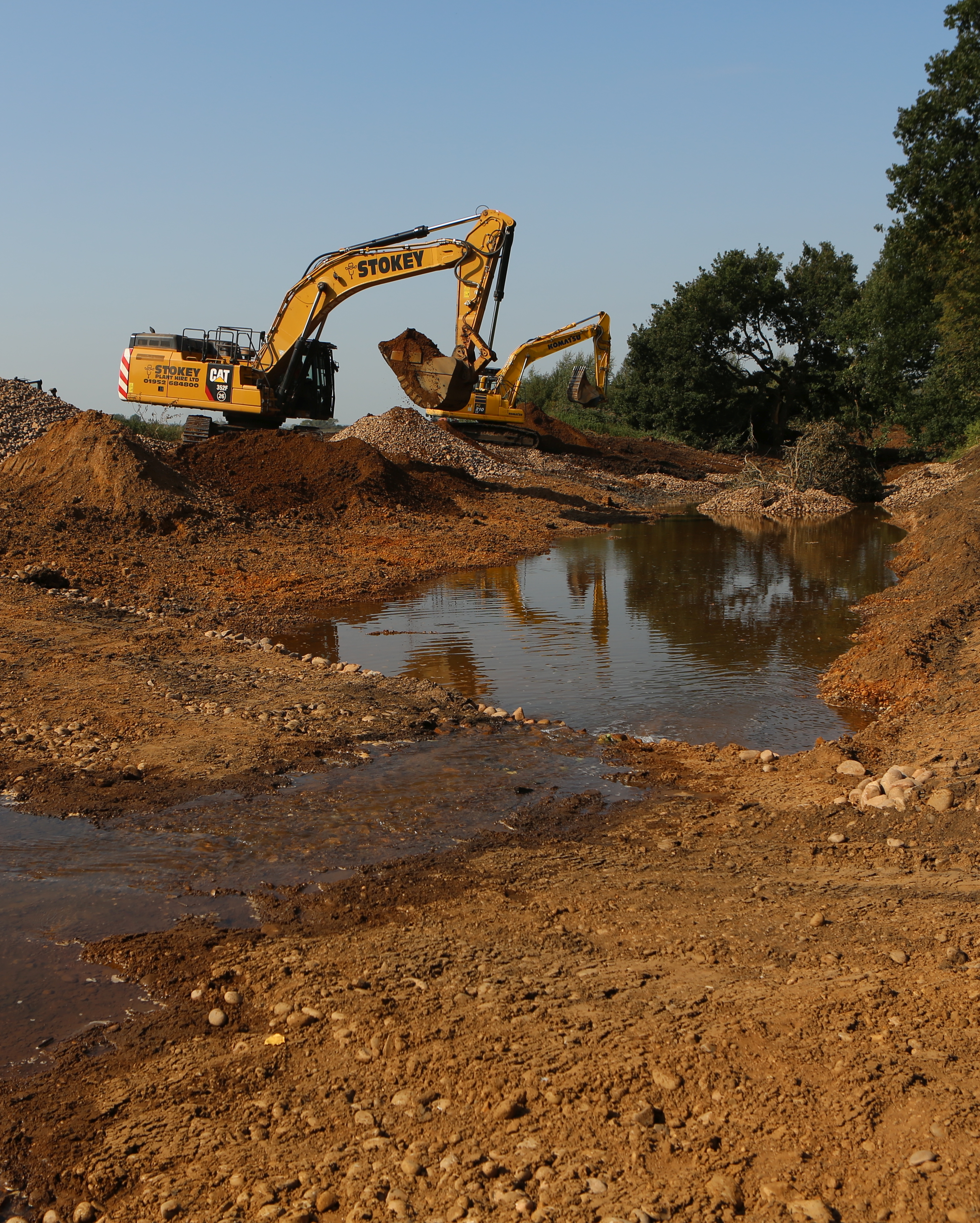
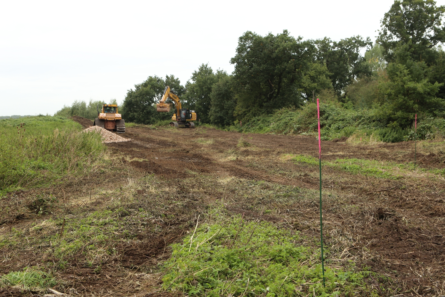
| 12:24, 12 November 2020 | Cherry Holme scheme18-9-20.jpg (file) |  |
2.37 MB | Nick Mott | 1 | |
| 14:15, 2 November 2020 | Gravel for spawning grounds.jpg (file) |  |
5.97 MB | KristinKlausen | Gravel for spawning grounds. Photo: Kristin B. Klausen, local watercoordinator. | 1 |
| 14:13, 2 November 2020 | After digging of ditches and reinforcement of ditches.jpg (file) |  |
5.54 MB | KristinKlausen | After digging of ditches and reinforcement of ditches. Photo: Kristin B. Klausen, local watercoordinator. | 1 |
| 14:11, 2 November 2020 | Digging of ditches and reinforcement of ditches.JPG (file) |  |
2.63 MB | KristinKlausen | Digging of ditches and reinforcement of ditches. Photo: Kristin B. Klausen, local watercoordinator. | 1 |
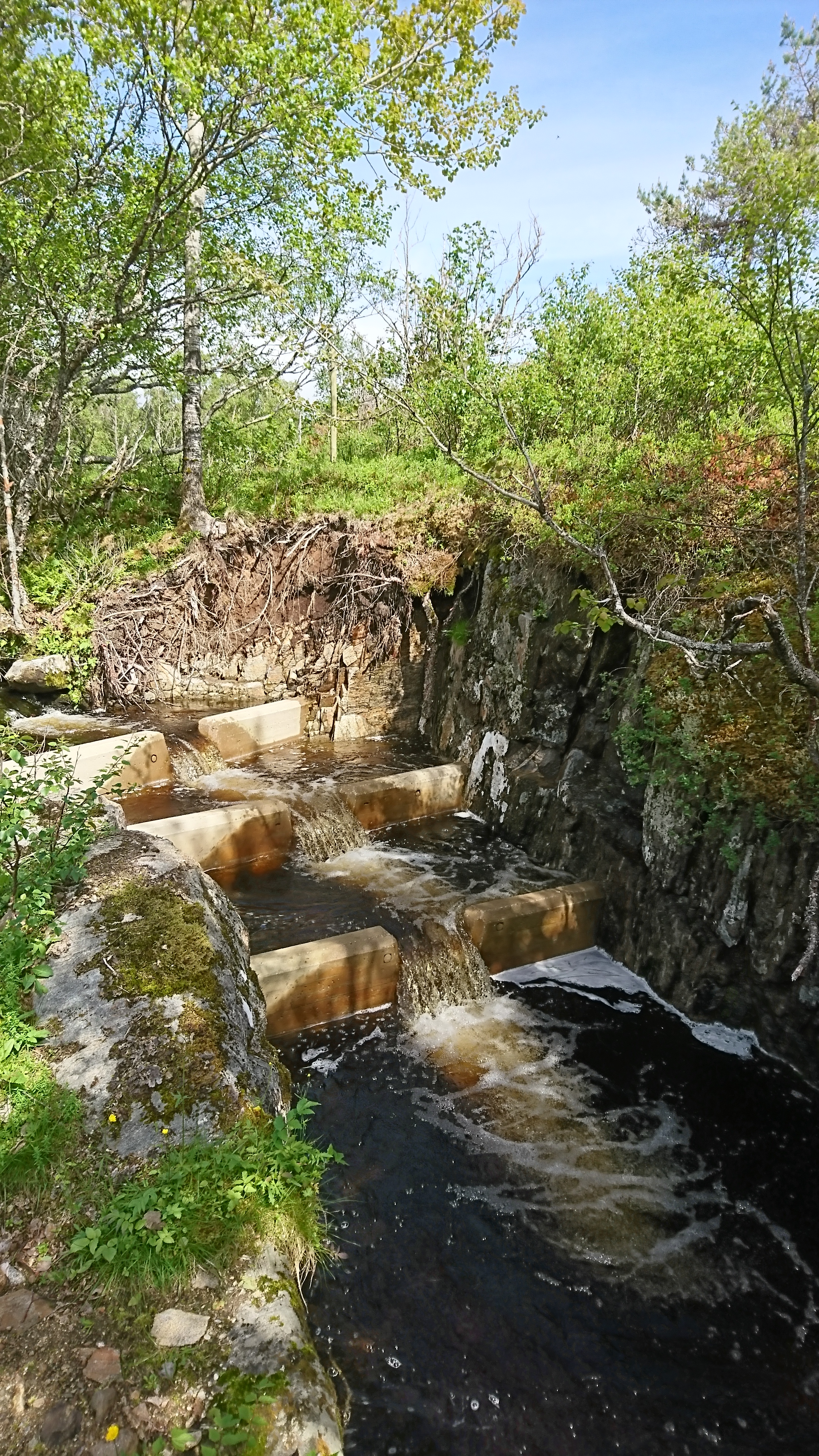
| 14:06, 2 November 2020 | Fish ladder after measure.JPG (file) |  |
5.09 MB | KristinKlausen | Fish ladder after measure. Photo: Kristin B. Klausen, local watercoordinator. | 1 |
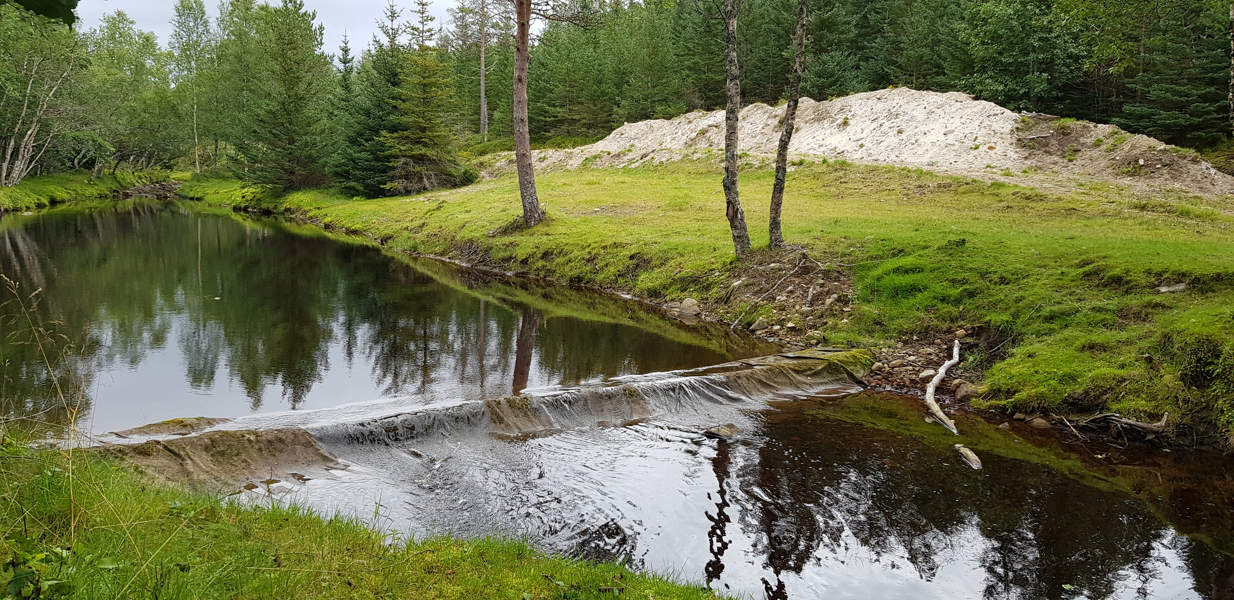
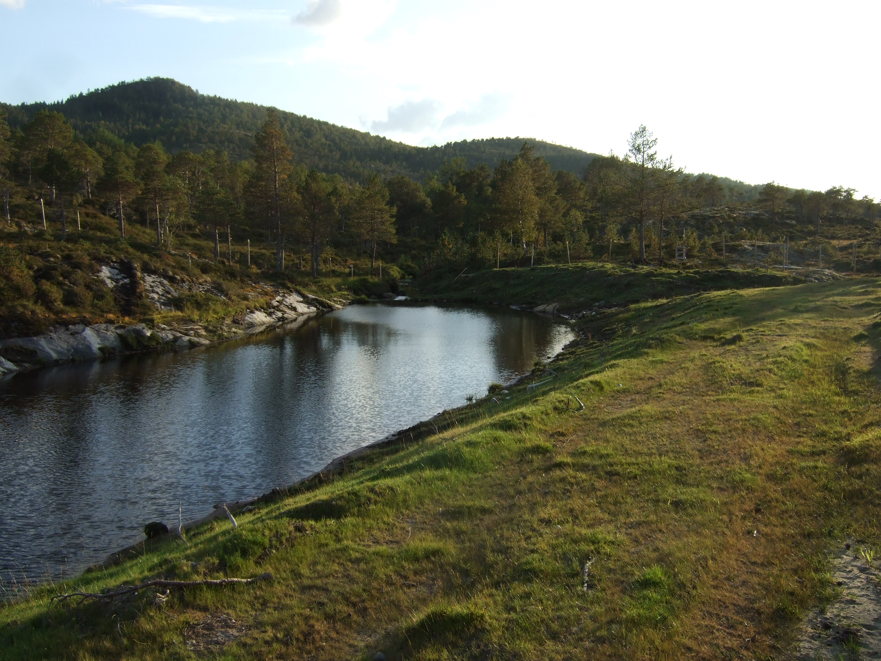
| 14:03, 2 November 2020 | Sediment pond in the middle part after measure.jpg (file) |  |
5.11 MB | KristinKlausen | Sediment ponds in the middle part of the river after measure. Photo: Kristin B. Klausen, local watercoordinator. | 1 |
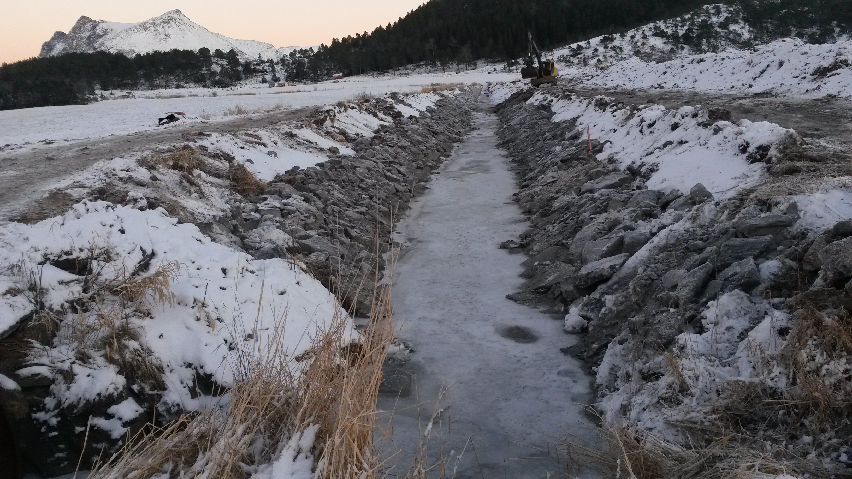
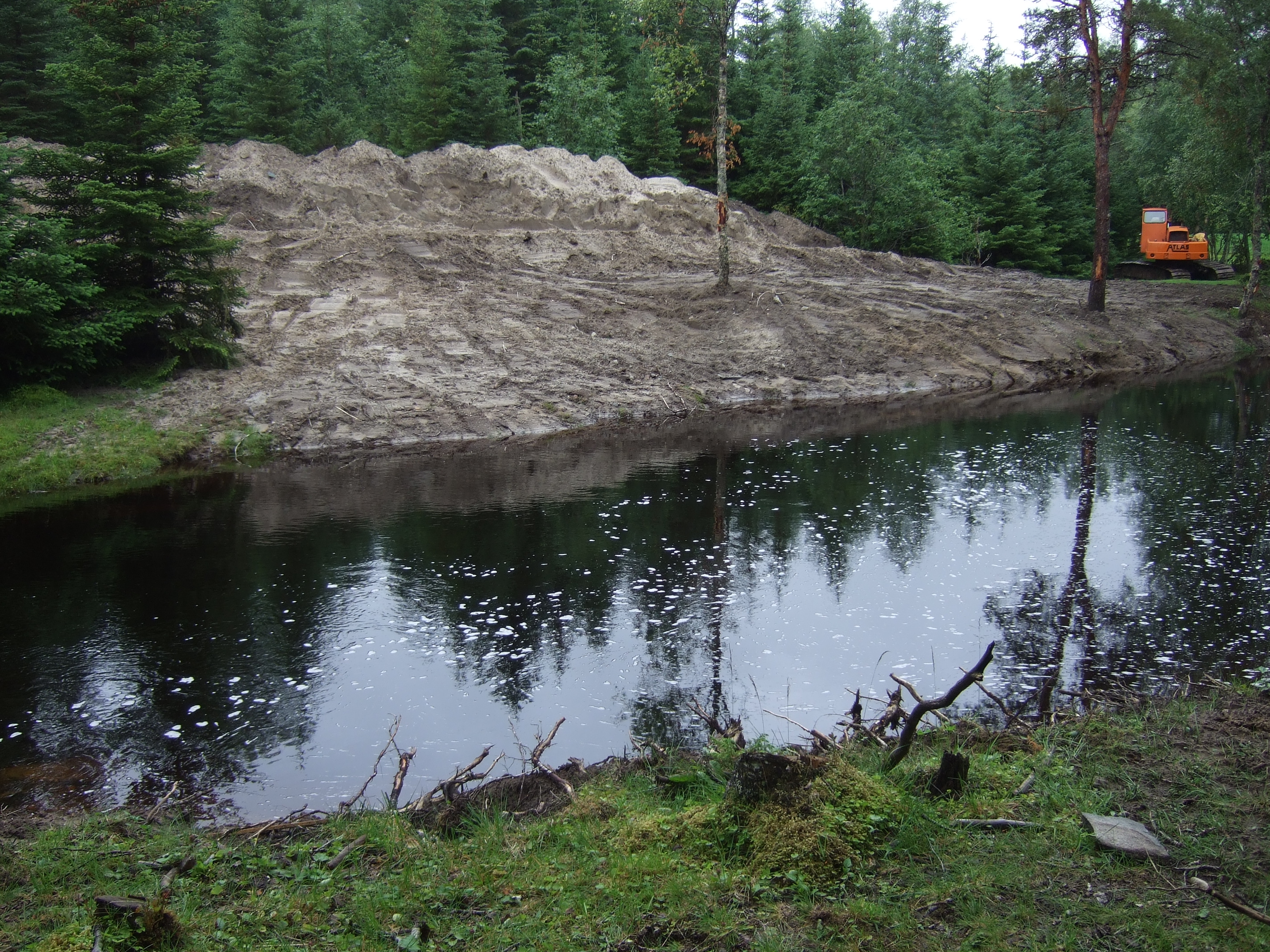
| 14:02, 2 November 2020 | Excavation of sediment pond in the middel part.JPG (file) |  |
3.17 MB | KristinKlausen | Excavation of sediment ponds in the middle part of the river. Photo: Kjetil Hansen, Rødøy municipality. Photo: Kjetil Hansen, Rødøy municipality. Photo: Kjetil Hansen, Rødøy municipality | 1 |
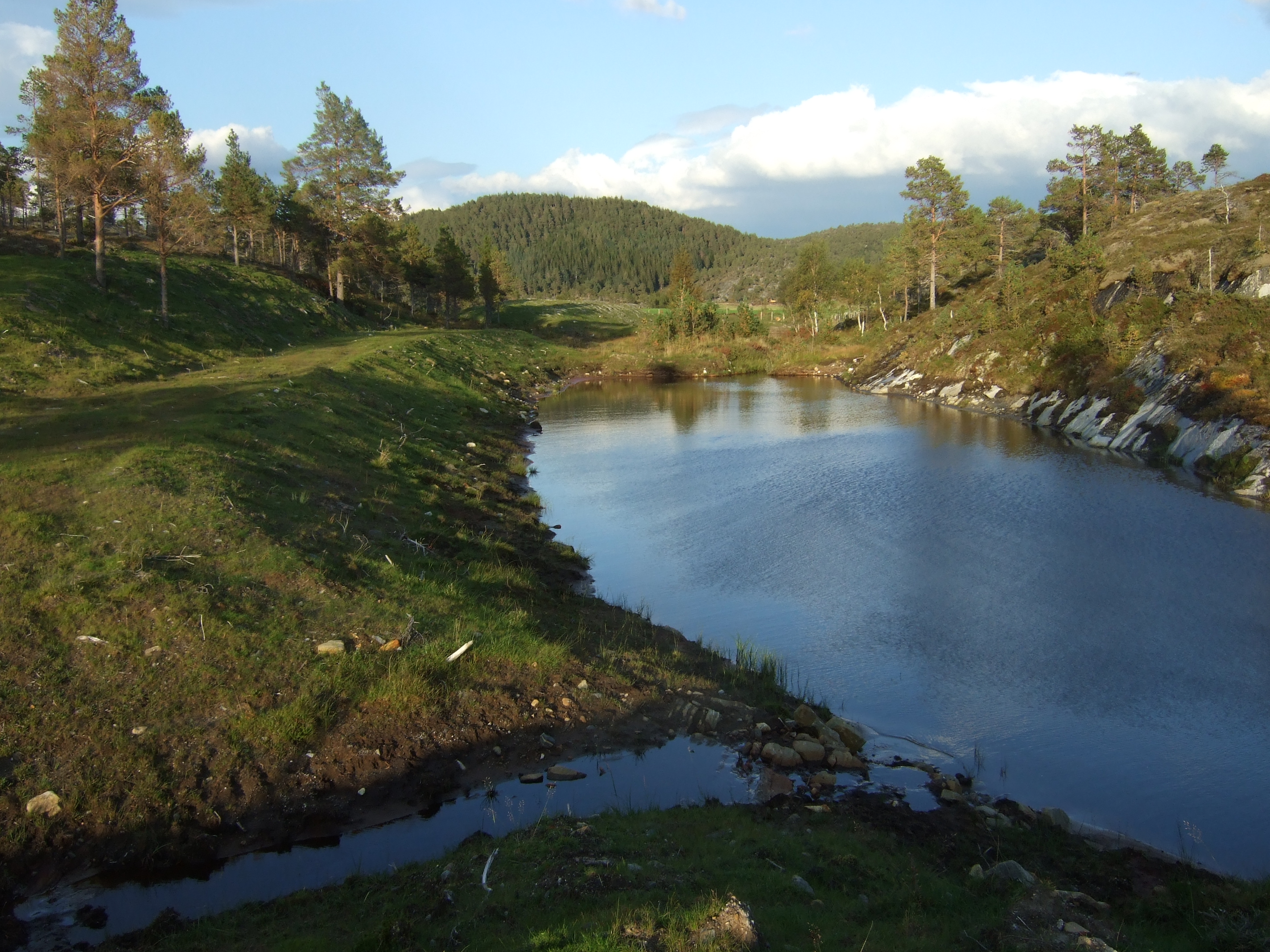
| 13:58, 2 November 2020 | Sediment pond after measure.JPG (file) |  |
2.97 MB | KristinKlausen | Sediment pond after measure. Photo: Kjetil Hansen, Rødøy municipality. Photo: Kjetil Hansen, Rødøy municipality | 1 |
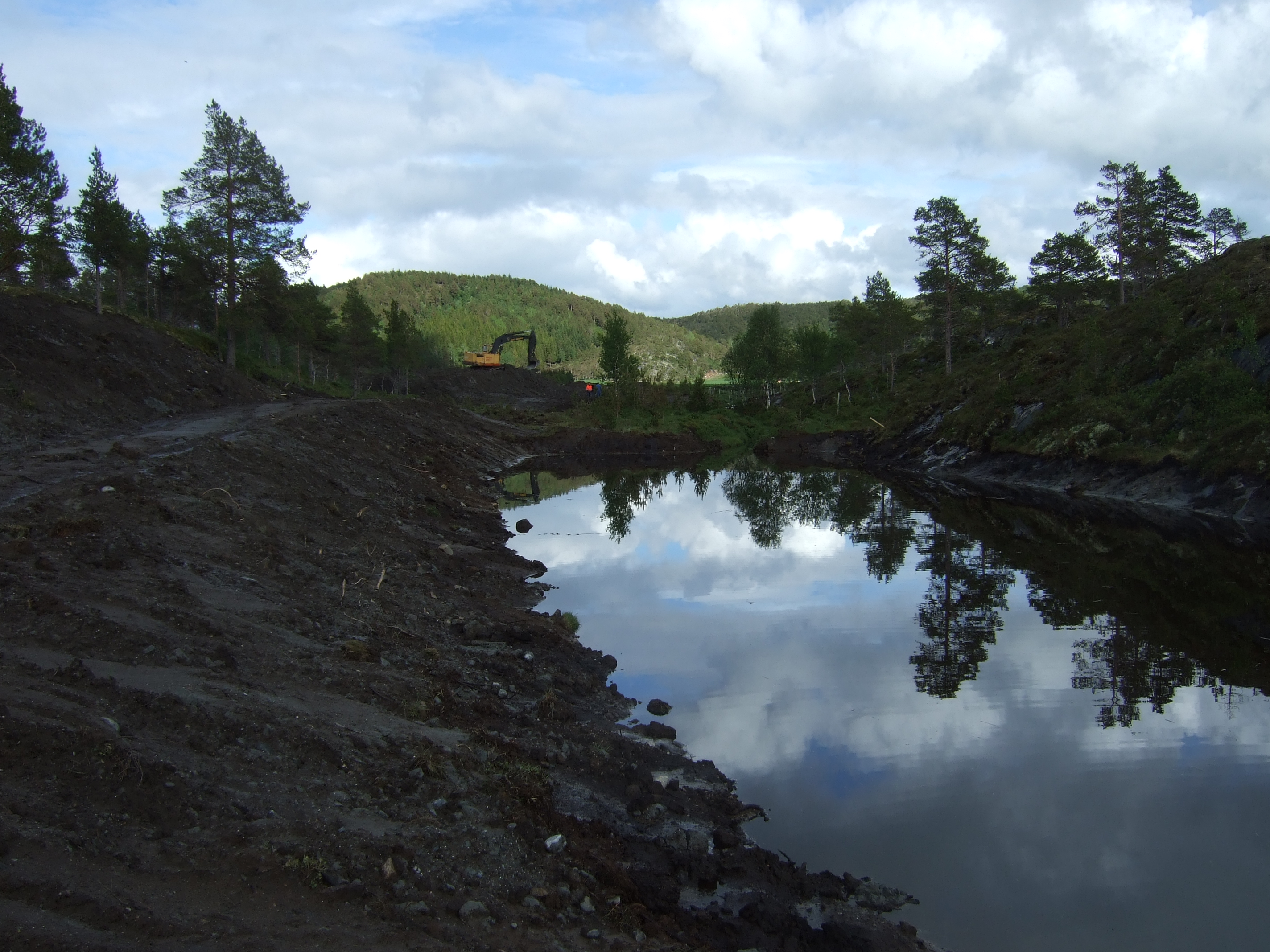
| 13:56, 2 November 2020 | Excavation of sediment ponds.JPG (file) |  |
3.13 MB | KristinKlausen | Excavation of sediment ponds in the upper part of the river. Photo: Kjetil Hansen, Rødøy municipality | 1 |
| 13:53, 2 November 2020 | After measures in the lower part of river.JPG (file) |  |
5.2 MB | KristinKlausen | After removal of the inorganic material (sludge/fine sand), reinfoorcement of river bank and gravel for spawning grounds. Photo: Kristin B. Klausen, local watercoordinator. | 1 |
| 13:51, 2 November 2020 | Removing inorganic material.JPG (file) |  |
3.01 MB | KristinKlausen | Removing inorganic material (sludge/fine sand. Photo: Kjetil Hansen, Rødøy municipality | 1 |
| 13:46, 2 November 2020 | Construction of fishing ladder.jpg (file) |  |
3.12 MB | KristinKlausen | Construction of fishing ladder. Photo: Kjetil Hansen, Rødøy municipality | 1 |
| 13:43, 2 November 2020 | Sediment pond in the middel part after measure.jpeg (file) |  |
5.11 MB | KristinKlausen | Sediment ponds in the middle part of the river after measure. Photo: Kristin B. Klausen, local watercoordinator. | 1 |
| 13:41, 2 November 2020 | Sediment pond in the middel part.jpeg (file) |  |
3.17 MB | KristinKlausen | Excavation of sediment ponds in the middle part of the river. Photo: Kjetil Hansen, Rødøy municipality. | 1 |
| 13:39, 2 November 2020 | Sediment pond.jpeg (file) |  |
3.08 MB | KristinKlausen | Sediment pond. Photo: Kjetil Hansen, Rødøy municipality | 1 |
| 13:35, 2 November 2020 | Excavation of sediment ponds.jpeg (file) |  |
3.03 MB | KristinKlausen | Excavation of sediment ponds in the upper part of the river. Photo: Kjetil Hansen, Rødøy municipality | 1 |
| 11:18, 2 November 2020 | After measures in the lower part of river.jpeg (file) |  |
5.2 MB | KristinKlausen | After removal of the inorganic material (sludge/fine sand), reinfoorcement of river bank and gravel for spawning grounds. Photo: Kristin B. Klausen, local water coordinator. | 1 |
| 11:02, 2 November 2020 | Utgraving Avsnitt 2A.JPG (file) |  |
3.01 MB | KristinKlausen | Removing inorganic material (sludge/fine sand). Photo: Kjetil Hansen, Rødøy municipality. | 1 |
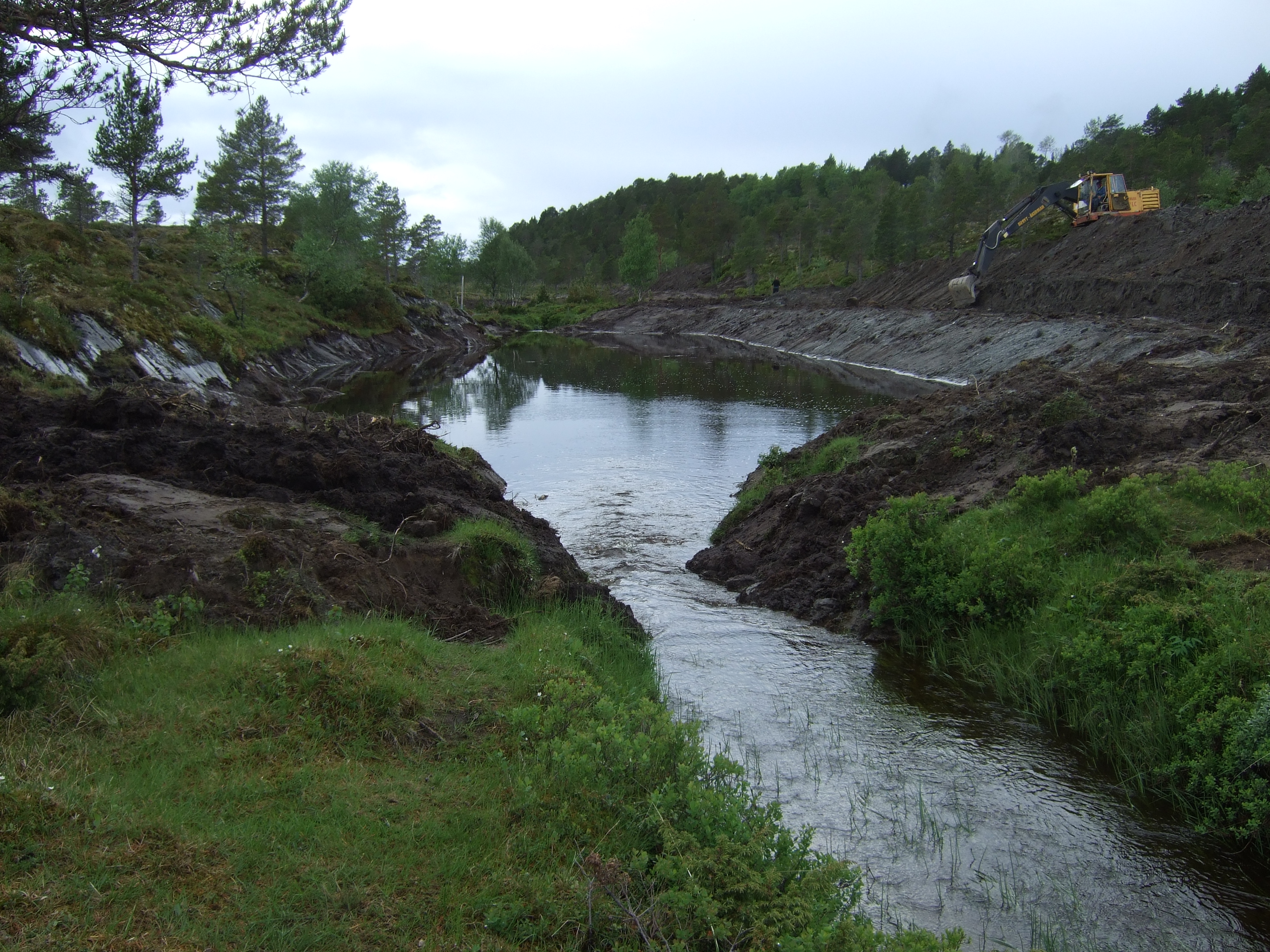
| 09:52, 2 November 2020 | Graving 2 fangdam avsnitt G .JPG (file) |  |
3.13 MB | KristinKlausen | Diggin out sediment ponds in the upper part of the river. Photo: Kjetil Hansen | 2 |
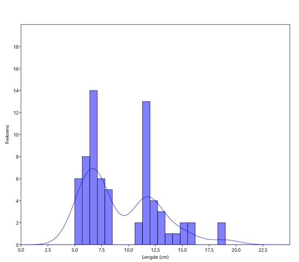
| 20:11, 1 November 2020 | Mjollost 3 (upstreams) october 2020.jpg (file) | _october_2020.jpg) |
25 KB | Tbgmiseg | 1 | |
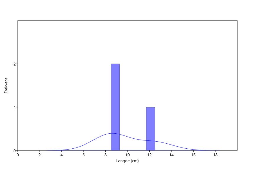
| 20:11, 1 November 2020 | Mjollost 2 (upstreams) october 2020.jpg (file) | _october_2020.jpg) |
21 KB | Tbgmiseg | 1 | |
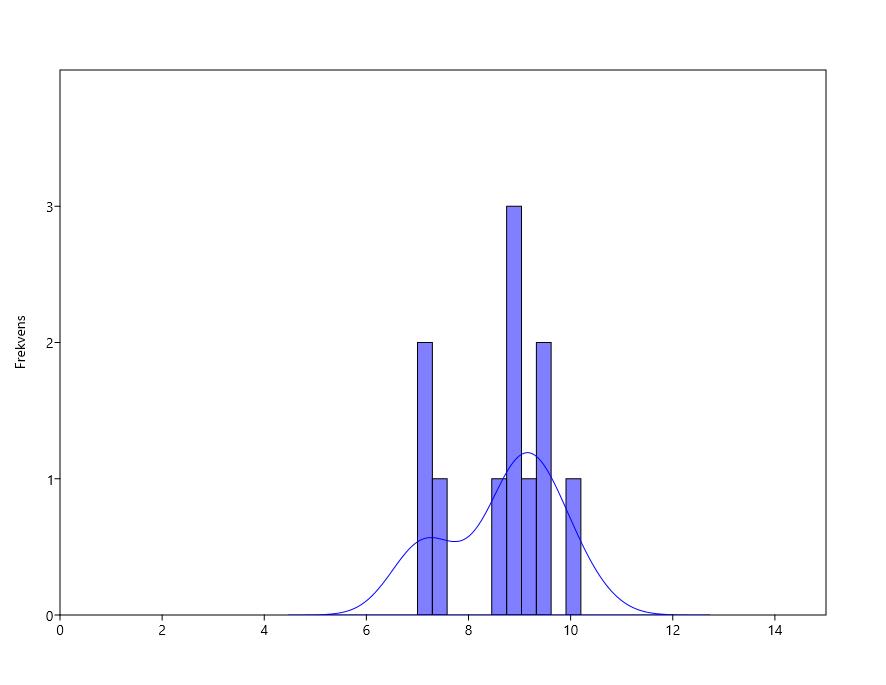
| 20:04, 1 November 2020 | Mjollost 1 (downtreams) october 2020.jpg (file) | _october_2020.jpg) |
28 KB | Tbgmiseg | Frequency of lengths Salmo trutta in Station Mjollost 1, october 2020. | 1 |
| 12:41, 1 November 2020 | Mjollostbekken 1959-79 (venstre) 2017 (hoyre).jpg (file) | _2017_(hoyre).jpg) |
178 KB | Tbgmiseg | 2 | |
| 22:45, 28 October 2020 | 8761-36790-1-PB.pdf (file) | 2.29 MB | Faroukbouhezila | Water quality assessment in Réghaïa (North of Algeria) lake basin by using traditional approach and water quality indices | 1 | |
| 14:19, 14 October 2020 | RWRS Fact Sheet 9 -Lenwade.pdf (file) | 414 KB | Amy.butcher | 1 | ||
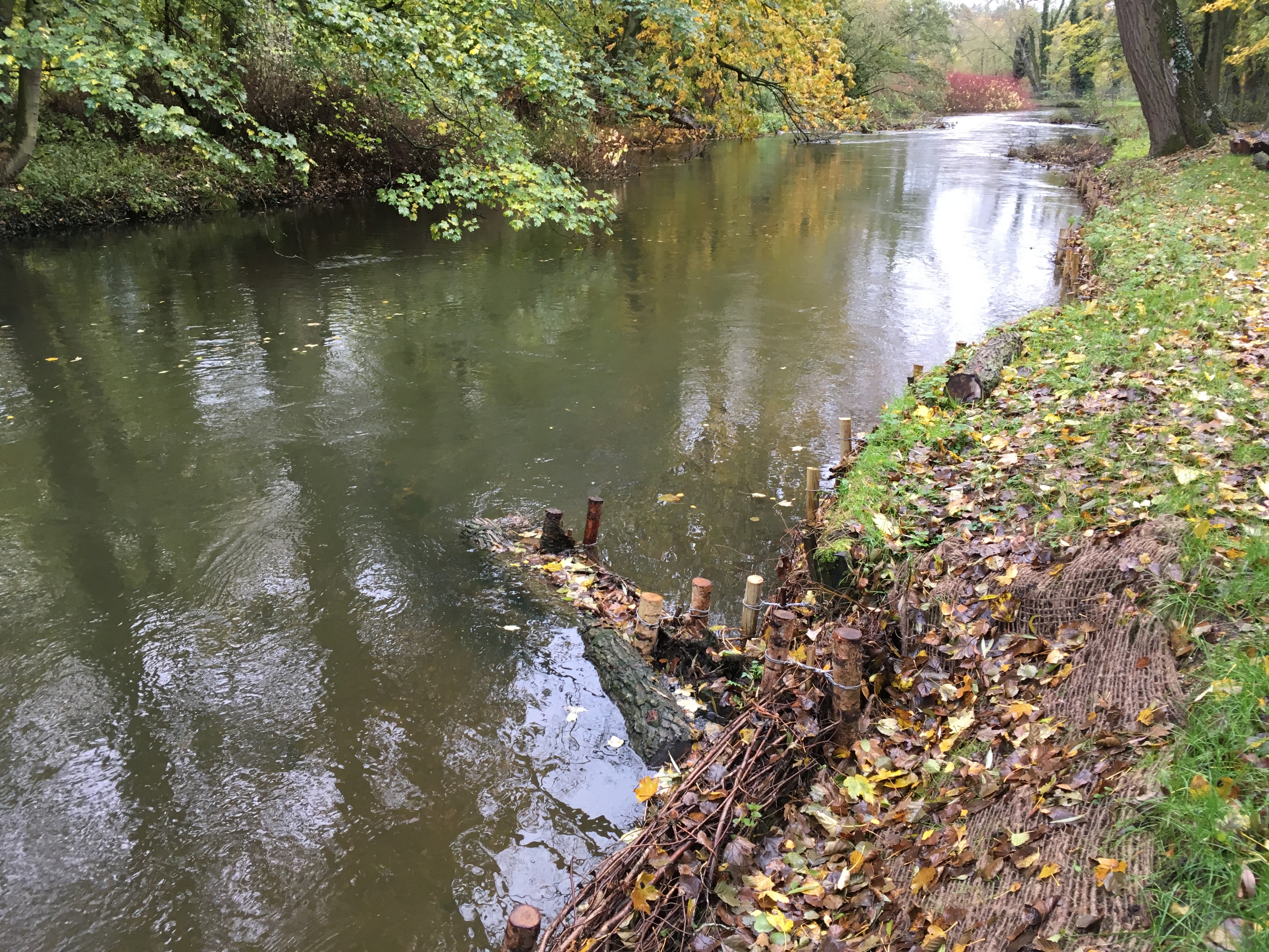
| 14:18, 14 October 2020 | LenwadeDeflector.JPG (file) |  |
4.45 MB | Amy.butcher | Woody material deflector secured into place using chestnut stakes. Erosion protection jute matting and brushwood toe protection. | 1 |
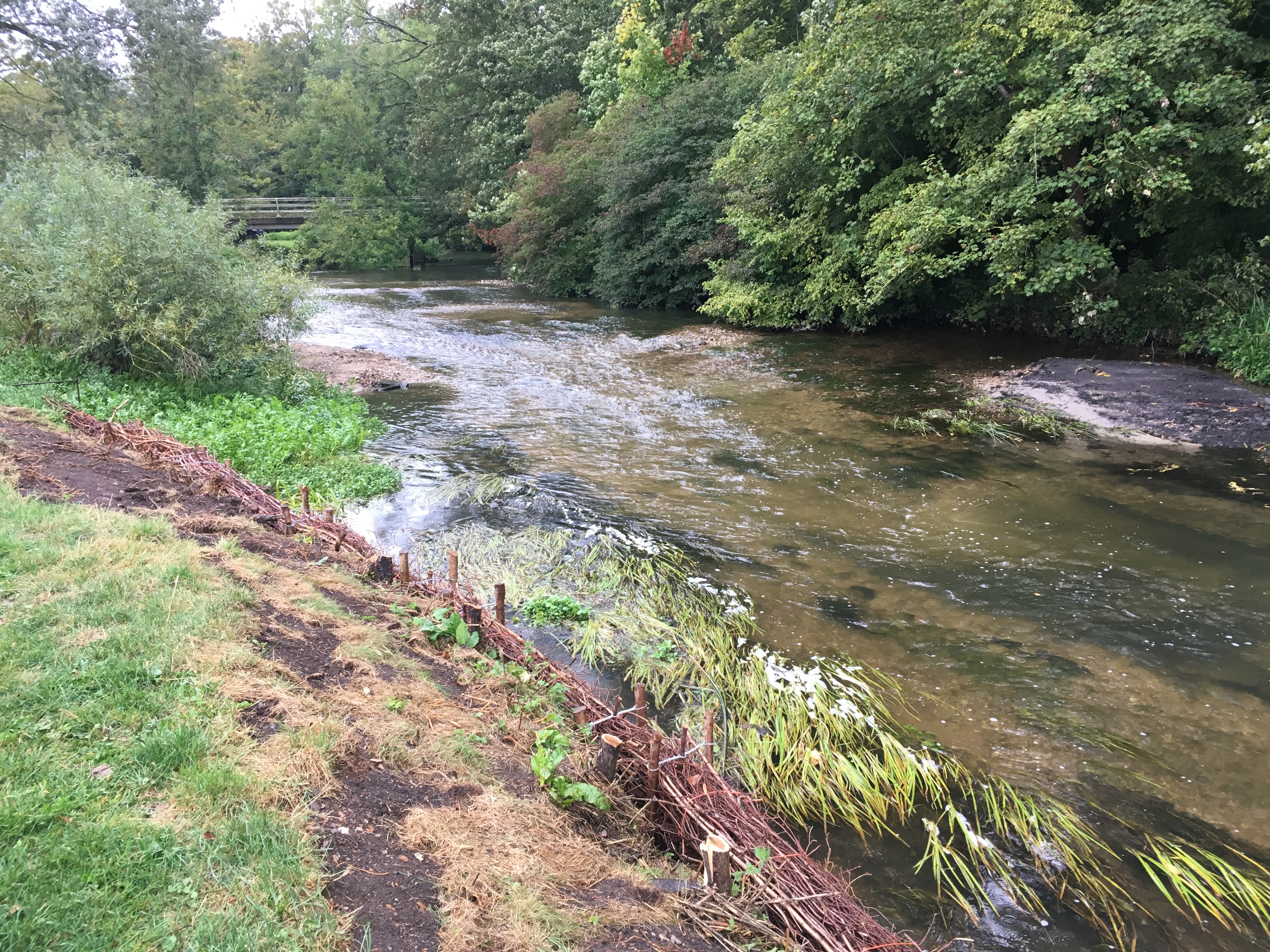
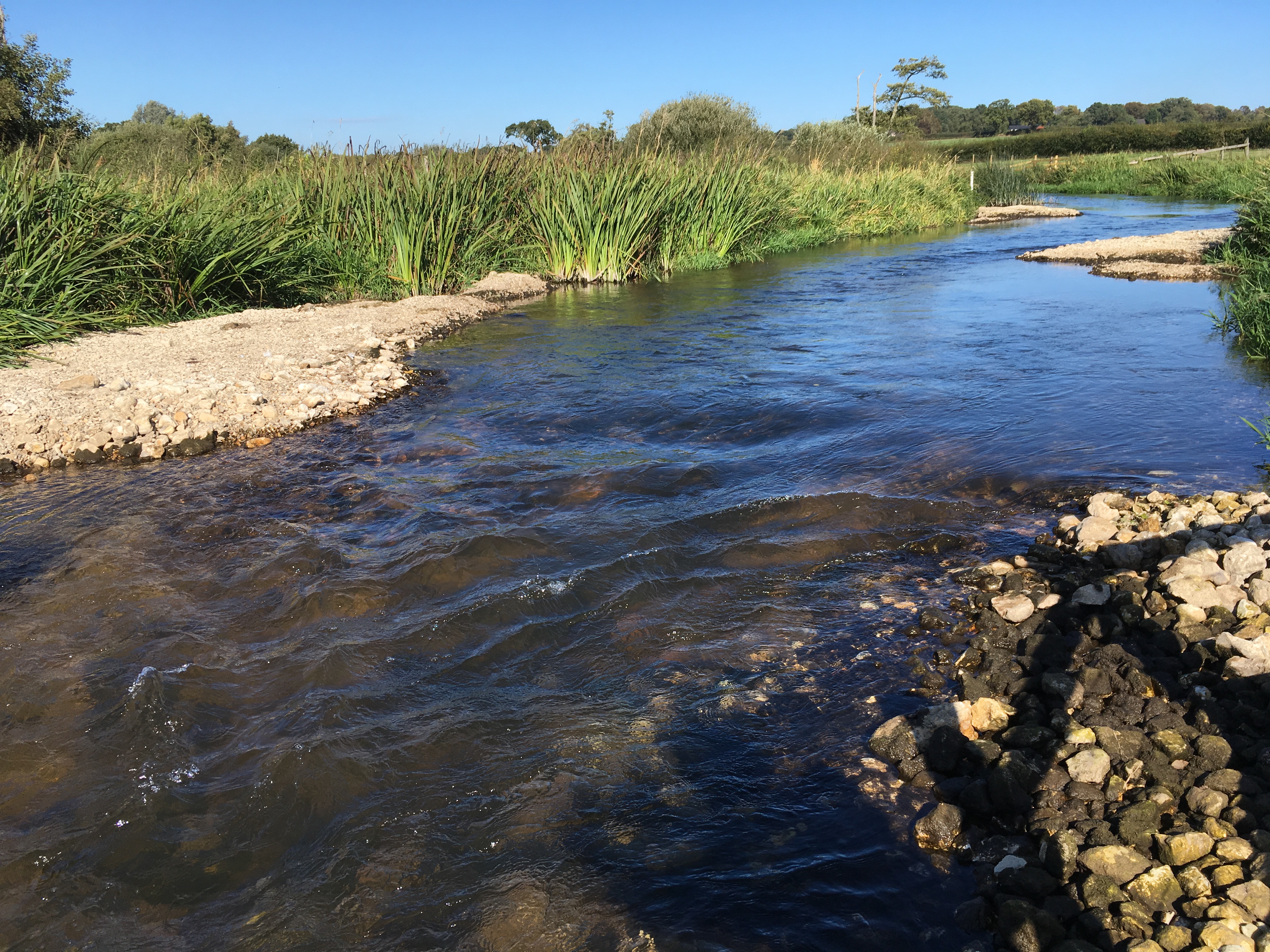
| 14:09, 14 October 2020 | LenwadeBankWorks.JPG (file) |  |
5.1 MB | Amy.butcher | View from downstream of re-engineered river bed. Also showing re-profiled river bank with brushwood faggots protecting toe of bank. | 1 |
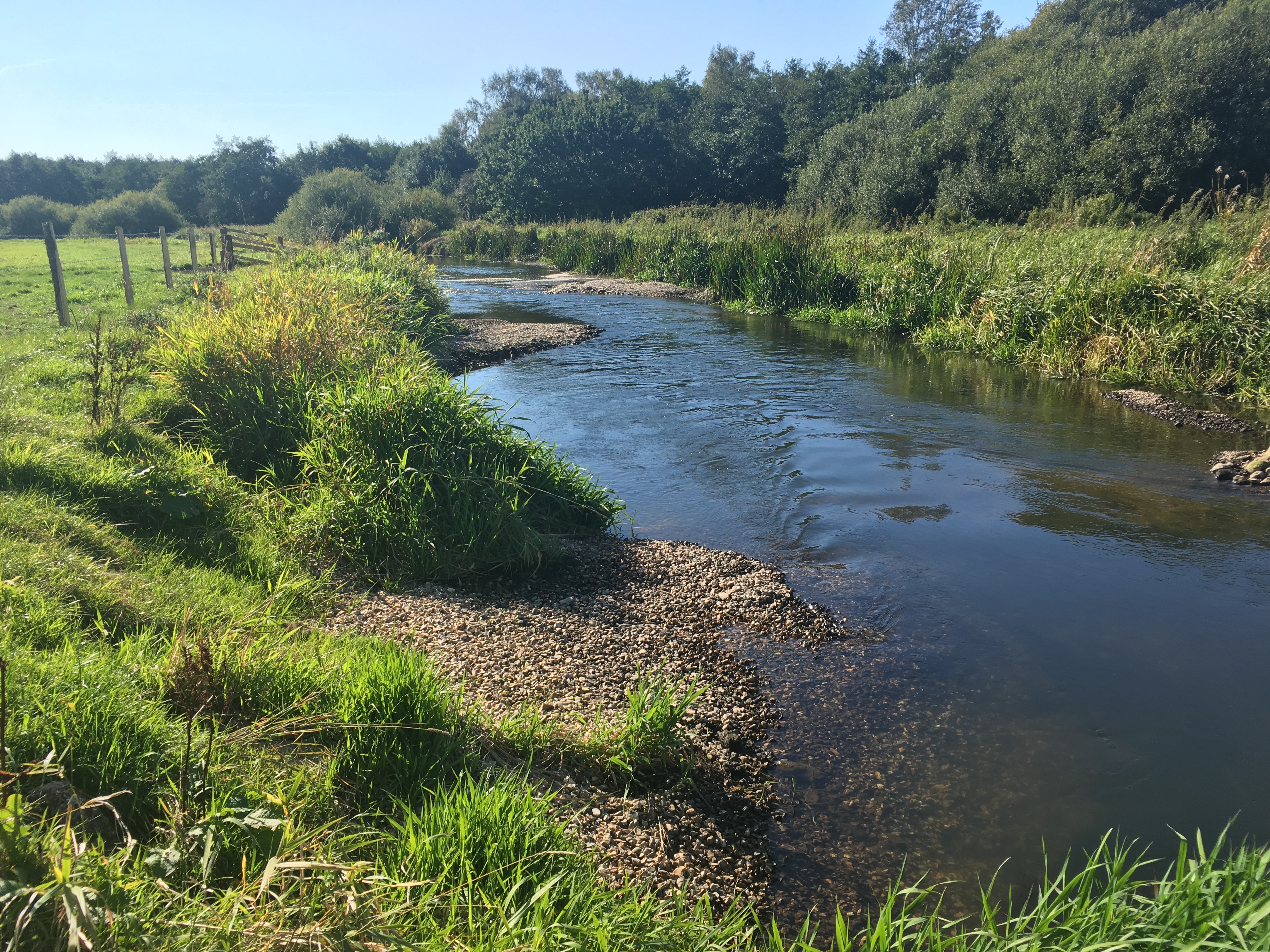
| 14:06, 14 October 2020 | LenwadeRiverBedWorks.JPG (file) |  |
4.54 MB | Amy.butcher | Existing gravel river bed worked using amphibious excavator to create riffles and pools. | 1 |
| 12:54, 14 October 2020 | FryBay.MOV (file) | 40.37 MB | Amy.butcher | Fry congregating and taking refuge in shallow, warmer, cattle drink. | 1 | |
| 12:49, 14 October 2020 | RWRS Fact Sheet 8 - Costessey.pdf (file) | 760 KB | Amy.butcher | 1 | ||
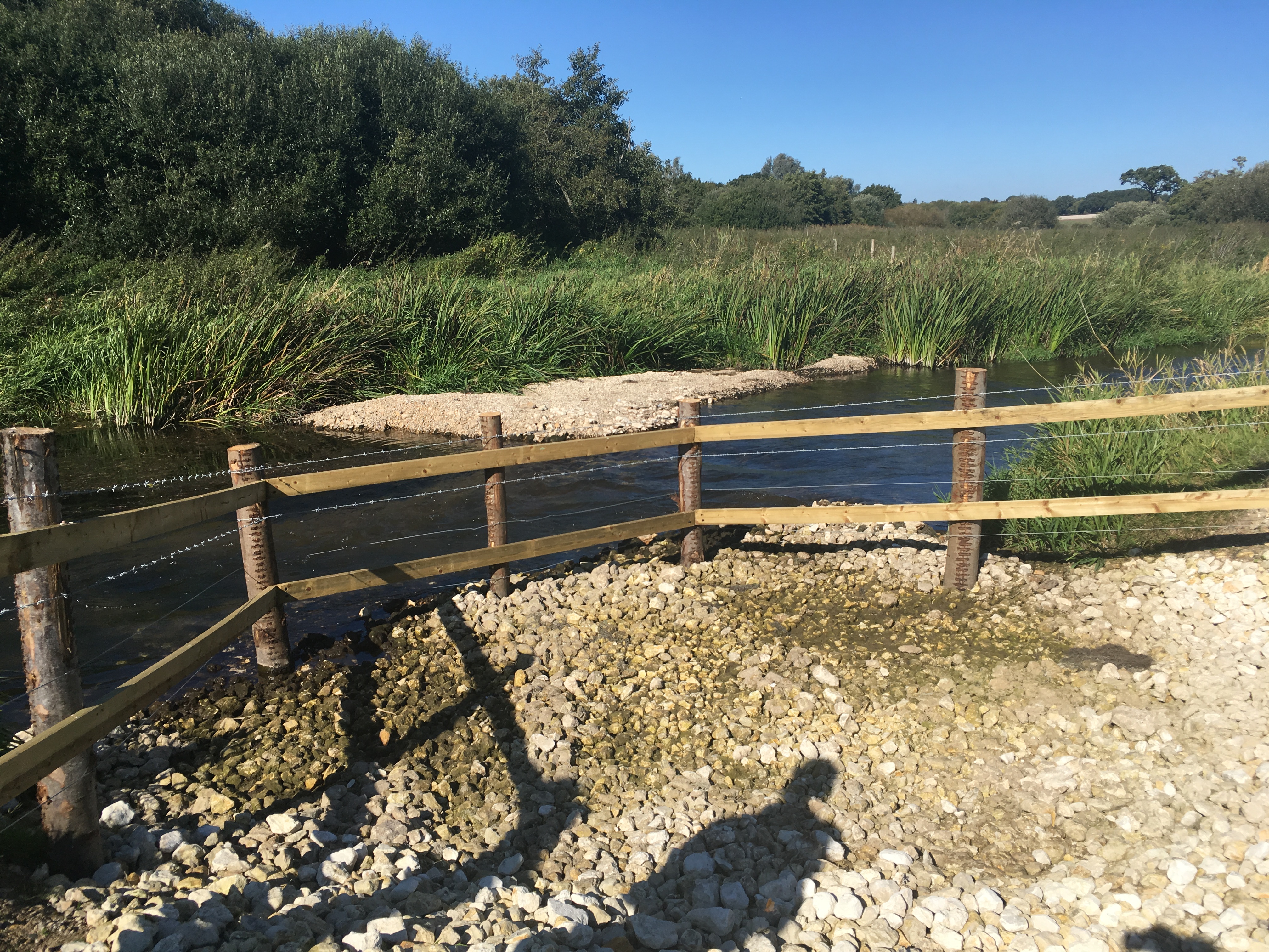
| 12:04, 14 October 2020 | FencedCattleDrink.JPG (file) |  |
4.16 MB | Amy.butcher | Cattle drink fenced to prevent full access to river by livestock and lined with chalk to reduce poaching and sediment input. Drink dry after exceptionally dry summer - learning point. | 1 |
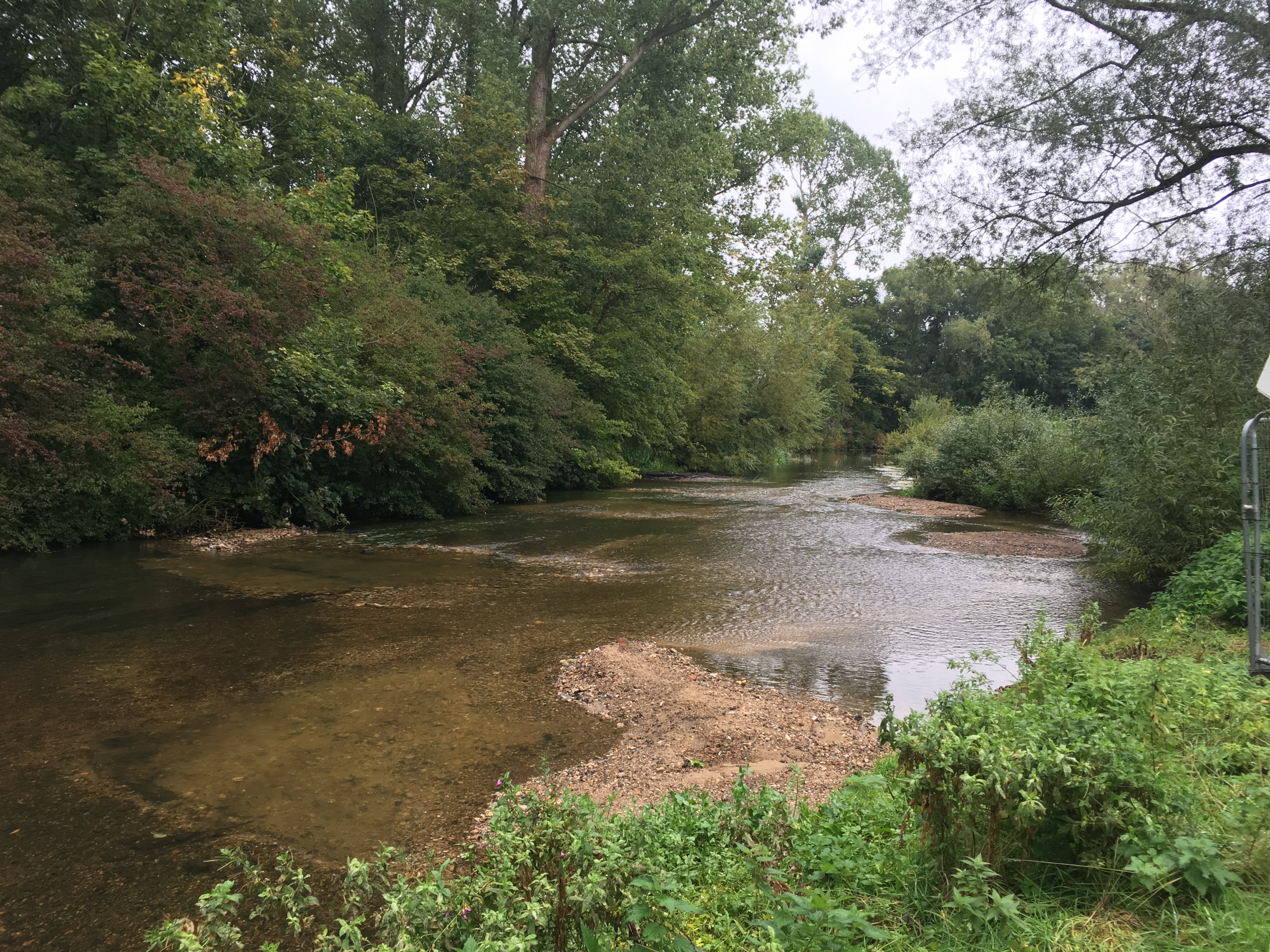
| 12:02, 14 October 2020 | CostesseyBerms2.JPG (file) |  |
4.9 MB | Amy.butcher | Gravel berms providing flow heterogeneity. | 1 |
| 11:59, 14 October 2020 | CostesseyBerms.JPG (file) |  |
3.96 MB | Amy.butcher | 'Reject' flint gravel berms providing flow heterogeneity. | 1 |
| 07:31, 4 September 2020 | Merin4.jpg (file) |  |
419 KB | Ieuan | 2 | |
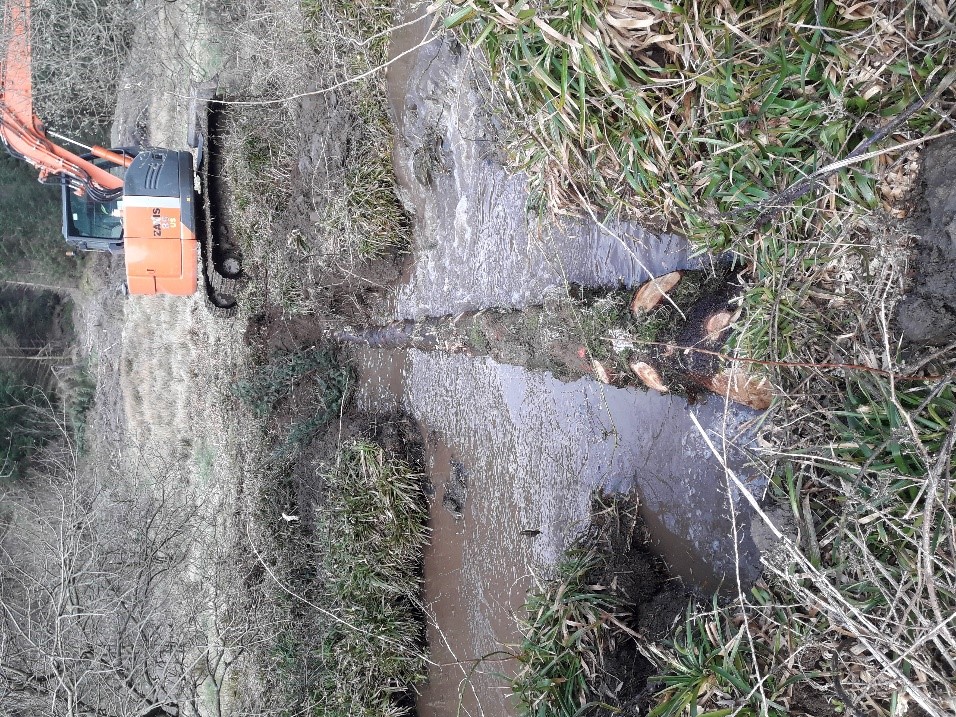
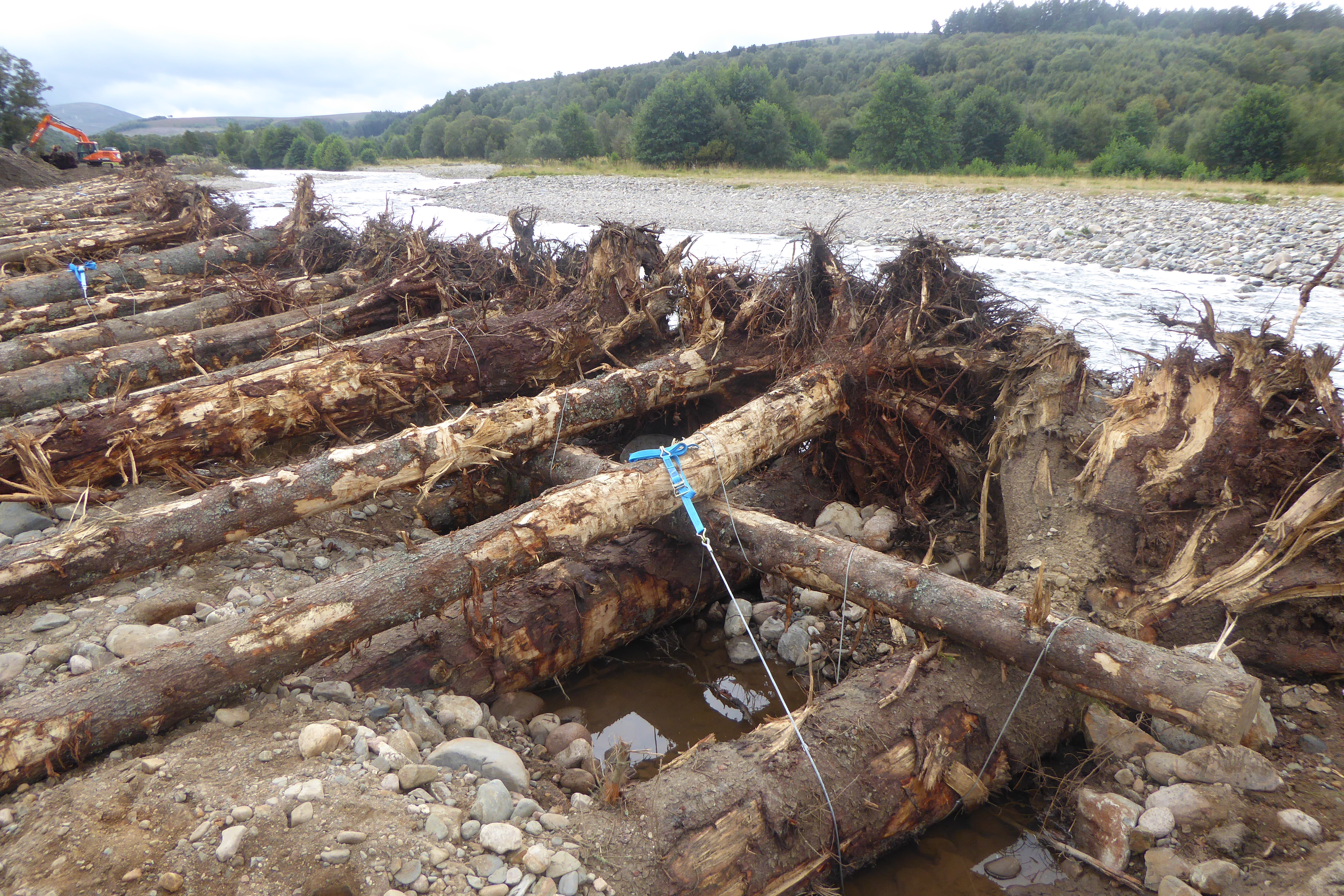
| 17:37, 3 September 2020 | FordmouthRevetment.jpg (file) |  |
124 KB | Alexrrc | Installation of a log revetment along River Avon to reduce bank erosion and protect agricultural land | 1 |
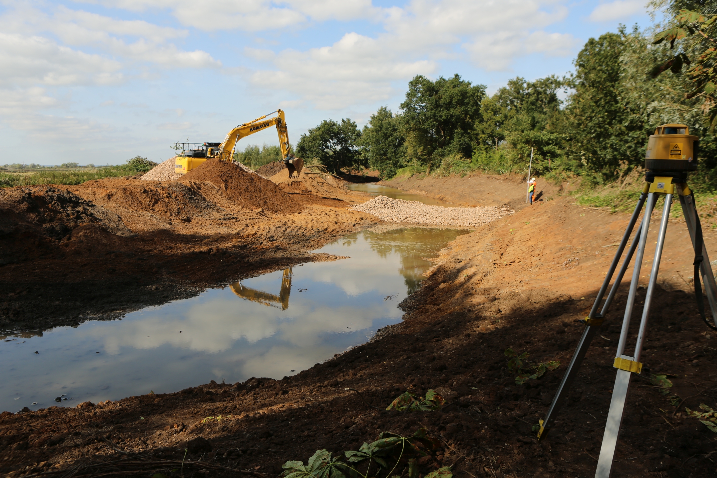
| 15:00, 2 September 2020 | 19 08 06 Protected Species Survey Fordmouth and Delnabo Pic 34.jpg (file) |  |
4.23 MB | JosMilner | One of two areas from which sediment was to be removed to allow increased flow down a secondary channel. | 1 |
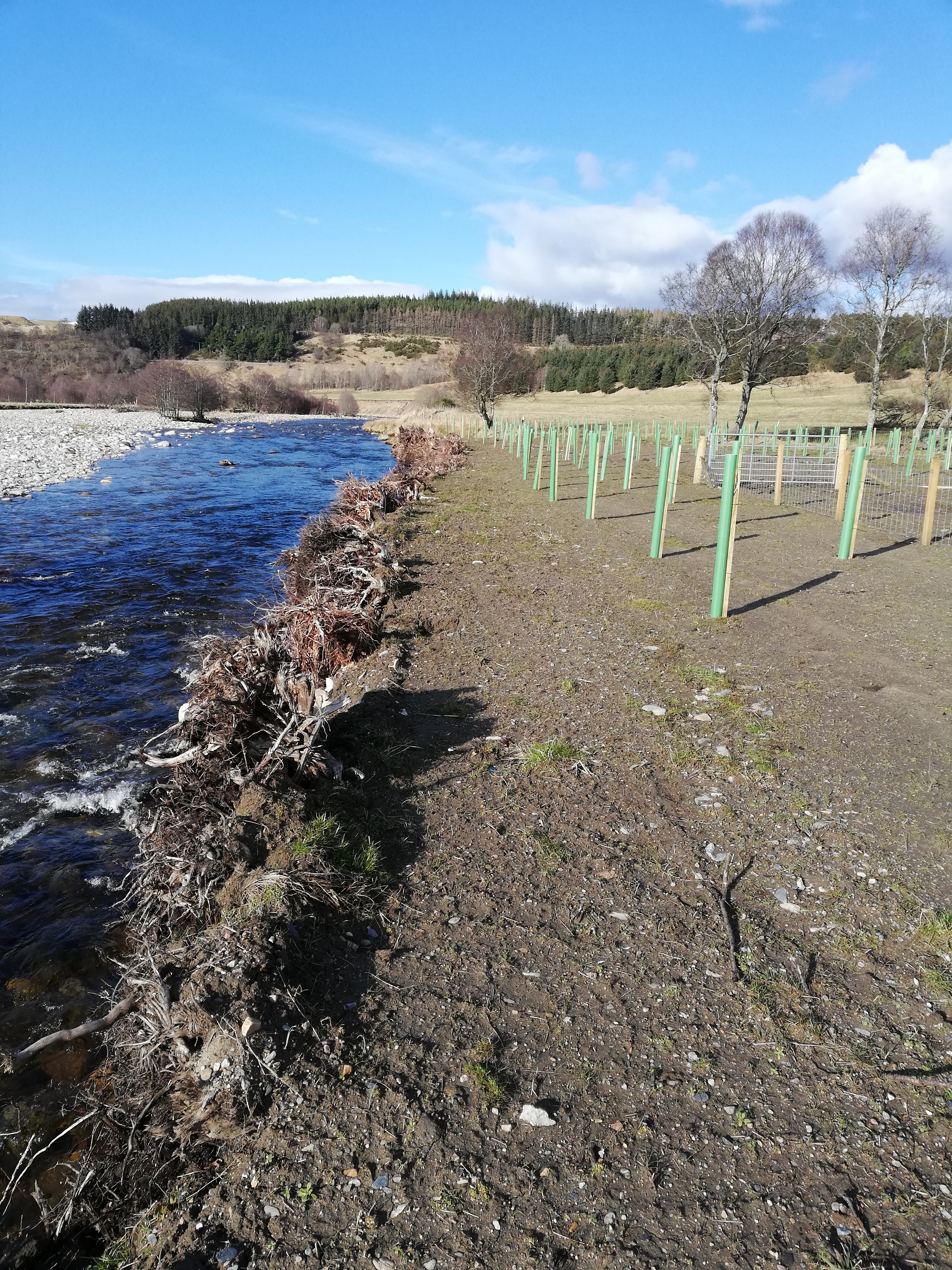
| 12:17, 18 August 2020 | FordmouthPlanting&LogRevetMar20.jpg (file) |  |
8.12 MB | JosMilner | Riparian planting on reinstated ground over log revetment, with root plates visible along river edge | 1 |
| 12:13, 18 August 2020 | 19 09 17-uppersection.jpg (file) |  |
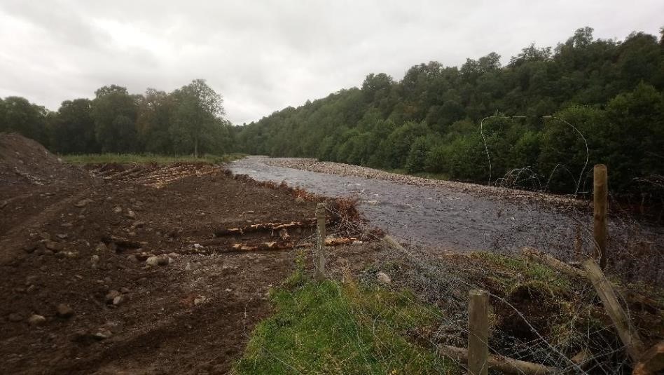
157 KB | JosMilner | Reinstated ground over log revetment | 1 |
| 12:11, 18 August 2020 | 19 09 10-uppersection.jpg (file) |  |
131 KB | JosMilner | River bank bein g reinstated by burying log revetment | 1 |
| 11:07, 18 August 2020 | P1040005.JPG (file) |  |
5.91 MB | JosMilner | Fixings for log revetment | 1 |