Uploads by NickRRC
Jump to navigation
Jump to search
This special page shows all uploaded files.
| Date | Name | Thumbnail | Size | Description | Versions |
|---|---|---|---|---|---|
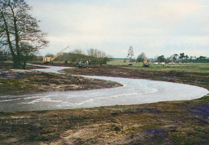
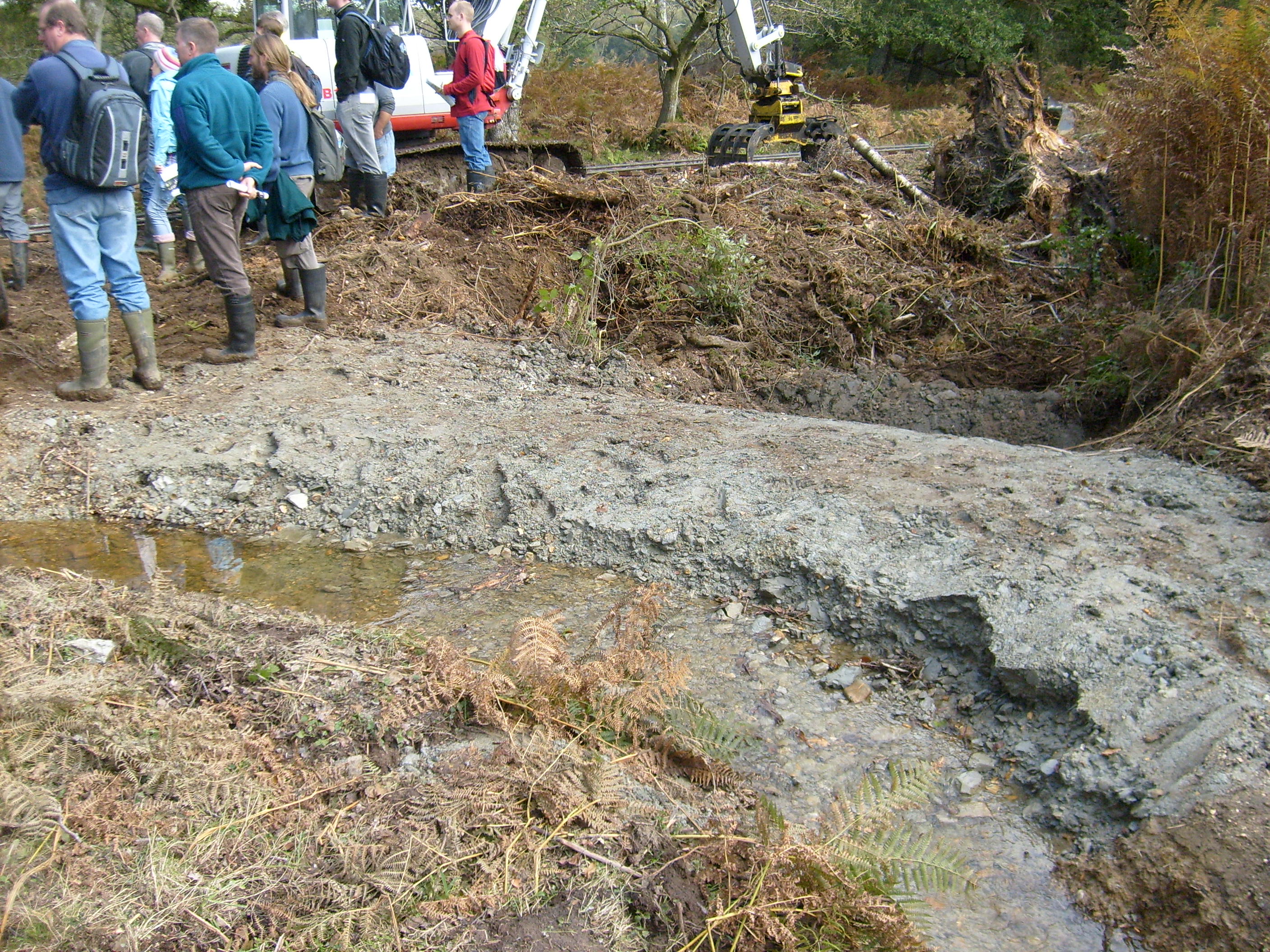
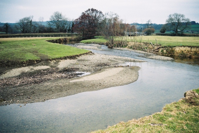
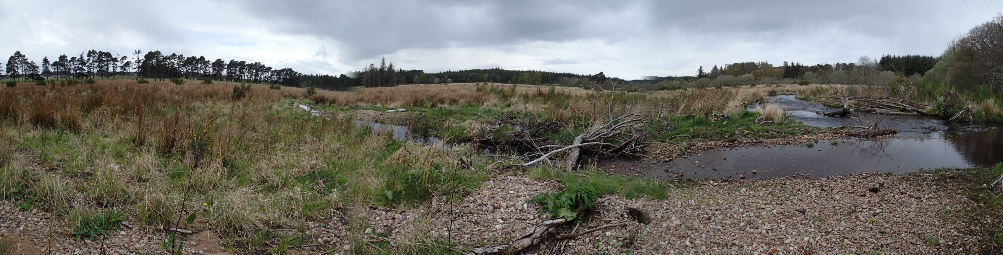
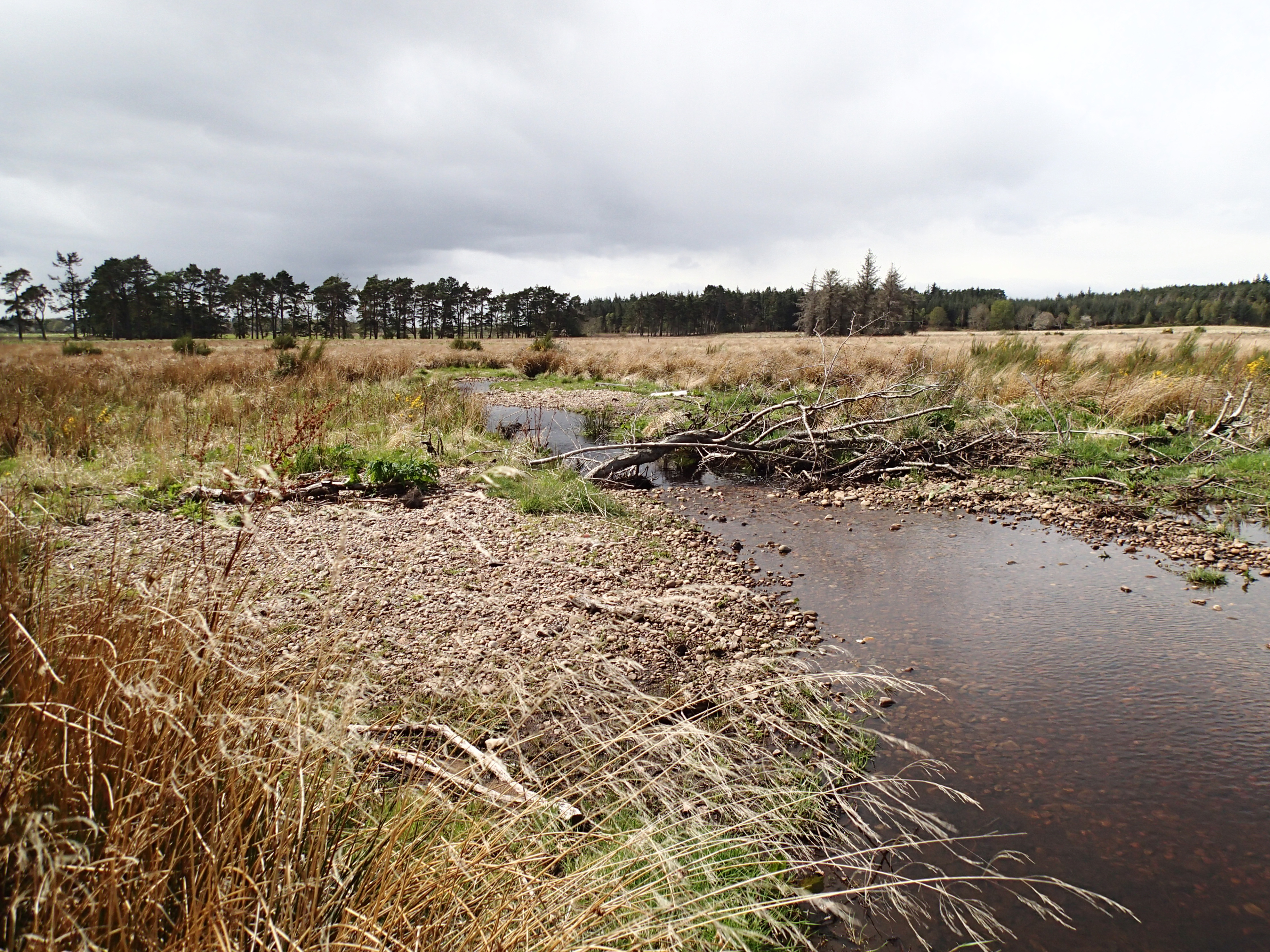
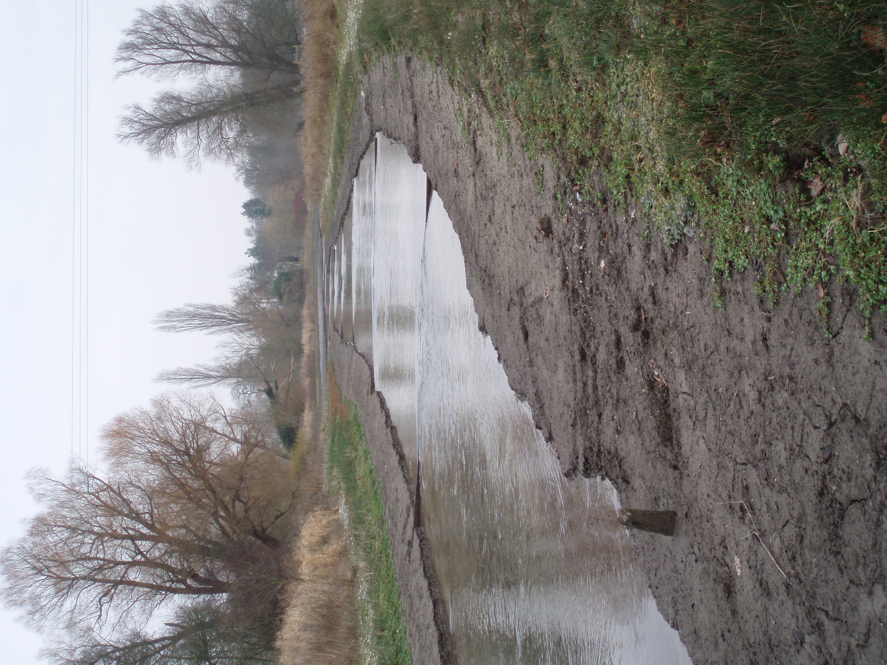
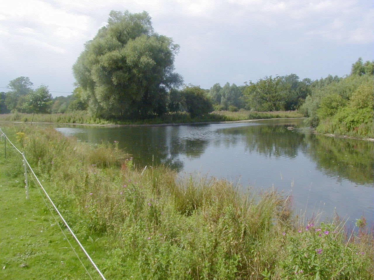
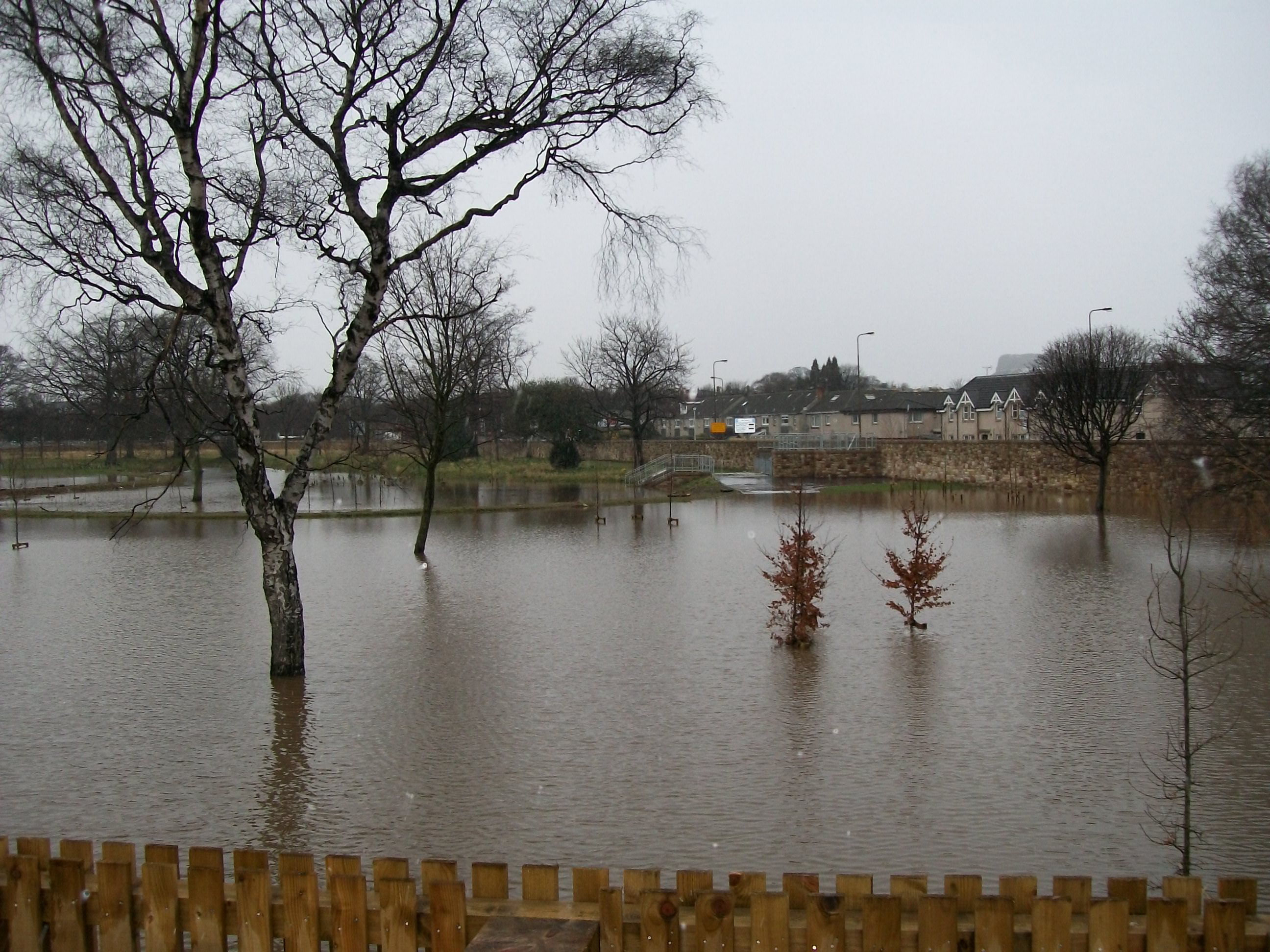
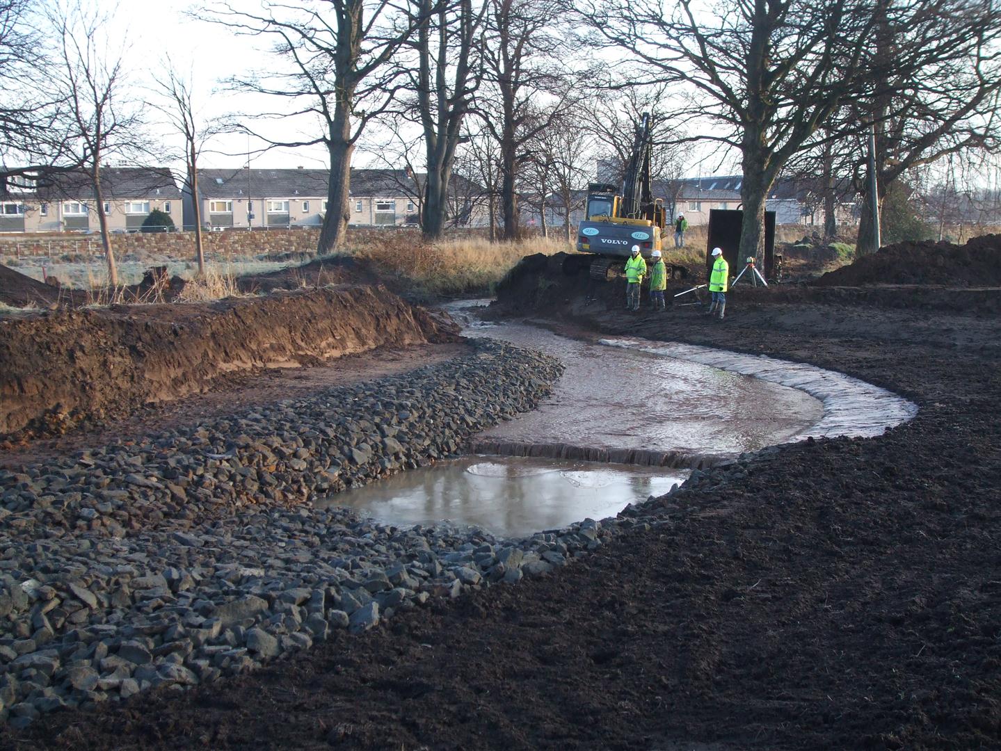
| 16:16, 16 July 2013 | Meanders reopened Little Ouse.jpg (file) |  |
144 KB | Re-opening of the meanders | 1 |
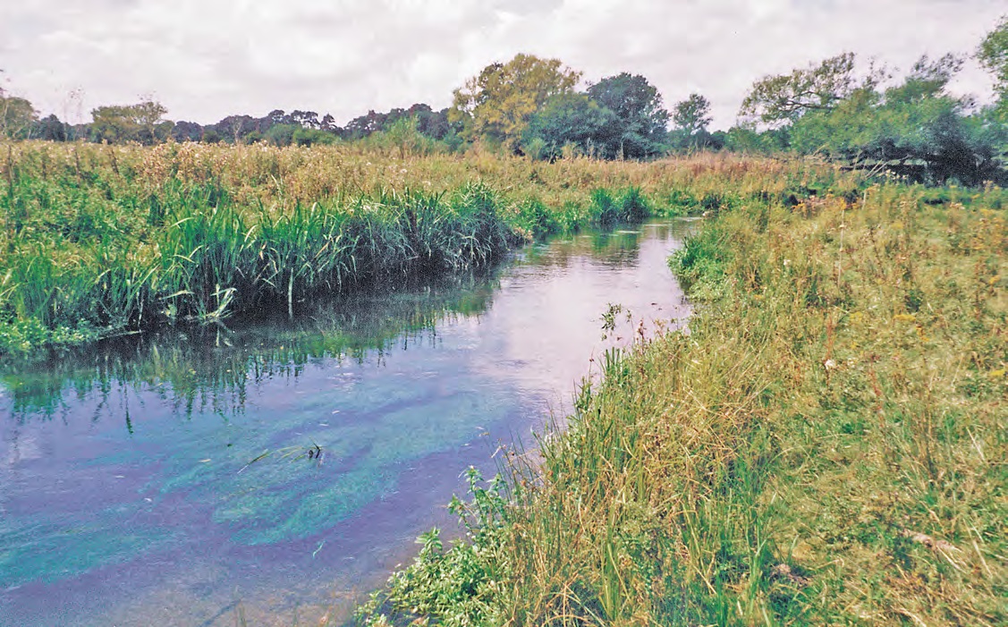
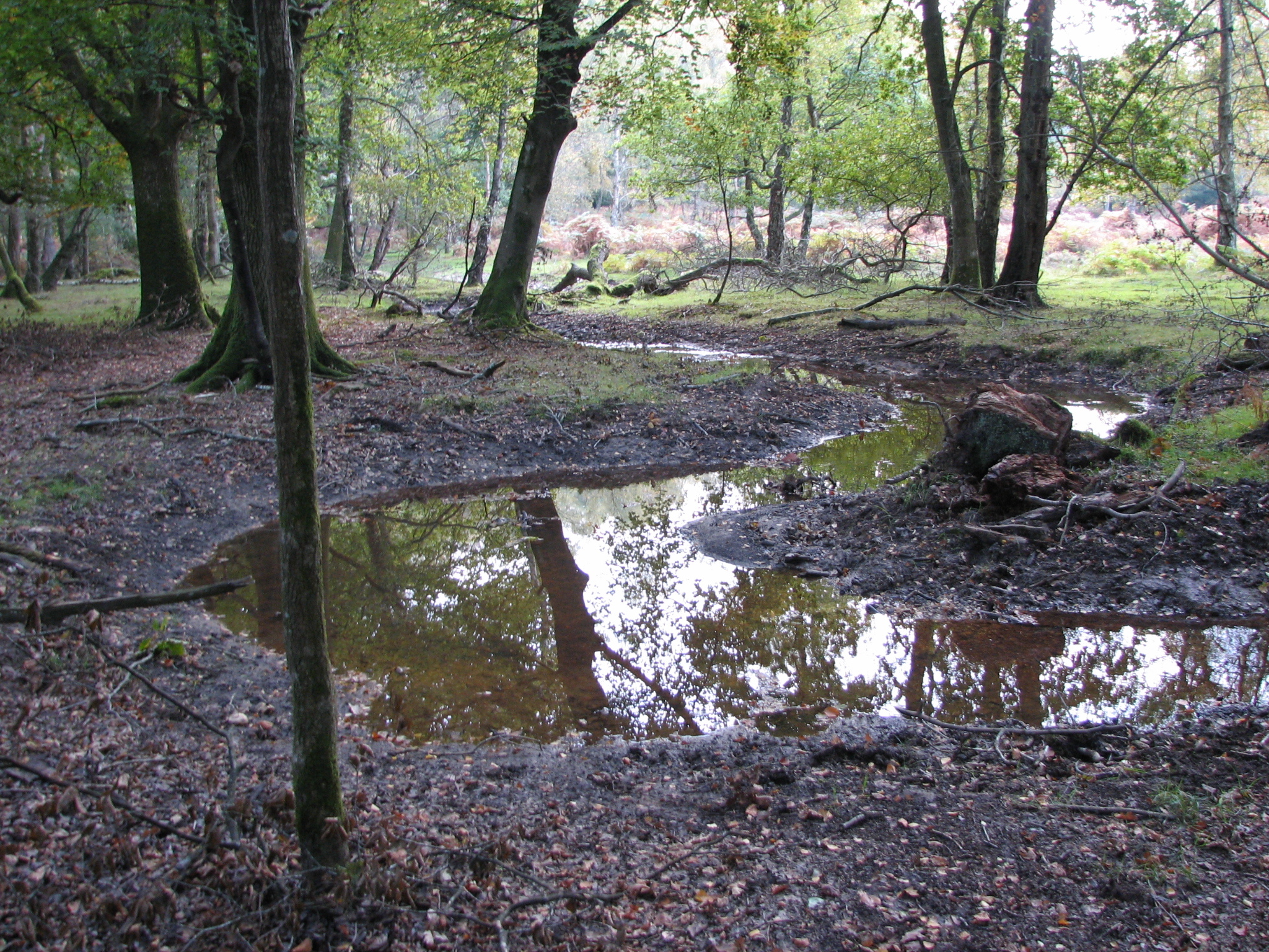
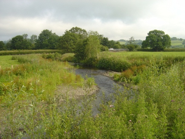
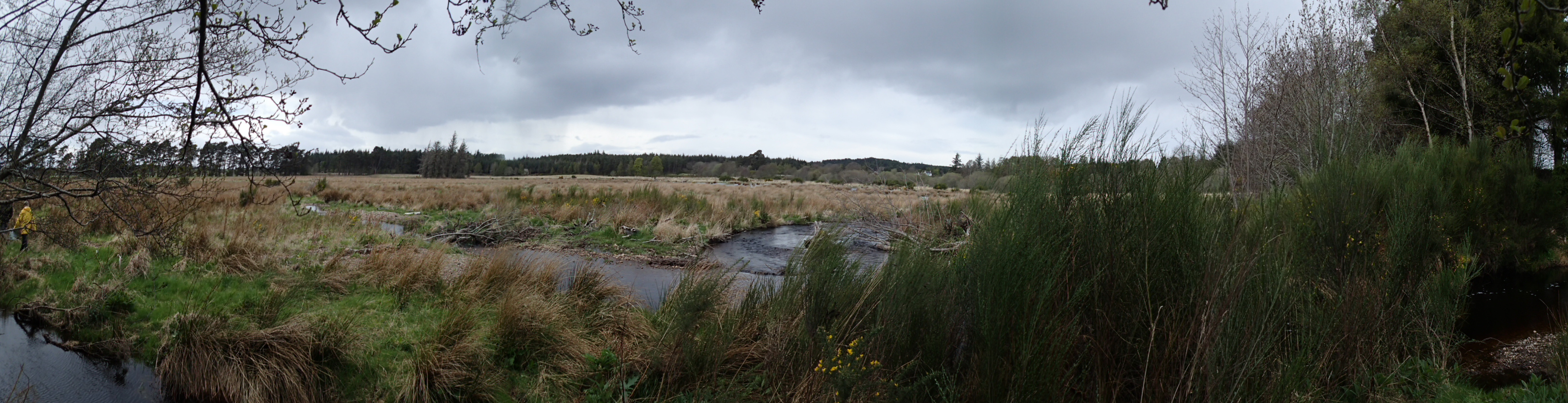
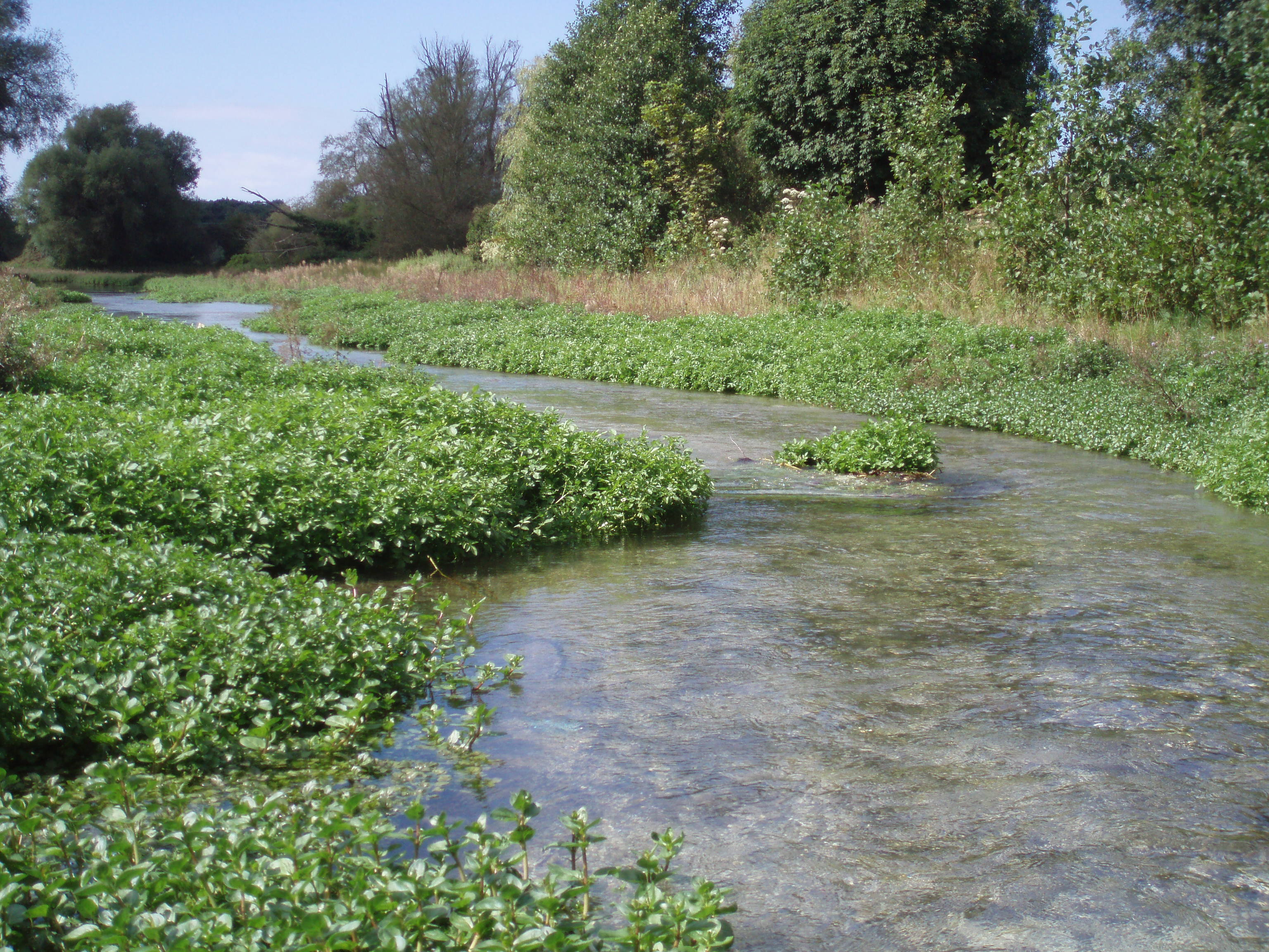
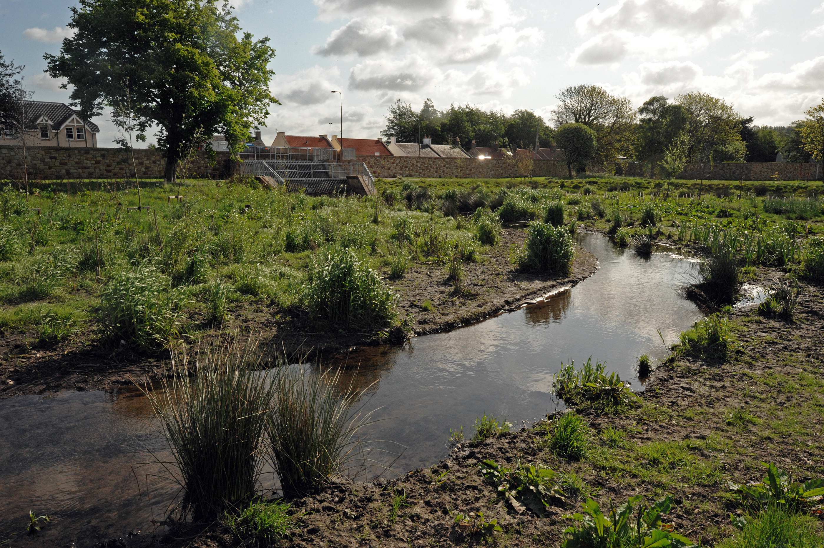
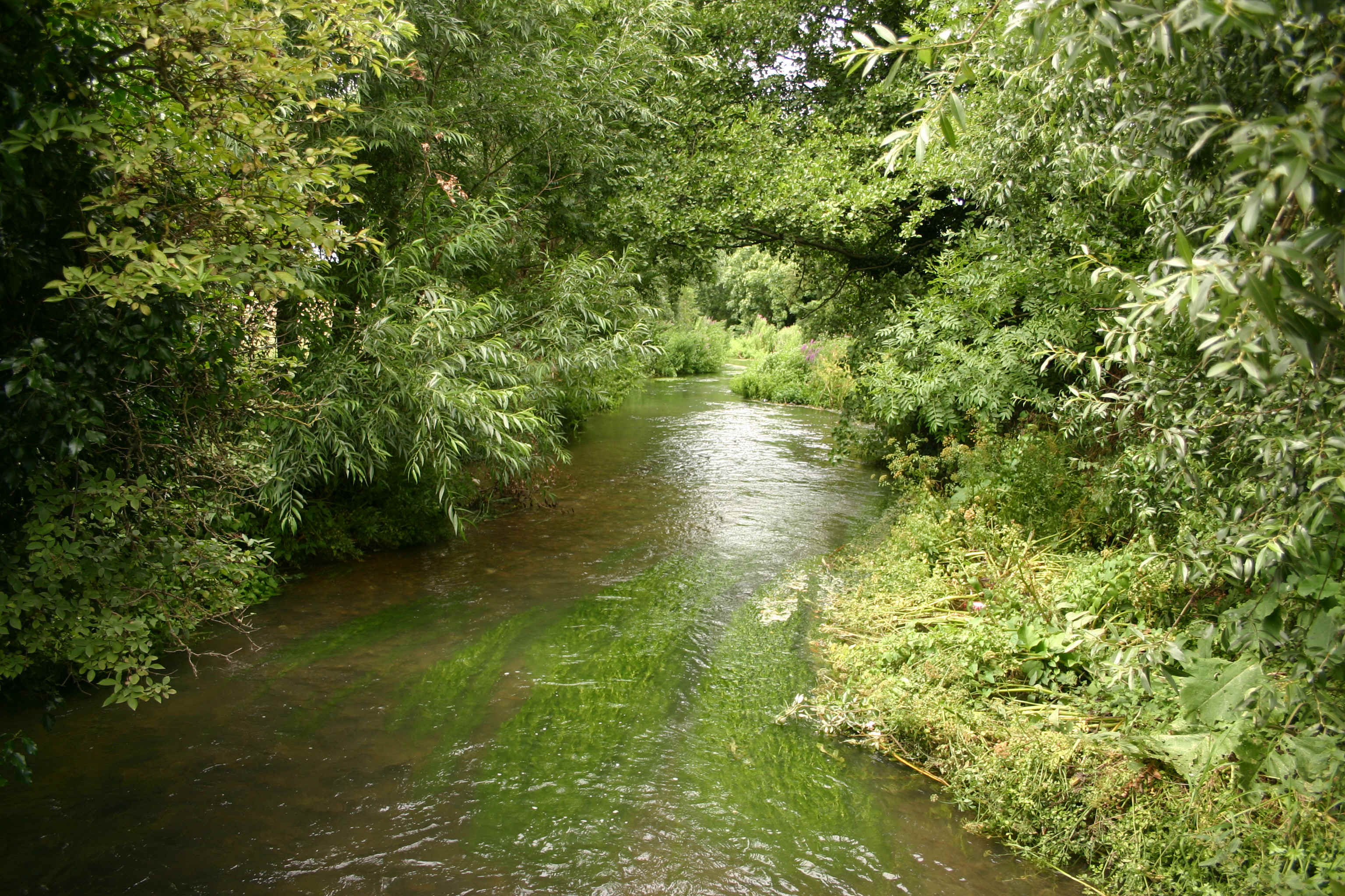
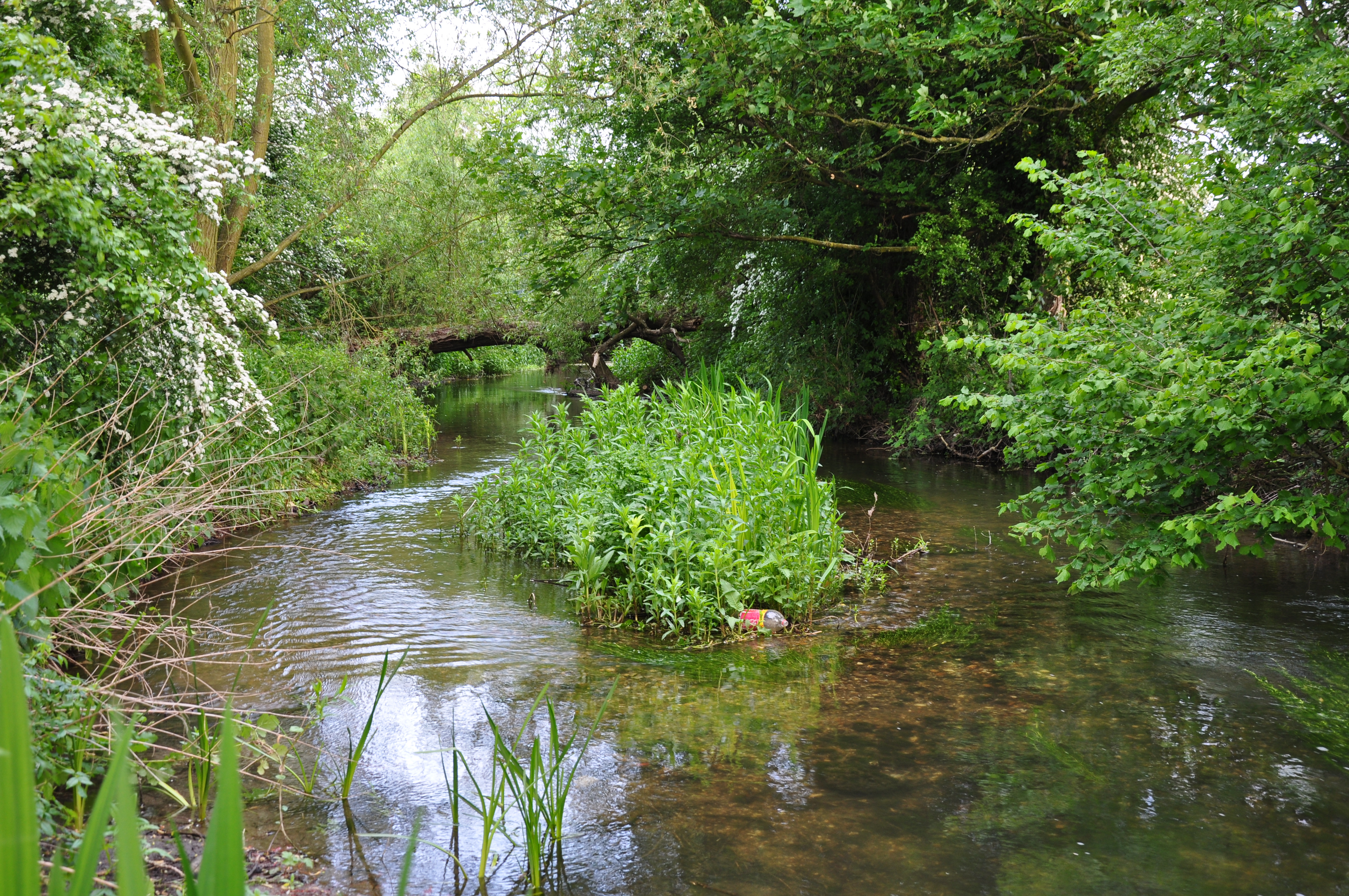
| 15:31, 16 July 2013 | Restored Little Ouse.jpg (file) |  |
401 KB | The Little Ouse following restoration | 1 |
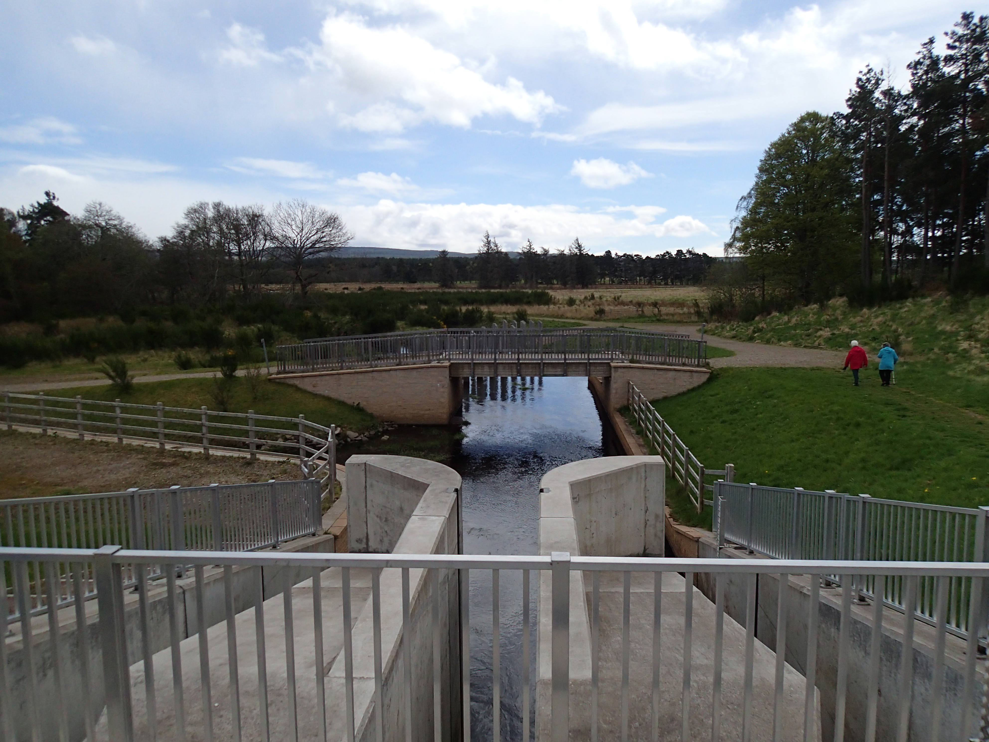
| 15:10, 16 July 2013 | After works 5.jpg (file) |  |
211 KB | 1 | |
| 15:04, 16 July 2013 | Constructing berms.jpg (file) |  |
157 KB | 1 | |
| 15:02, 16 July 2013 | During.jpg (file) |  |
178 KB | 1 | |
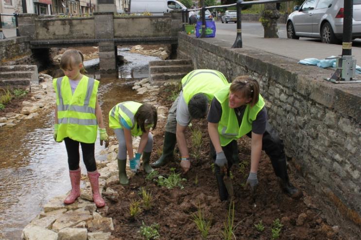
| 15:01, 16 July 2013 | Community.jpg (file) |  |
73 KB | 1 | |
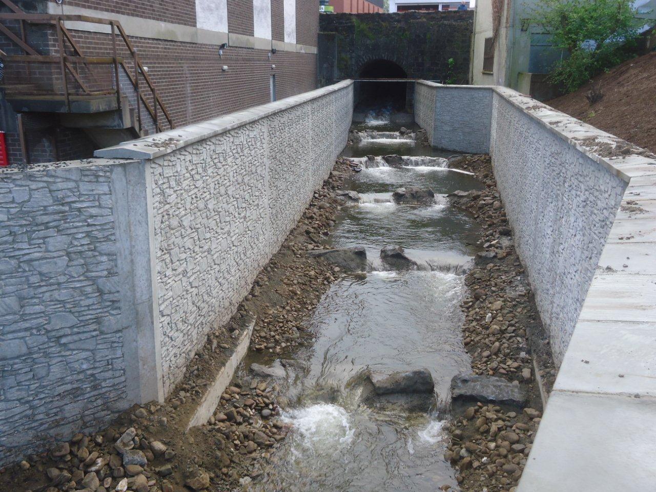
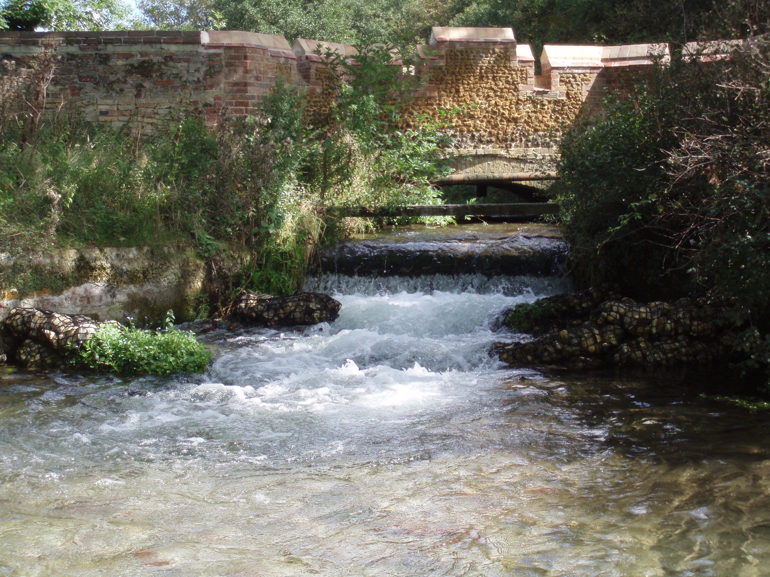
| 14:52, 16 July 2013 | Step pools post works (3).jpg (file) | .jpg) |
253 KB | New cascade fish pass post construction (Rivers Agency) | 1 |
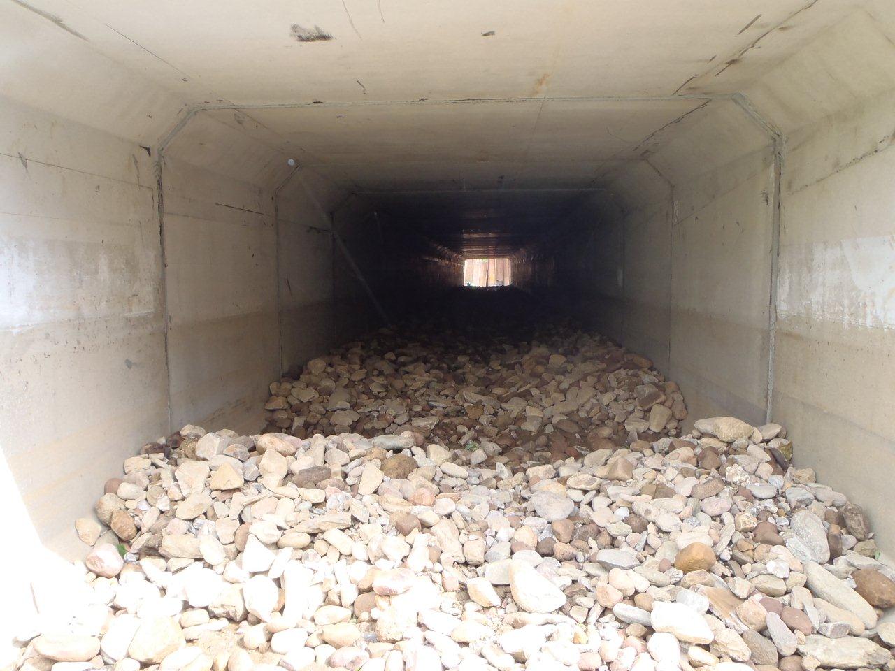
| 14:44, 16 July 2013 | Placed stone in culvert.jpg (file) |  |
160 KB | New culvert bed in construction (Rivers Agency) | 1 |
| 14:42, 16 July 2013 | 4 months post construction.jpg (file) |  |
258 KB | new cascade 4 months post-construction(Rivers Agency) | 1 |
| 14:41, 16 July 2013 | Step pools post works (2).jpg (file) | .jpg) |
253 KB | step pool post works (Rivers Agency) | 1 |
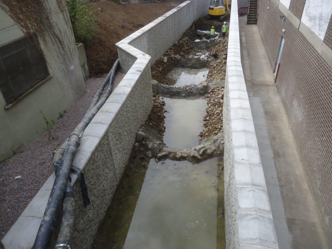
| 14:40, 16 July 2013 | Pool construction (2).jpg (file) | .jpg) |
192 KB | construction of new cascade pool sequence (Rivers Agency) | 1 |
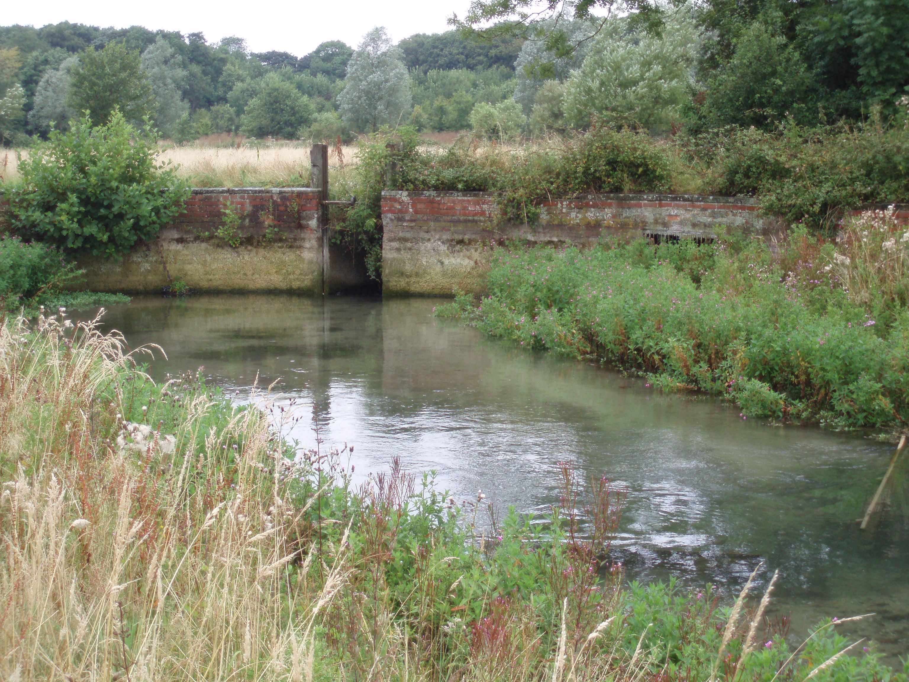
| 14:38, 16 July 2013 | Culvert apron pre works.jpg (file) |  |
196 KB | Culvert apron pre-works (Rivers Agency) | 1 |
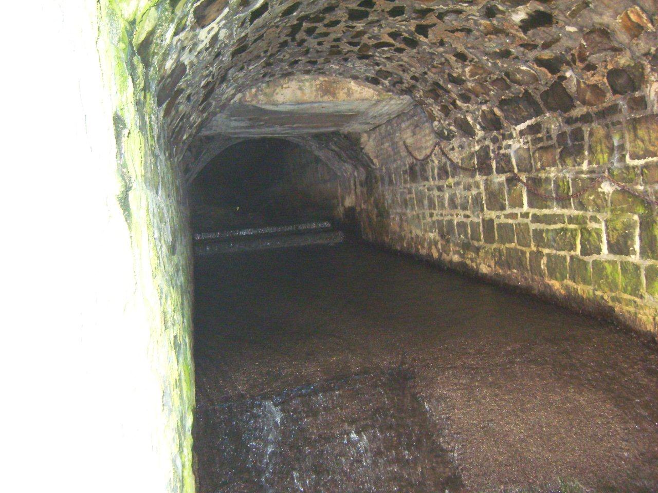
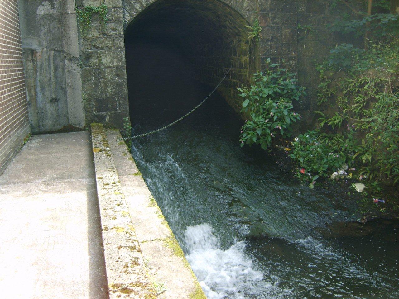
| 14:36, 16 July 2013 | Culvert outlet pre works.jpg (file) |  |
221 KB | Culvert outlet pre-works was causing a major obstruction to fish passage (Rivers Agency) | 1 |
| 12:52, 16 July 2013 | S6300226.JPG (file) |  |
1.5 MB | 1 | |
| 12:51, 16 July 2013 | 2009 10 14 (34).JPG (file) | .JPG) |
2.21 MB | 1 | |
| 09:53, 16 July 2013 | After dulais.jpg (file) |  |
117 KB | Dulais after restoration (2005) | 1 |
| 09:52, 16 July 2013 | Before dualis.jpg (file) |  |
147 KB | Dulais before restoration (2003) | 1 |
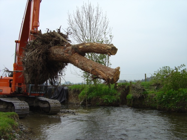
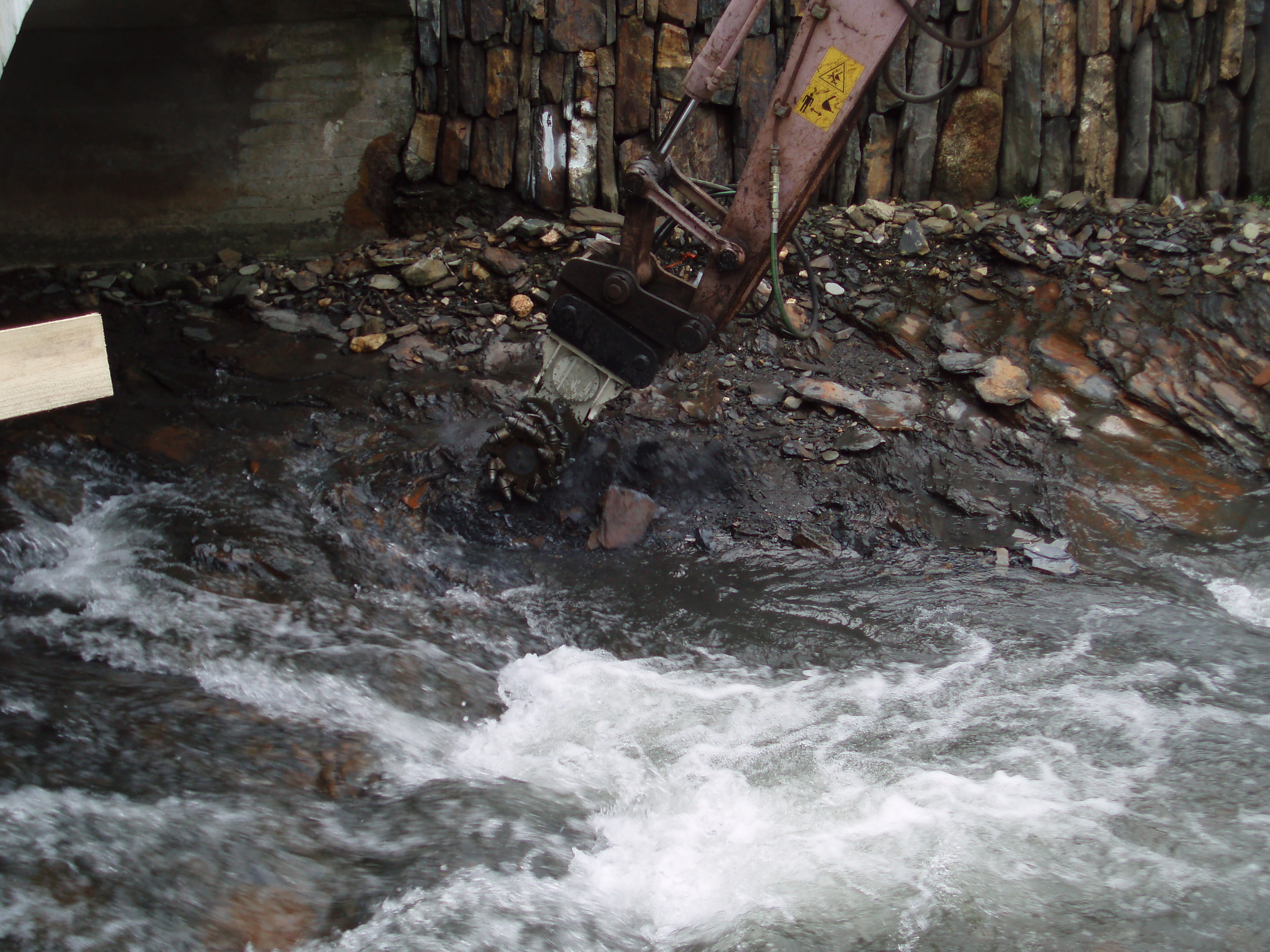
| 09:46, 16 July 2013 | Rootward excavator.jpg (file) |  |
111 KB | Root wad being installed in the bank | 1 |
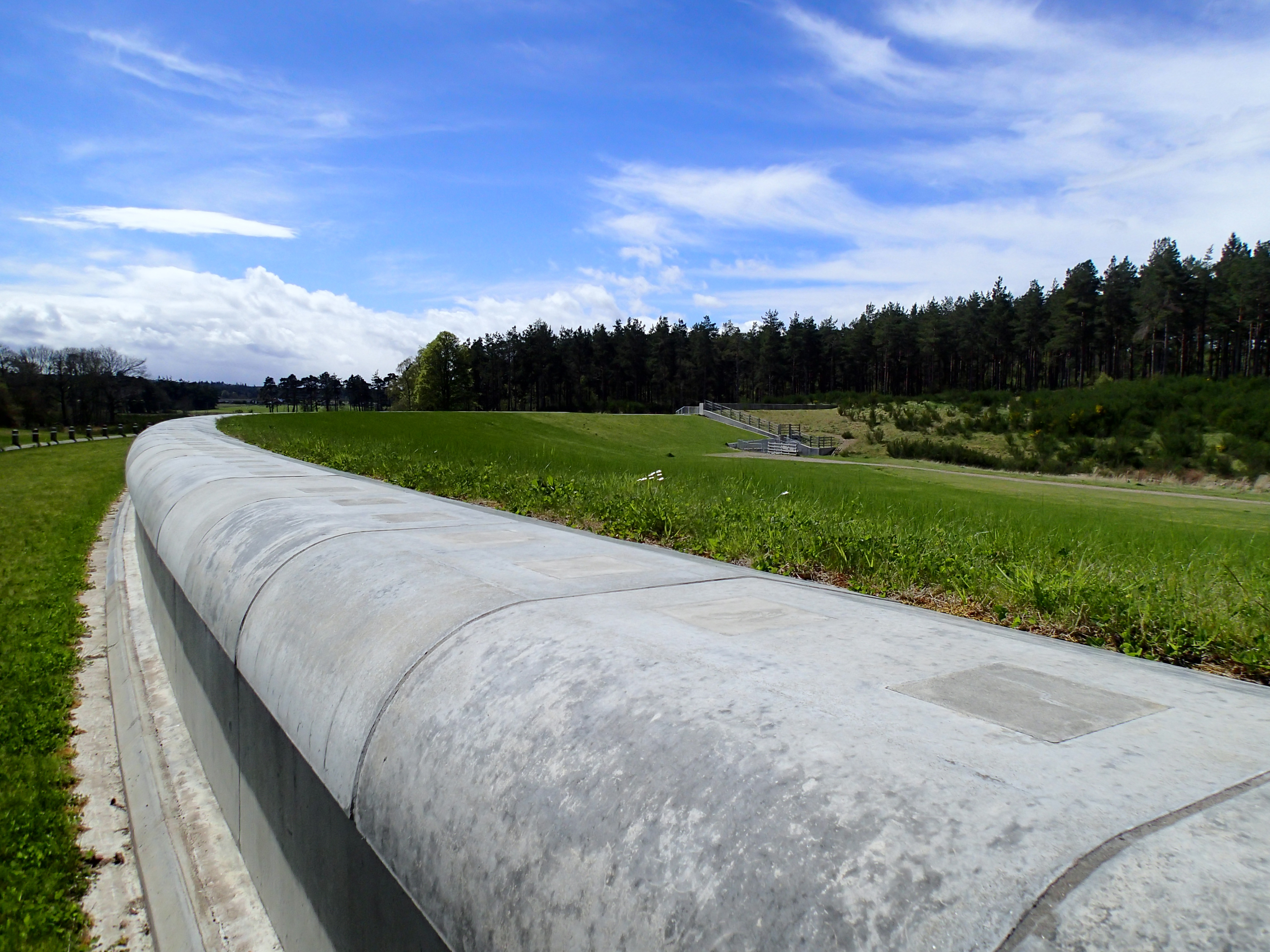
| 17:03, 15 July 2013 | P5130064.JPG (file) | 1.23 MB | Chapelton Dam flood storage area (2013) | 1 | |
| 17:02, 15 July 2013 | P5130062.JPG (file) |  |
4.2 MB | Chapelton Dam (2013) | 1 |
| 16:59, 15 July 2013 | P5130109.JPG (file) | 1.69 MB | Woody debris and sediment is effectively being stored in the new floodplain area (2013) | 1 | |
| 16:57, 15 July 2013 | P5130108.JPG (file) | 1.57 MB | The Burn management works | 1 | |
| 16:56, 15 July 2013 | P5130077.JPG (file) |  |
4.19 MB | Chapelton Dam control structure | 1 |
| 16:41, 15 July 2013 | P5130092.JPG (file) |  |
5.05 MB | Burn of Mosset- sustainable sediment and flood management by reconnecting the river with its floodplain and working with natural processes | 1 |
| 16:25, 8 July 2013 | Restored bed levels and bank profile.JPG (file) |  |
3.06 MB | Restored bed levels and bank profile - November 2012 © Natural Resources Wales | 1 |
| 16:22, 8 July 2013 | Restored Island 1.JPG (file) |  |
3.04 MB | Restored Island - November 2012 © Natural Resources Wales | 1 |
| 15:45, 8 July 2013 | Restored bed levels and bank profile 2.JPG (file) |  |
3.07 MB | Restored bed levels and bank profile - November 2012 ©Natural Resources Wales | 1 |
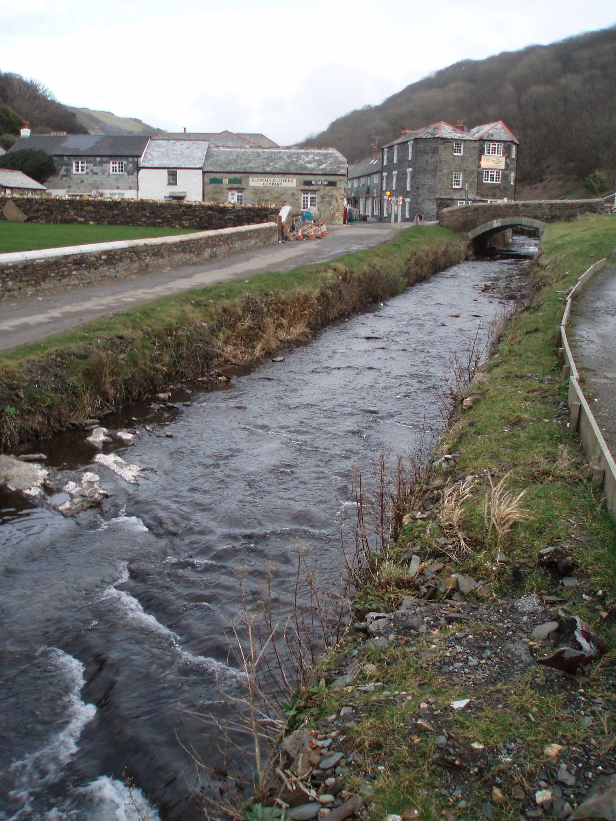
| 14:24, 8 July 2013 | Upstream reference reach.JPG (file) |  |
1.78 MB | Natural cascade and pool on the Valency, upstream of Boscastle. © Halcrow | 1 |
| 14:22, 8 July 2013 | Valency ReferenceReach.jpeg (file) |  |
1.78 MB | Natural cascade and pool on the Valency, upstream of Boscastle. © Halcrow | 1 |
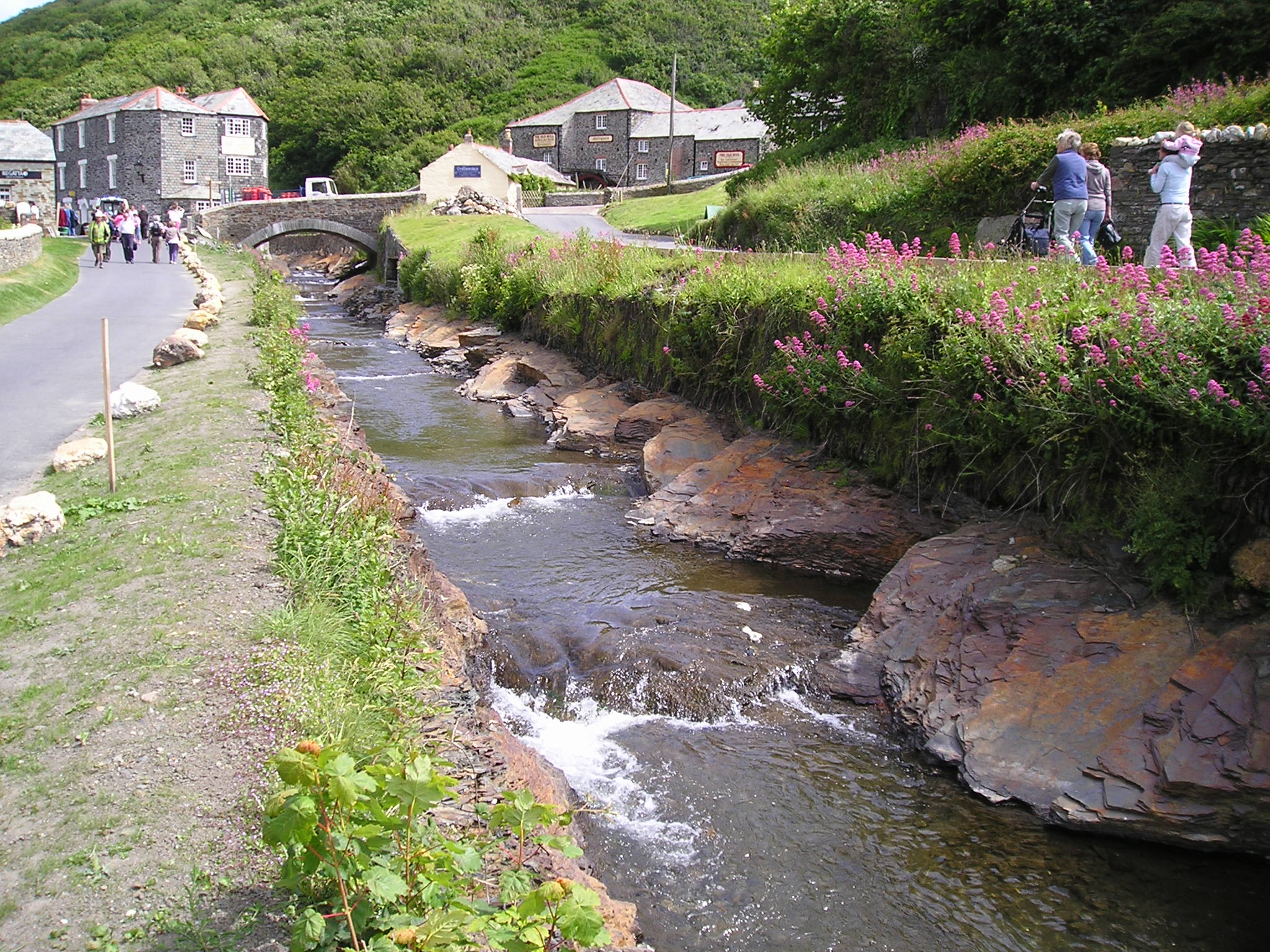
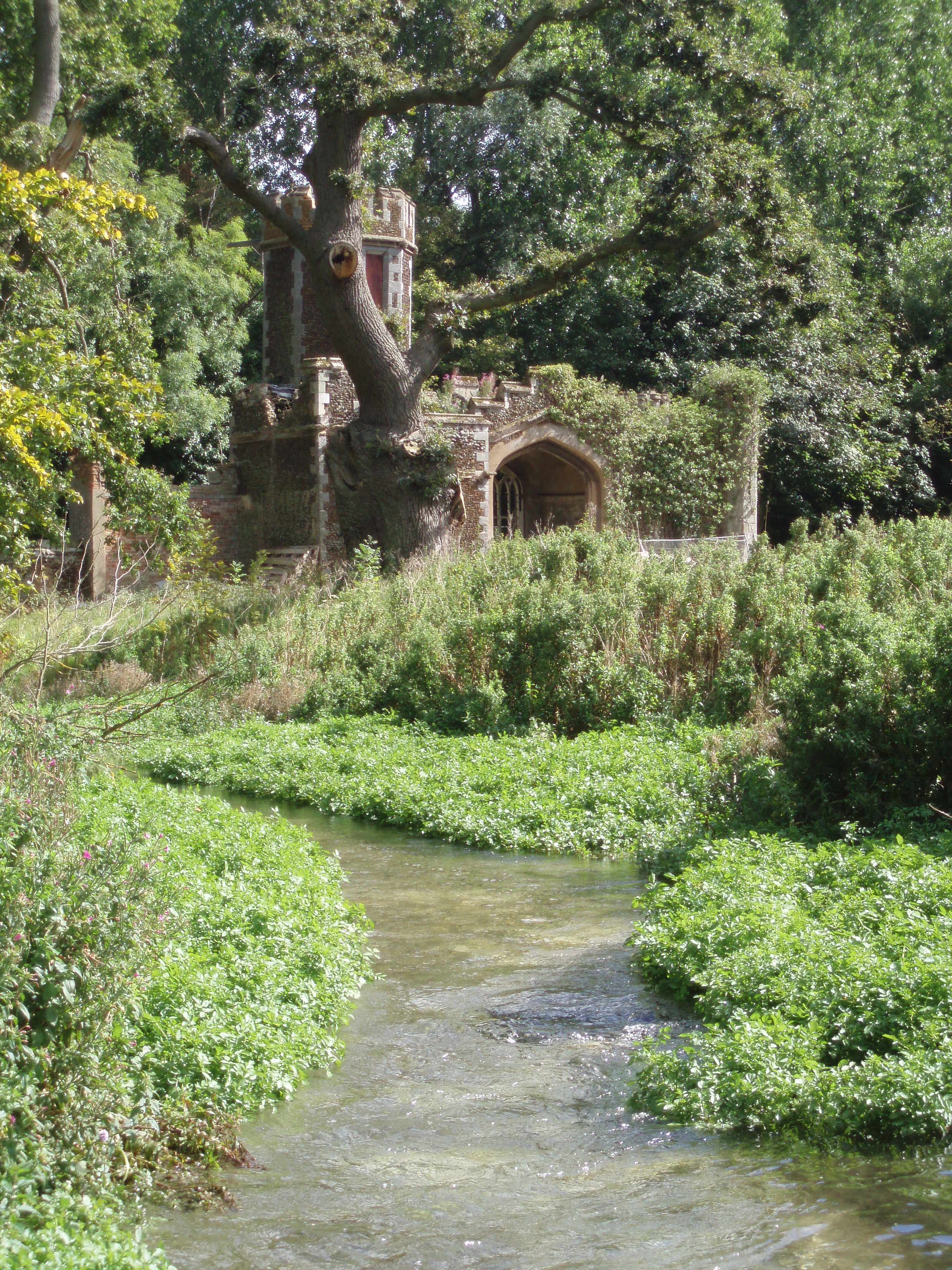
| 14:19, 8 July 2013 | Photo with beaches.jpg (file) |  |
723 KB | Gravel beaches have subsequently formed within the bedrock channel - 2008 ©RRC | 1 |
| 14:17, 8 July 2013 | 2005-01-01 00.00.00-1.jpg (file) |  |
1.28 MB | Breaking out bedrock. © Halcrow | 1 |
| 14:14, 8 July 2013 | 2006-02-21 11.15.10.jpg (file) |  |
533 KB | Valency through Boscastle prior to works being carried out. © Halcrow | 1 |
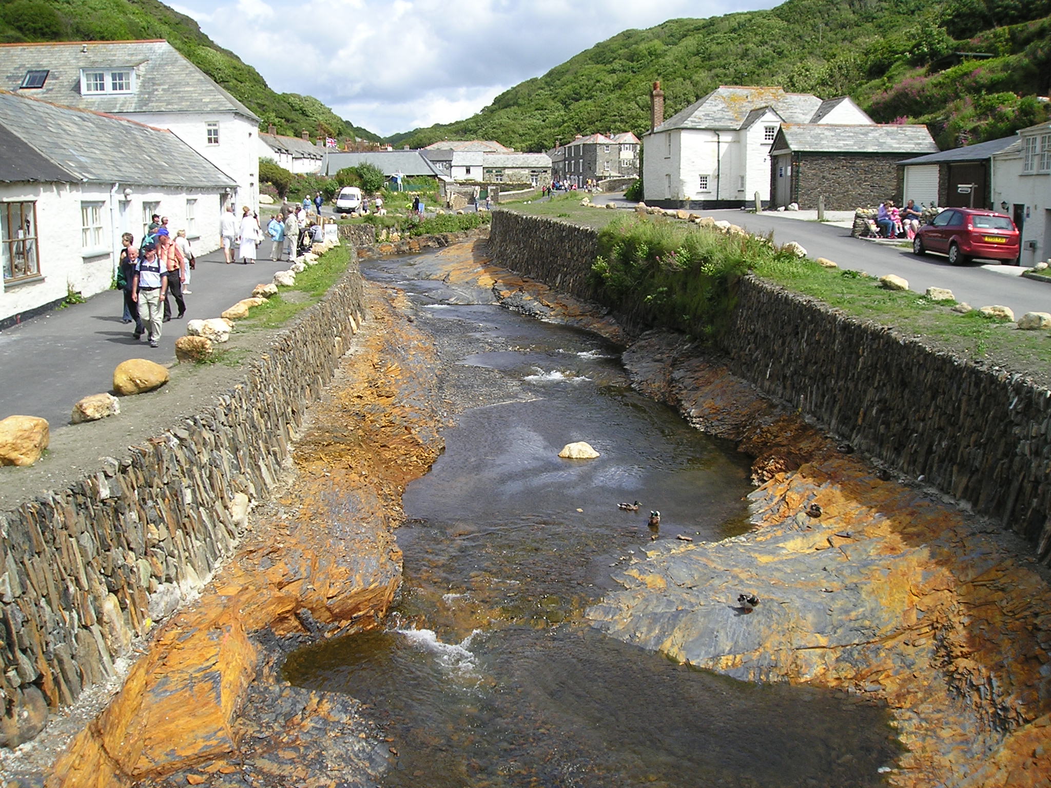
| 14:11, 8 July 2013 | P1010016.JPG (file) |  |
705 KB | The natural fracture lines within the bedrock were used when deepening the channel to ensure its stability. The retaining flood walls have become vegetated. © Halcrow | 1 |
| 14:07, 8 July 2013 | P1010022.JPG (file) |  |
674 KB | The low flow course had to be entirely excavated to best mimic millennia of erosion of a hard bed rock. © Halcrow | 1 |
| 12:11, 8 July 2013 | Babingley Sept2007post.JPG (file) |  |
1.43 MB | Seven months post restoration works.The channel is narrower and shallower with diverse marginal vegetation and good spawning habitat - September 2007 ©Environment Agency | 1 |
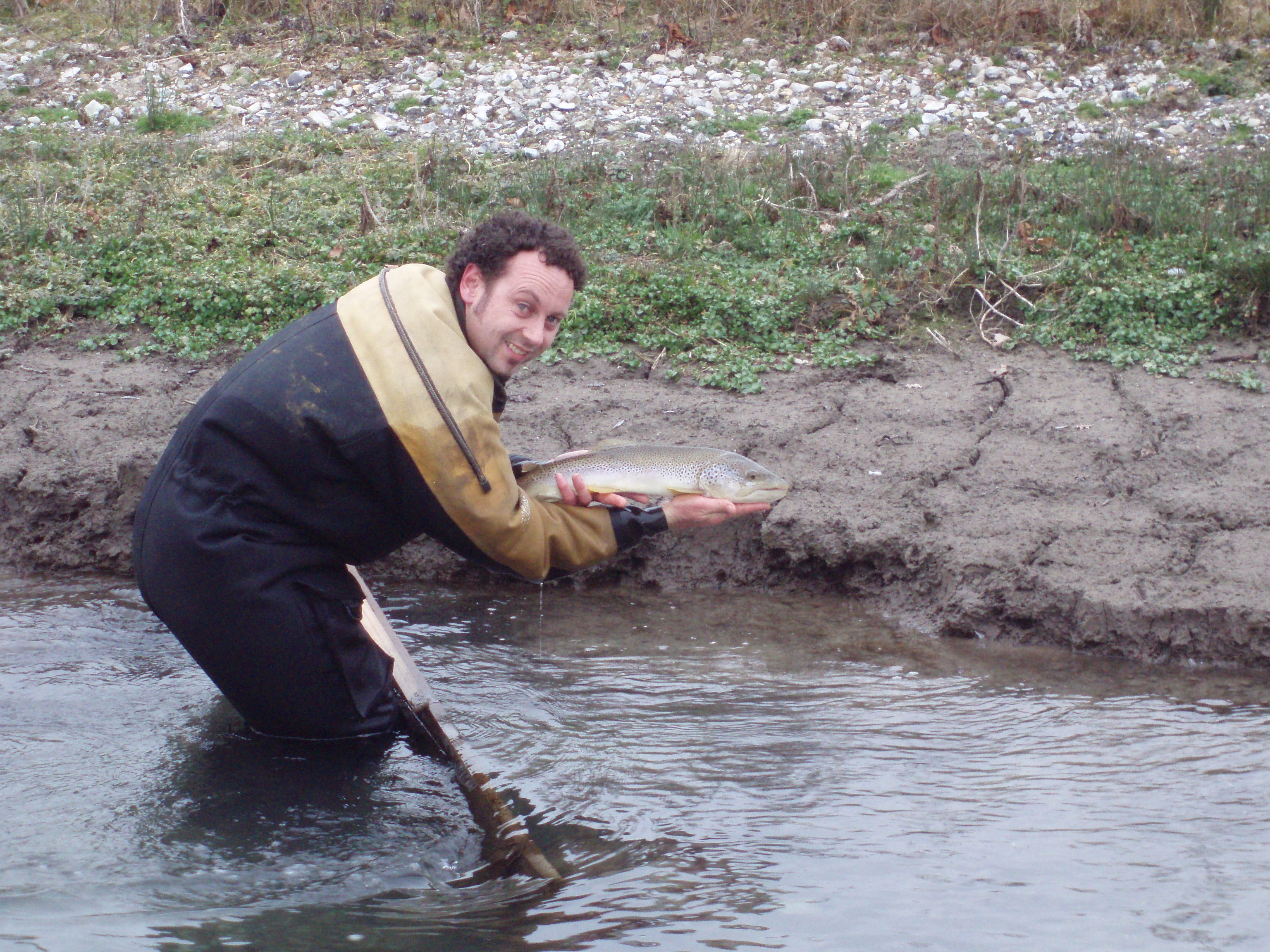
| 12:09, 8 July 2013 | Babingley Feb2007trout.JPG (file) |  |
1.54 MB | Brown trout (Salmo trutta) present in the river one year after works were completed - February 2007 ©Environment Agency | 1 |
| 12:08, 8 July 2013 | Babingley Aug2007Deflectors.JPG (file) |  |
1.53 MB | One pair of deflector boards, installed at an offset angle, after six months. Marginal vegetation has rapidly colonised the silt helping to stabilise it further – August 2007 ©Environment Agency | 1 |
| 12:08, 8 July 2013 | Babingley Feb2007Deflectors.JPG (file) |  |
1.68 MB | The newly installed deflectors face upstream and concentrate flow. Deposited silt has formed new banks and has since been colonised by vegetation - February 2007 ©Environment Agency | 1 |
| 12:07, 8 July 2013 | Babingley Aug2007Rockrolls.JPG (file) |  |
1.46 MB | Pool and traverse fish pass at existing weir after completion. Vegetation has already begun to establish on the rock rolls - August 2007 ©Environment Agency | 1 |
| 12:06, 8 July 2013 | Babingley August2007culvert.JPG (file) |  |
1.48 MB | Downstream extent of the reach where the river enters a 0.6m wide culvert. The sluice boards have been completely removed lowering the water levels upstream– August 2007 ©Environment Agency | 1 |
| 12:04, 8 July 2013 | Babingley Aug2006pre.JPG (file) |  |
218 KB | Babingley River and impounded Broadwater prior to restoration. ©Environment Agency | 1 |
| 11:15, 8 July 2013 | P9040007.JPG (file) |  |
2.1 MB | Babingley River at Hillington following restoration works - September 2007 ©Environment Agency | 1 |
| 10:36, 8 July 2013 | 100 1042.jpg (file) |  |
969 KB | Wetland area at high flows. The height of the floodwall (to the left) demonstrates the flood storage capacity within the park - March 2010. ©AECOM | 1 |
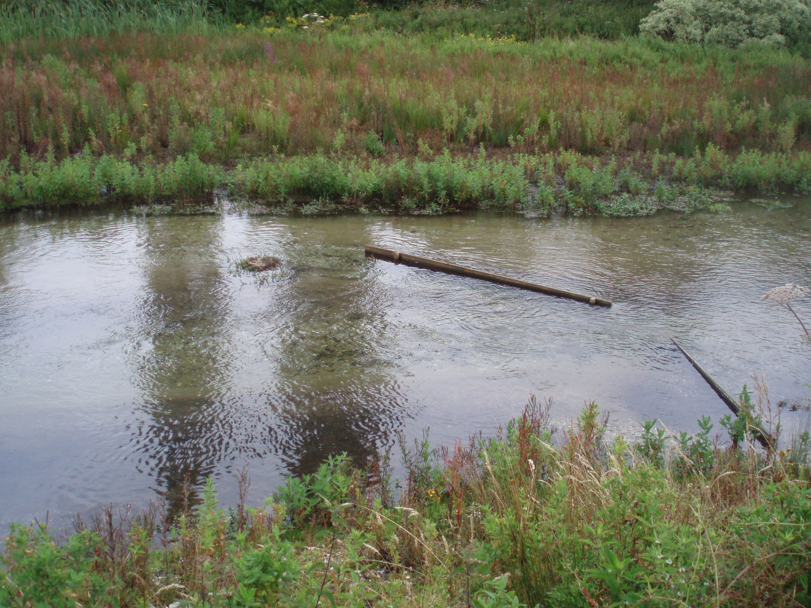
| 10:34, 8 July 2013 | LoRres89.JPG (file) |  |
936 KB | Creation of a wetland area at the downstream extent of the works - May 2011 ©AECOM | 1 |
| 10:30, 8 July 2013 | May 2011 Main channel.JPG (file) |  |
1,019 KB | May 2011 - The restored channel of the Braid Burn through Inch Park after two years. Marginal vegetation has established well and natural processes have enhanced the in-channel morphological features that were created. ©AECOM | 1 |
| 10:29, 8 July 2013 | Feb 2009 Complete.JPG (file) |  |
195 KB | Feb 2009 - During works. The new channel on completion. The gently sloped banks provide additional capacity and promote the natural processes of sediment transport and vegetation colonisation. This allows the burn to develop a more natural character with | 1 |
| 10:26, 8 July 2013 | Jan 2009 Opening meanders.JPG (file) |  |
359 KB | January 2009 - During works. New meander channel cut off-line and connected to the existing channel in stages once complete. The downstream end of each meander was opened up first and allowed to fill with water. Each meander was left for a period to allow | 1 |
| 10:21, 8 July 2013 | April 2006 Pre works.JPG (file) |  |
599 KB | Braid Burn as it flows through Inch Park before works were undertaken. April 2006. ©AECOM | 1 |
| 14:34, 4 July 2013 | Hawley July 2007c.jpg (file) |  |
890 KB | The restored reach of the River Darent at Hawley Manor after two years ©Alconbury Environmental | 1 |
| 14:29, 4 July 2013 | Darent 5 09 (3).jpg (file) | .jpg) |
6.4 MB | In-channel vegetation establishing well post works. ©Alconbury Environmental | 1 |