Uploads by NickRRC
Jump to navigation
Jump to search
This special page shows all uploaded files.
| Date | Name | Thumbnail | Size | Description | Versions |
|---|---|---|---|---|---|
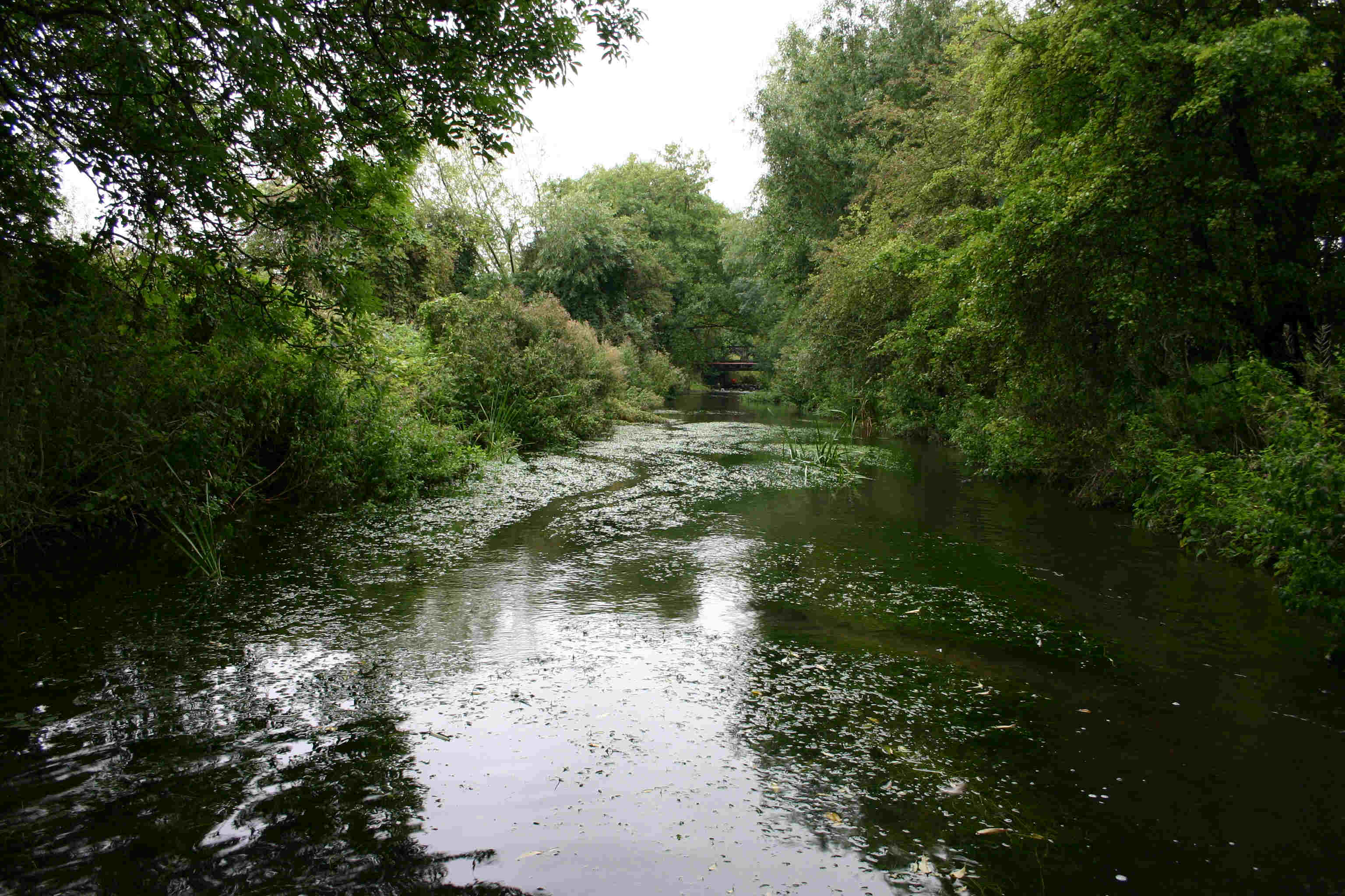
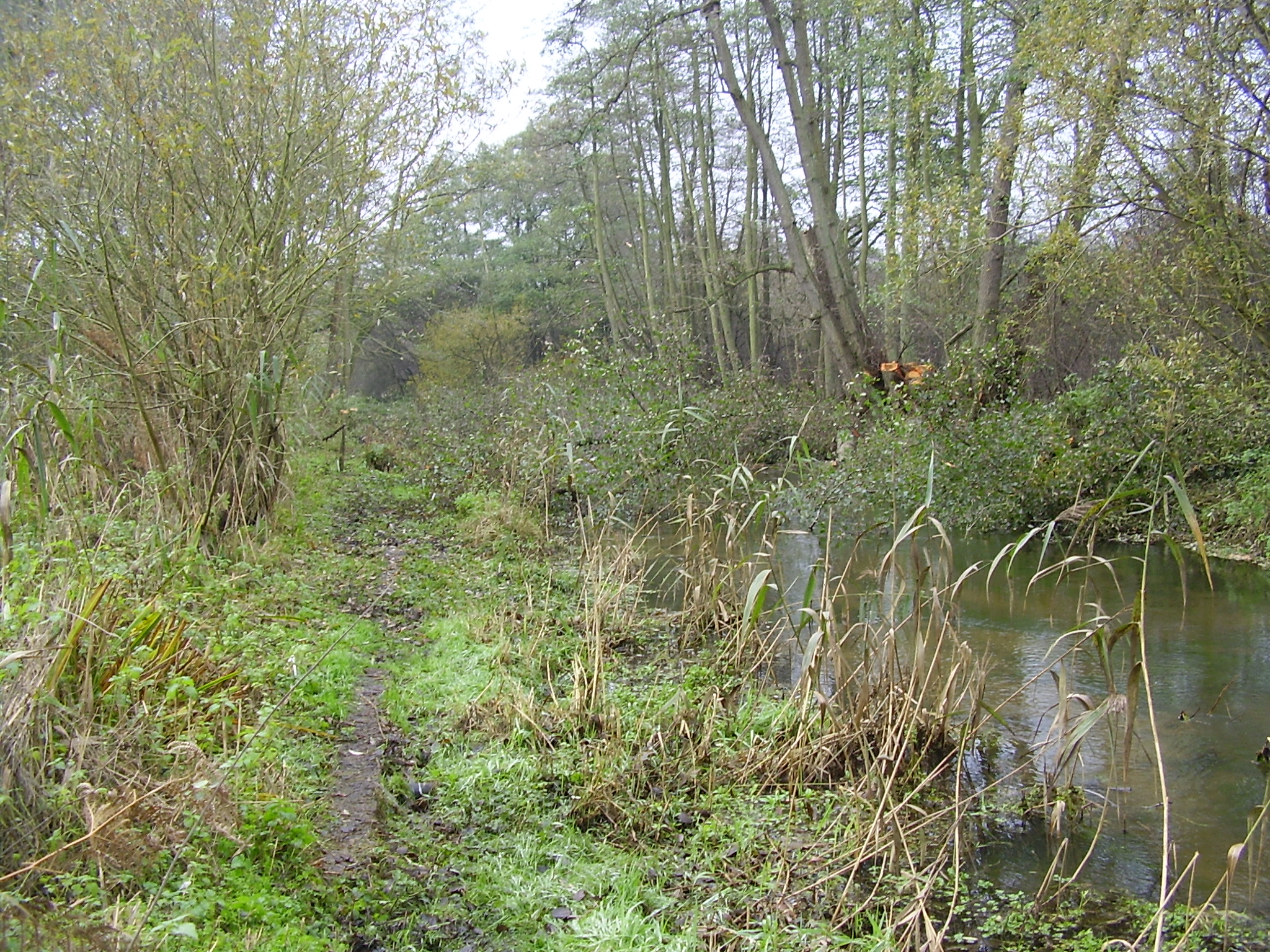
| 14:27, 4 July 2013 | Hm 5 BF.jpg (file) |  |
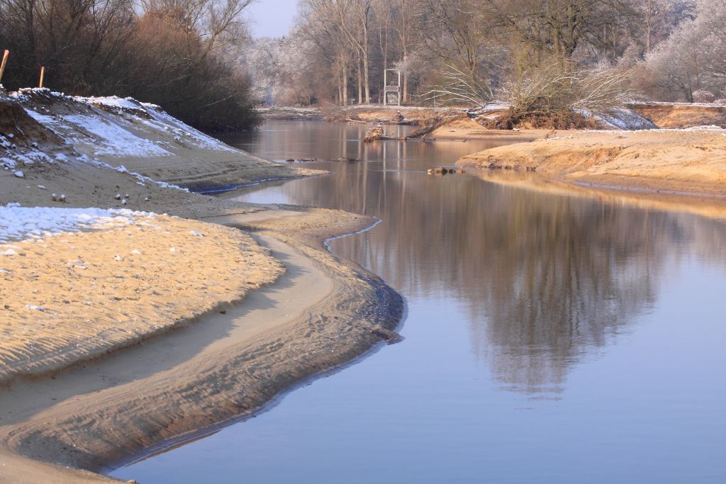
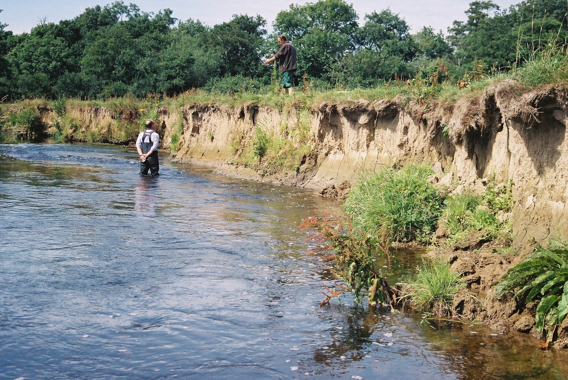
440 KB | The over widened River Darent prior to works starting. ©Alconbury Environmental | 1 |
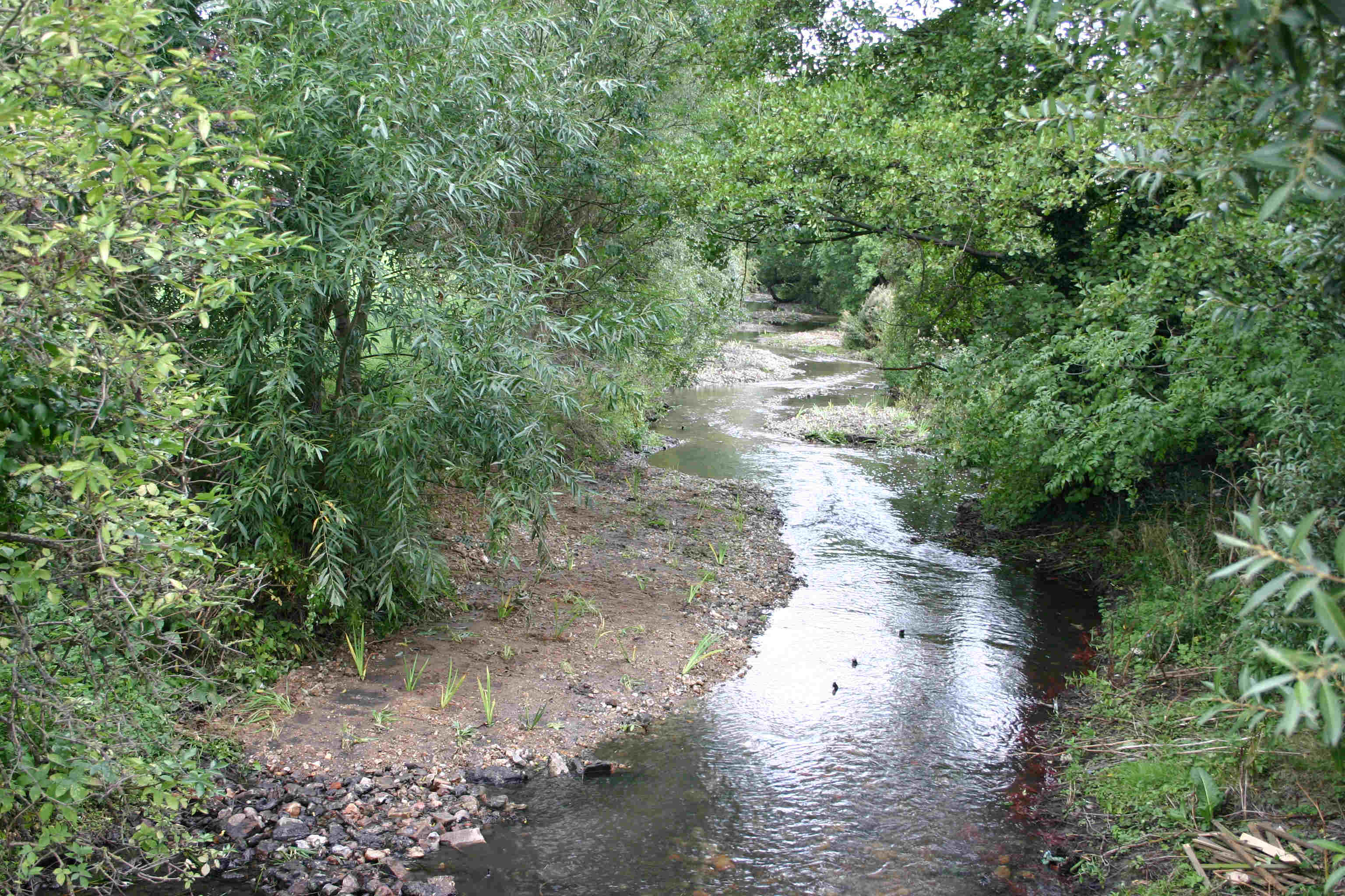
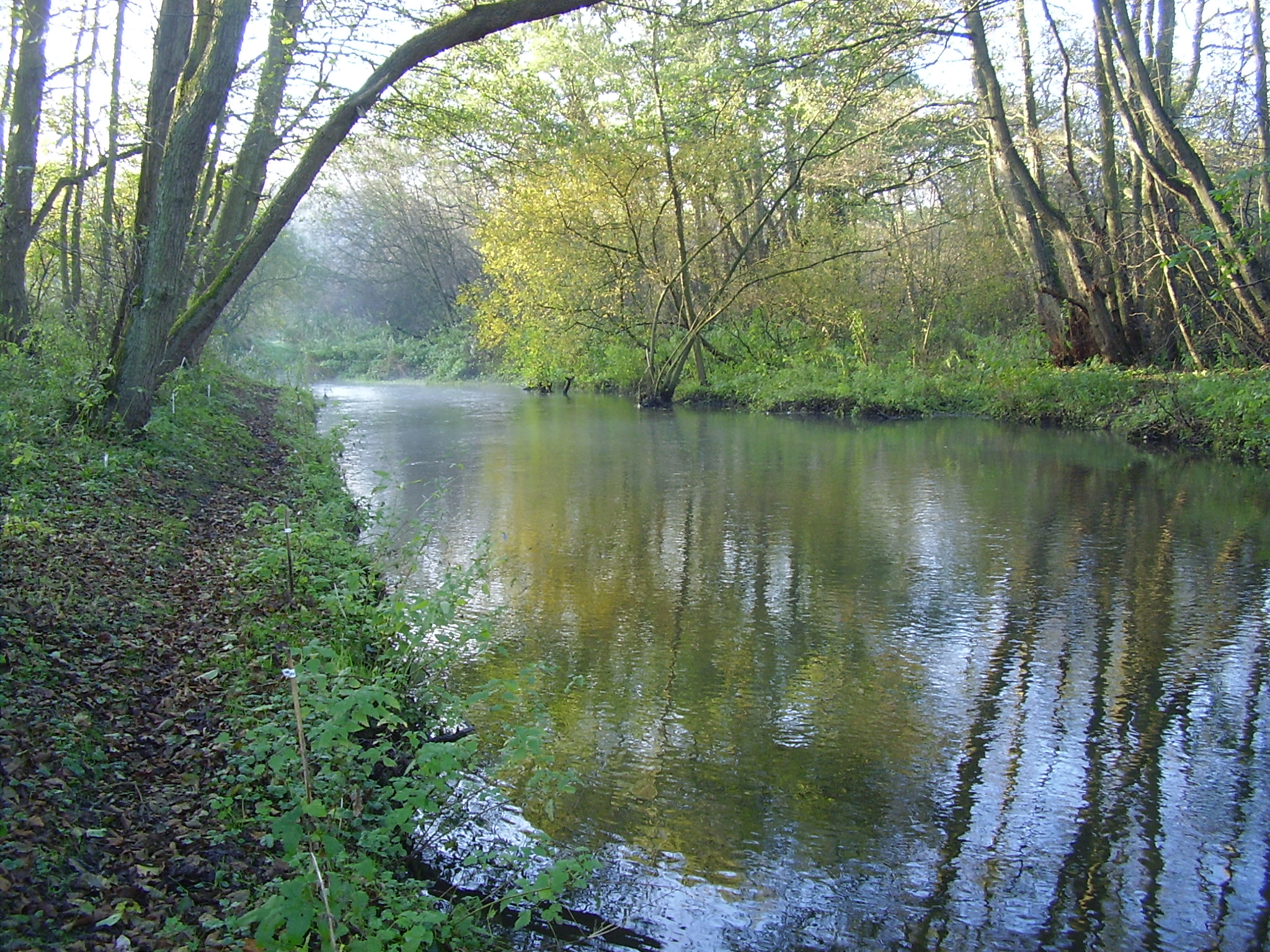
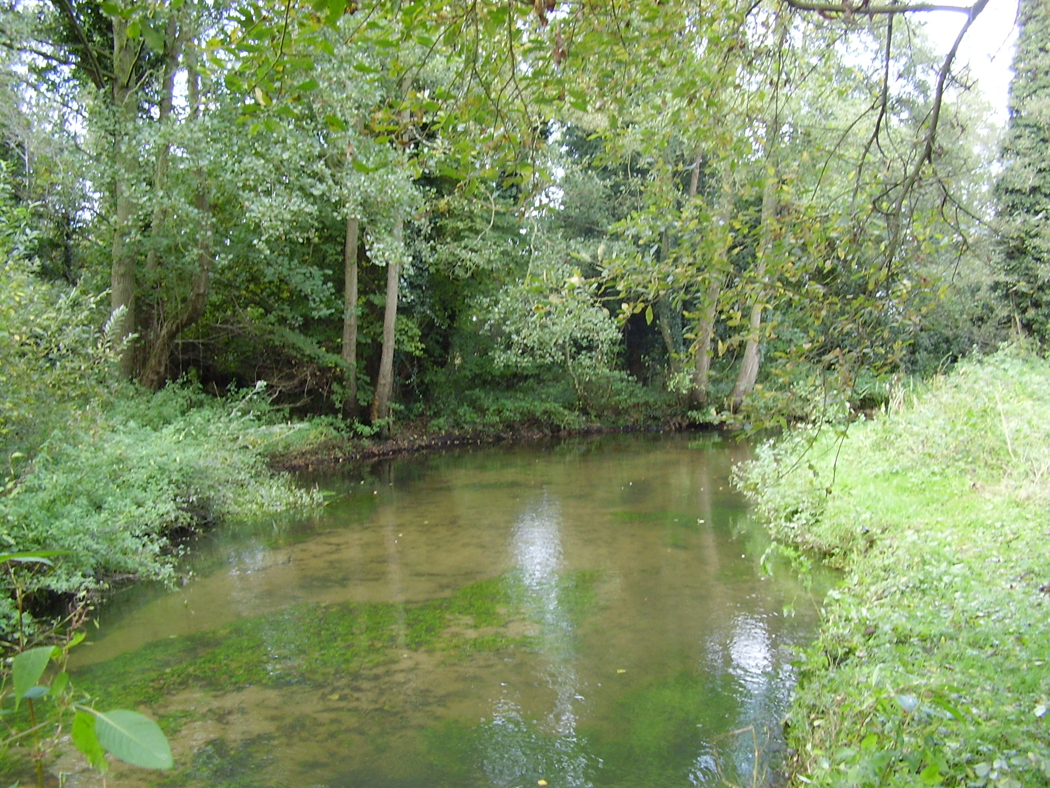
| 14:25, 4 July 2013 | HM2010 PPA.JPG (file) |  |
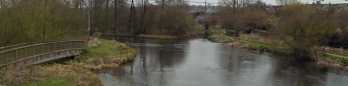
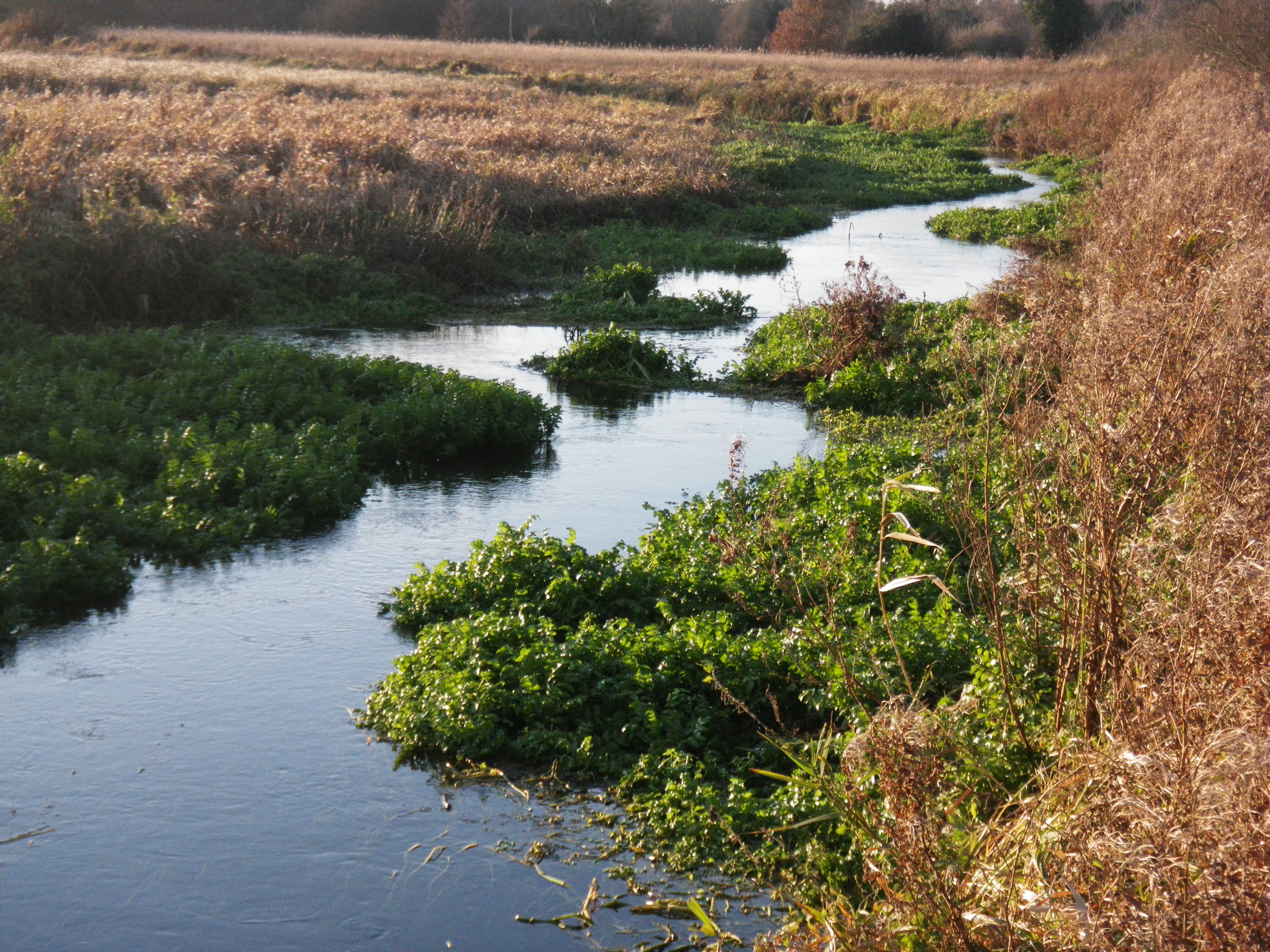
6.45 MB | The channel five years on. The planted berms have established well and variation in flow is evident. ©Alconbury Environmental | 1 |
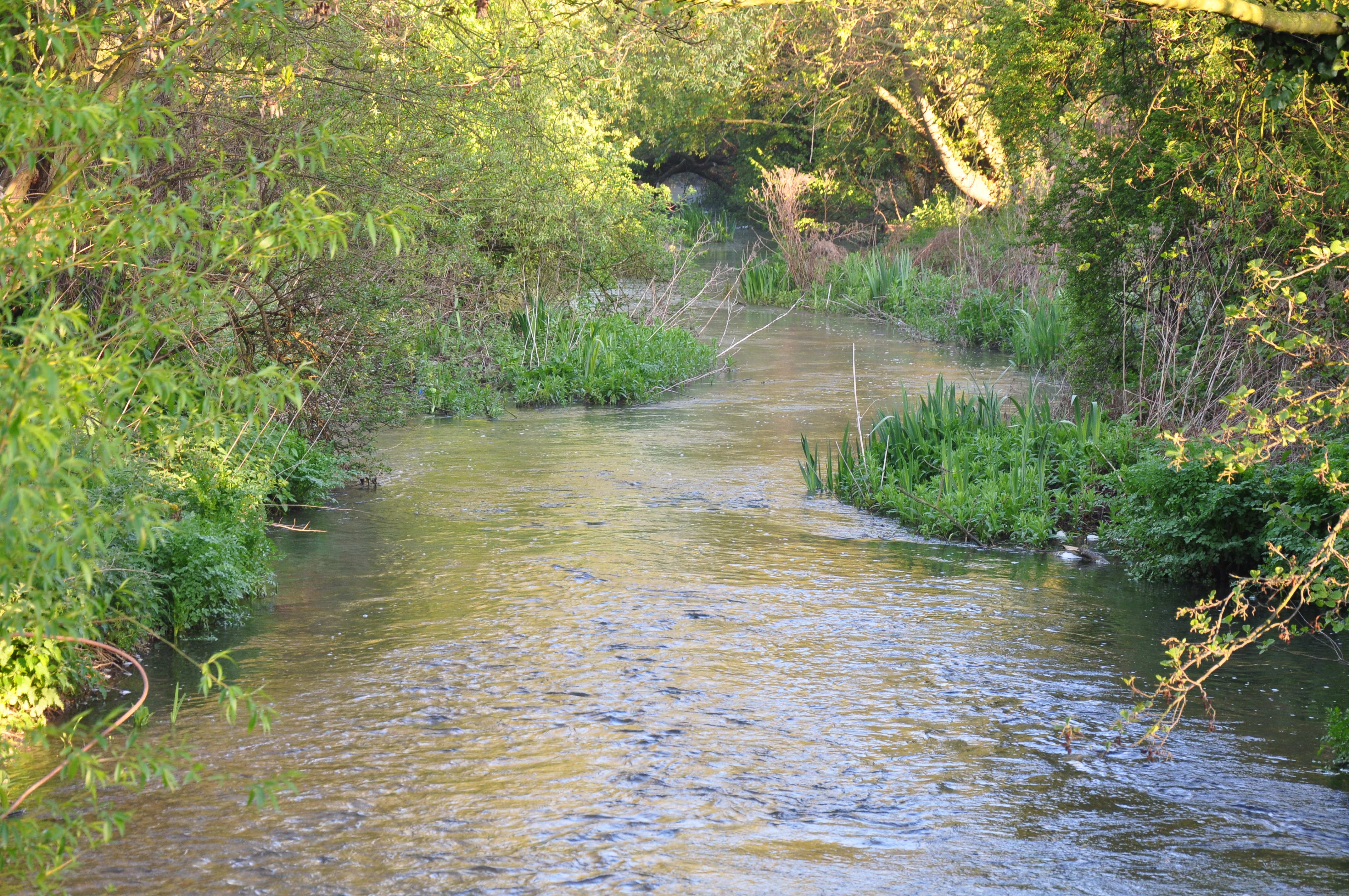
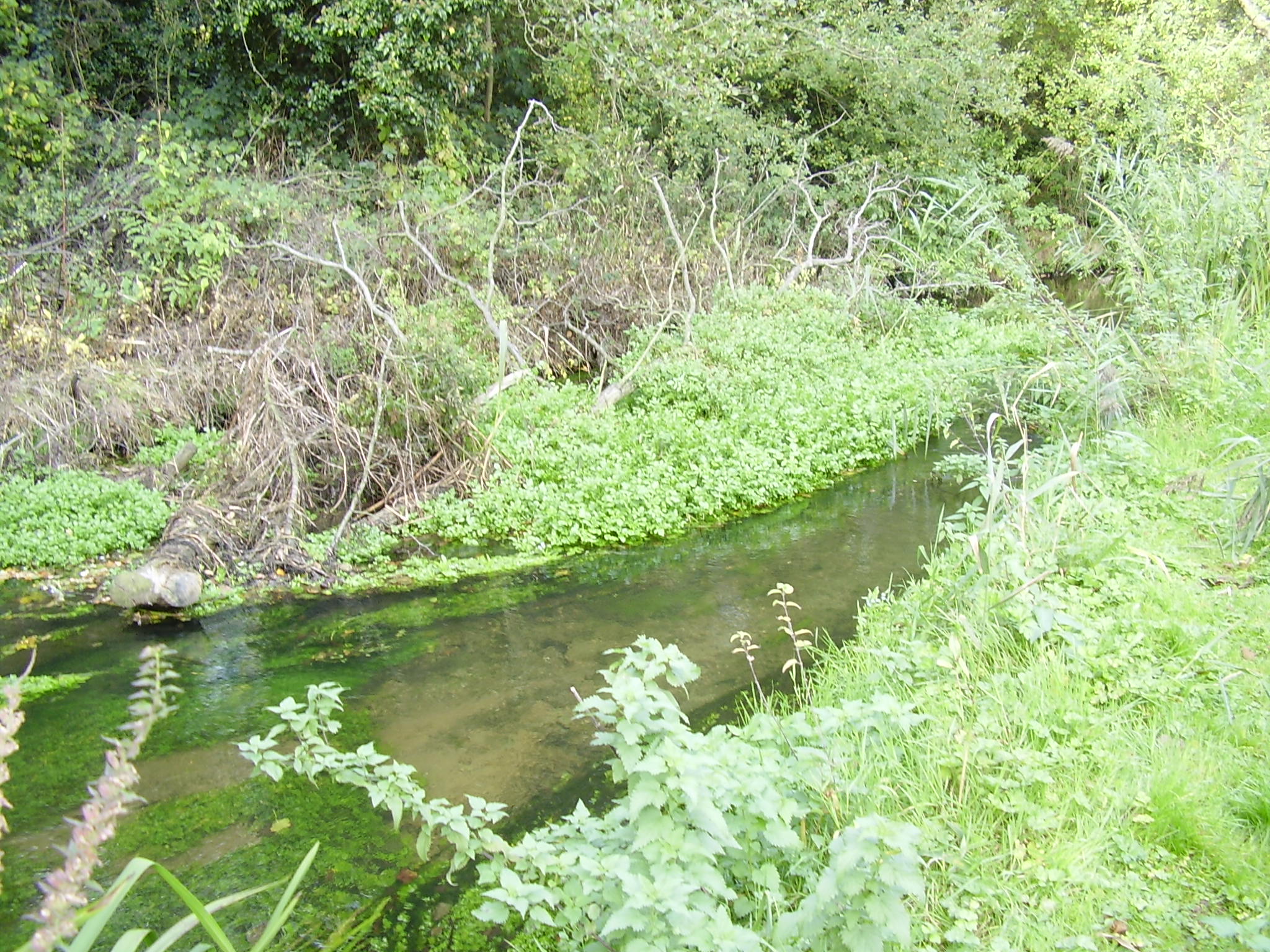
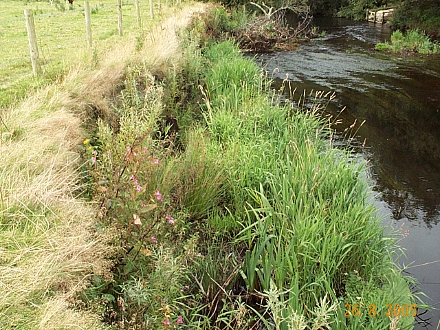
| 14:19, 4 July 2013 | HMAfter 2005.jpg (file) |  |
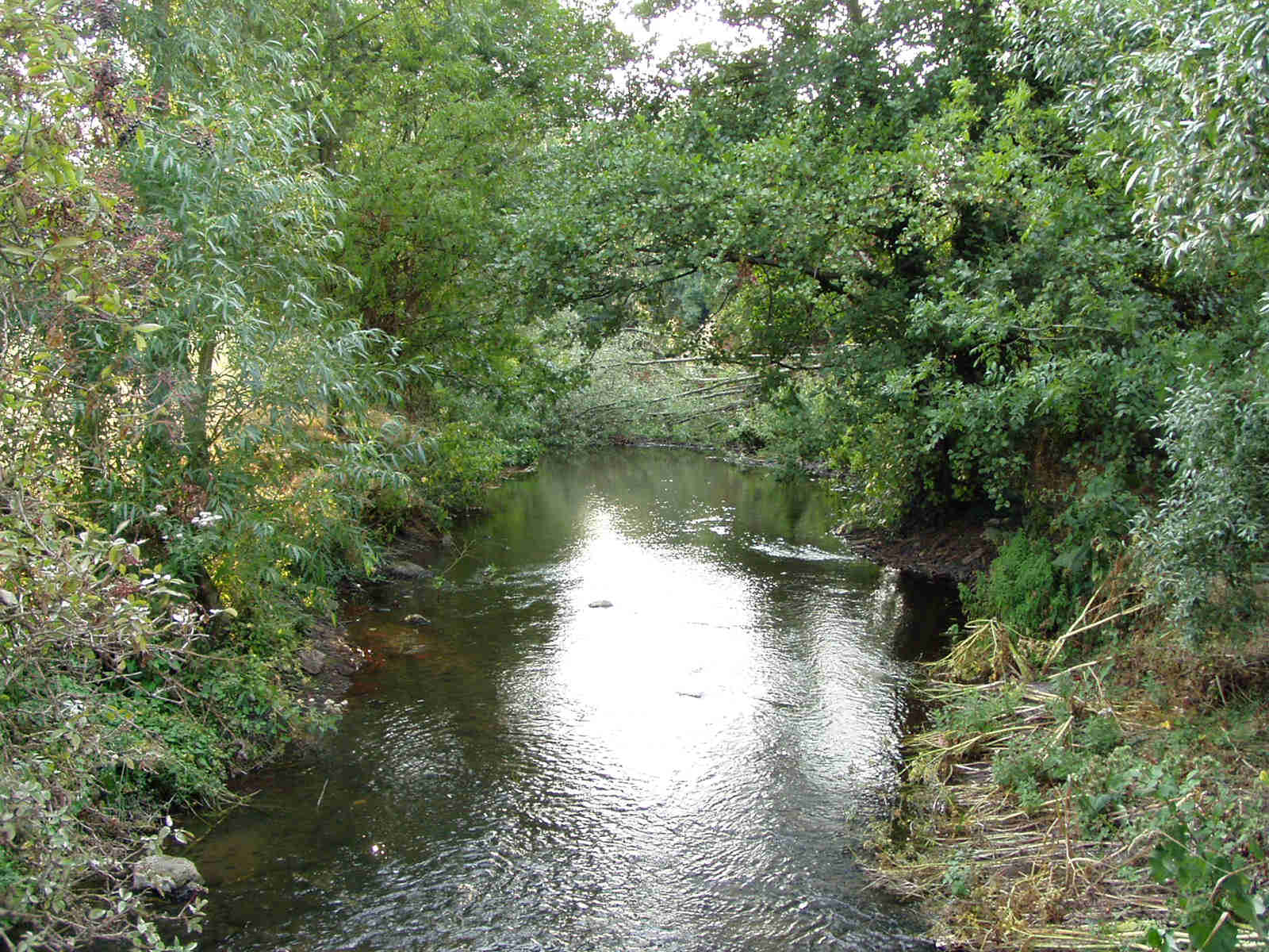
532 KB | Immediately after works. The newly planted berms and narrower and more sinuous channel are all visible. ©Alconbury Environmental | 1 |
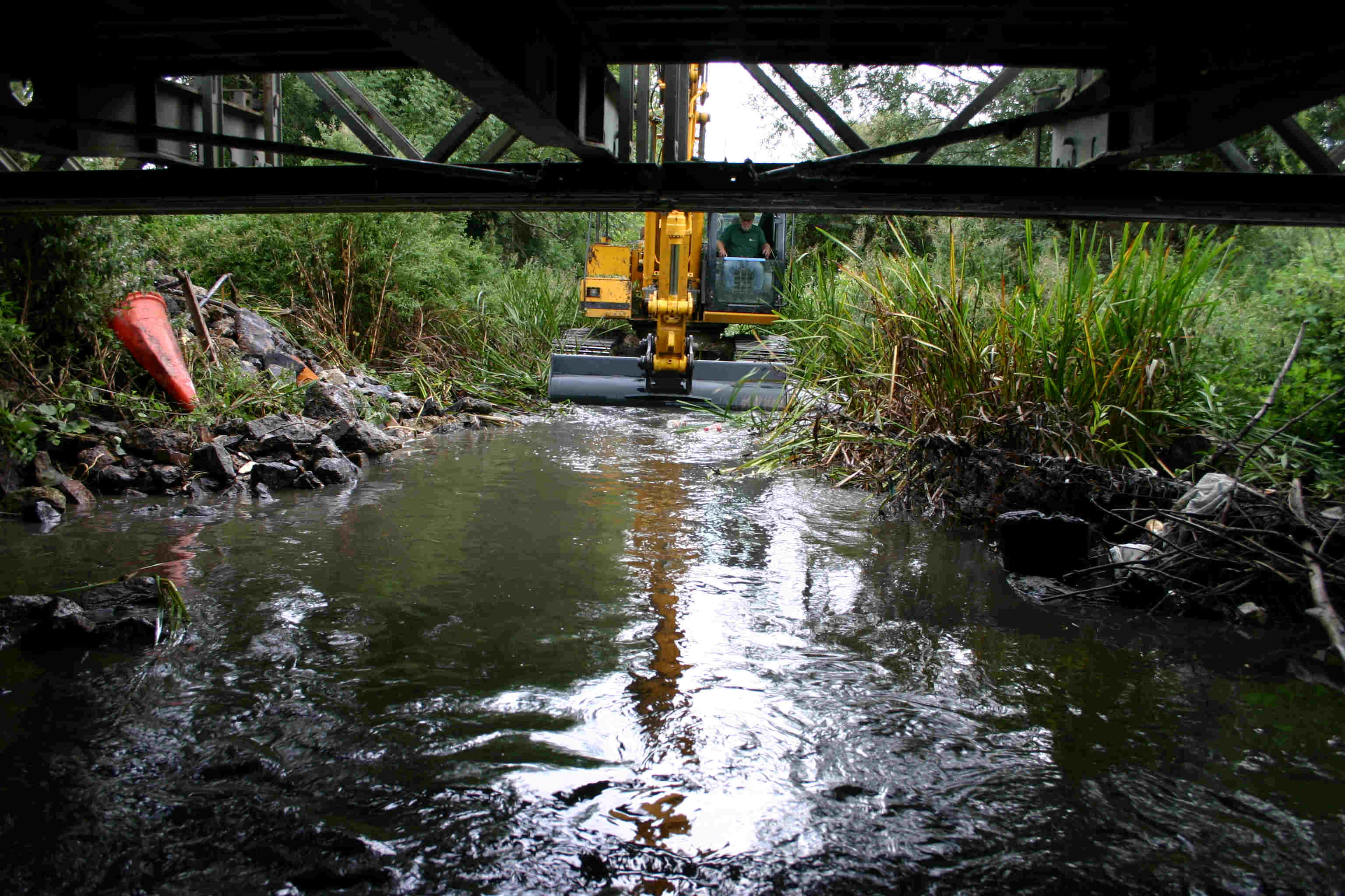
| 13:56, 4 July 2013 | HM 3d.jpg (file) |  |
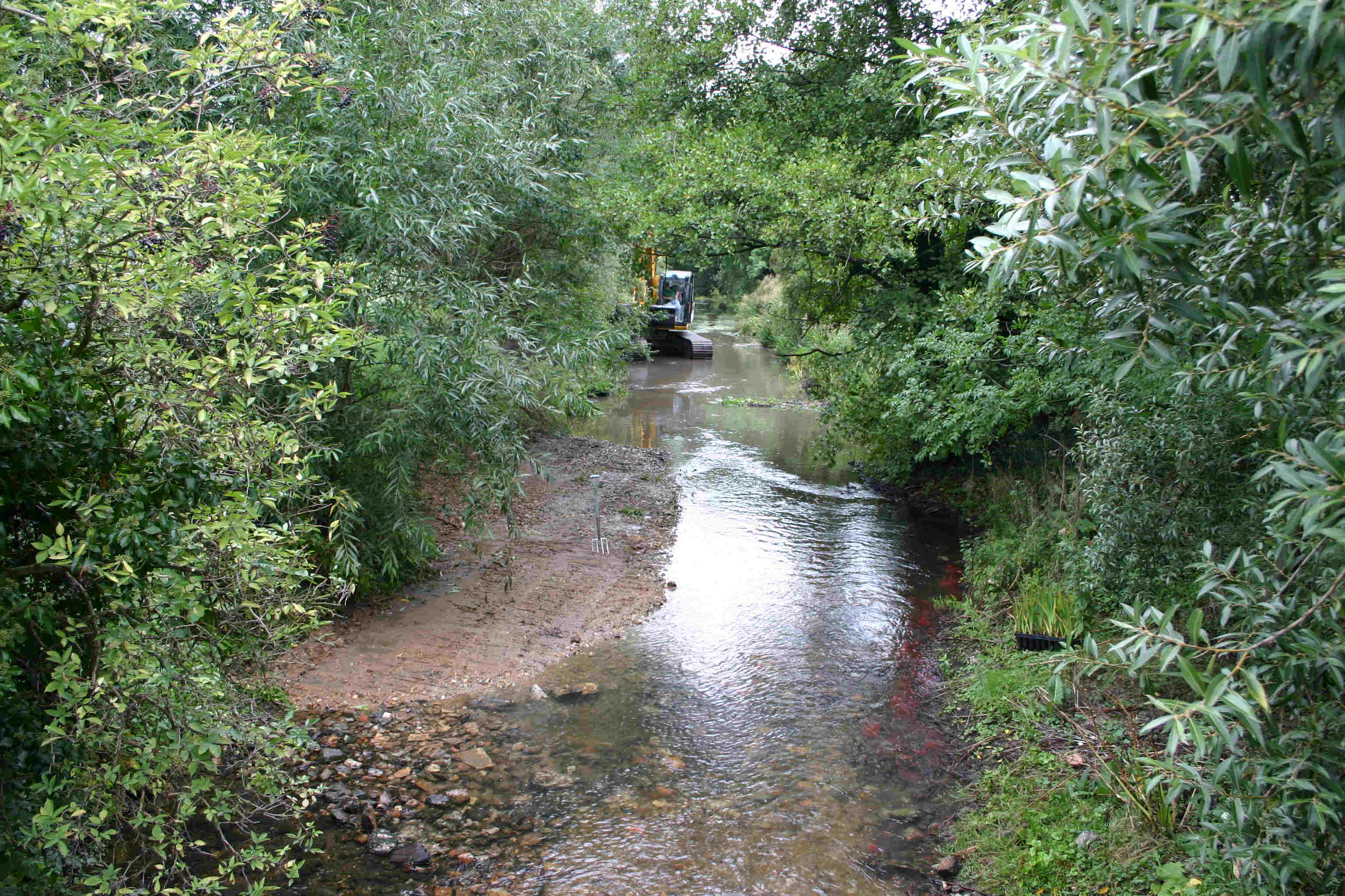
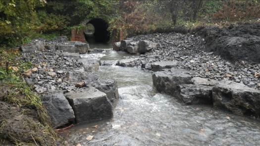
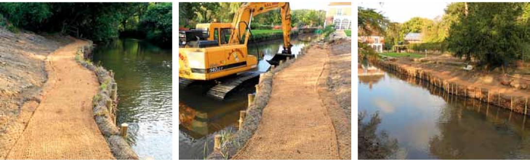
381 KB | Excavator carrying out in-channel works © Alconbury Environmental | 1 |
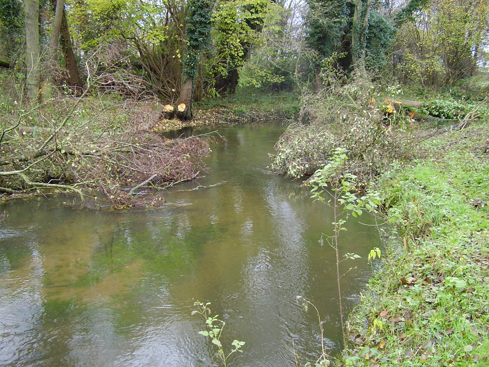
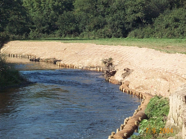
| 17:14, 3 July 2013 | HM2005 During.jpg (file) |  |
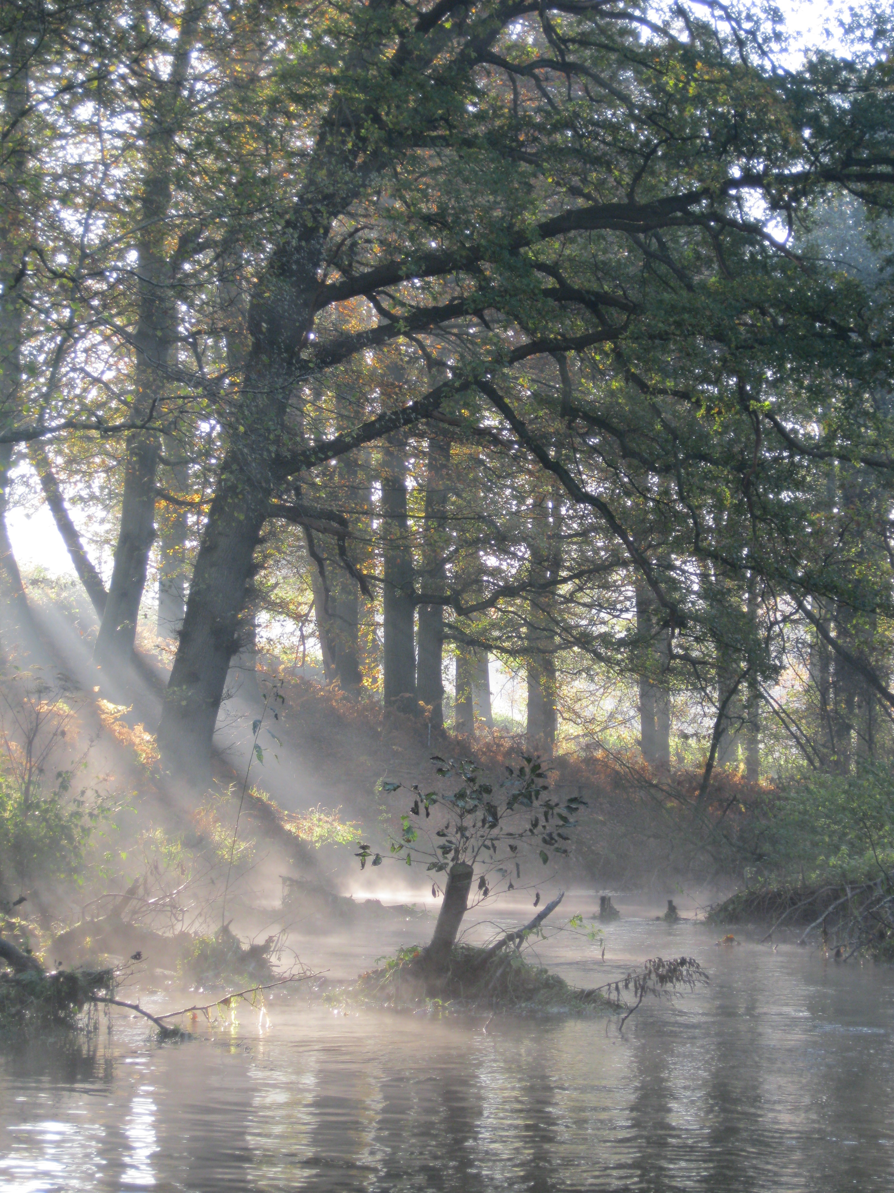
528 KB | During works. Long reach excavator can be seen in the background and newly created berms are visible in the foreground. ©Alconbury Environmental | 1 |
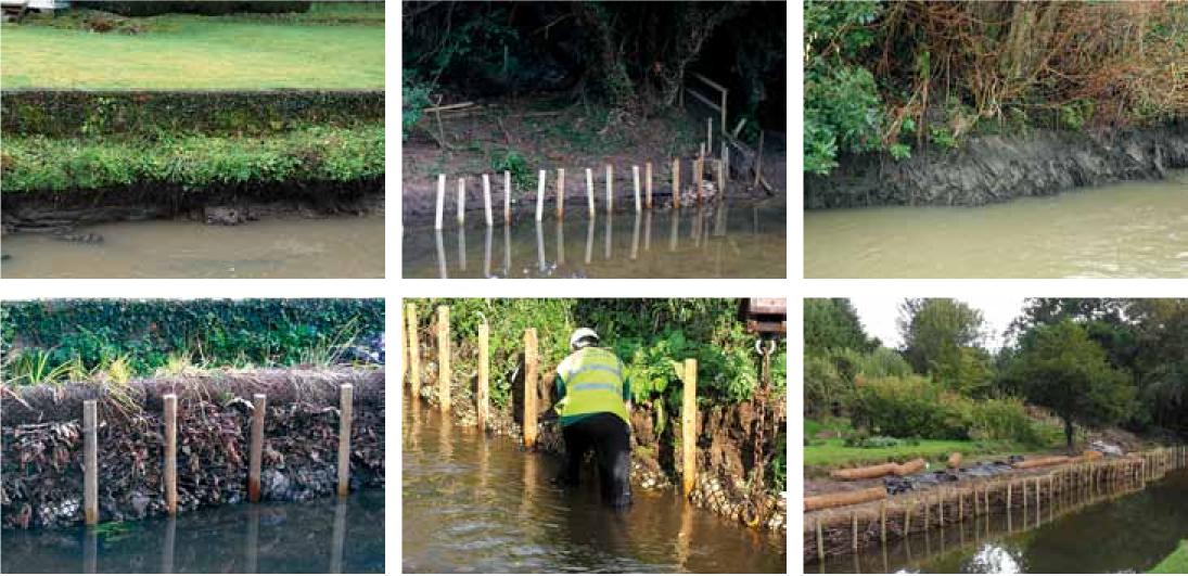
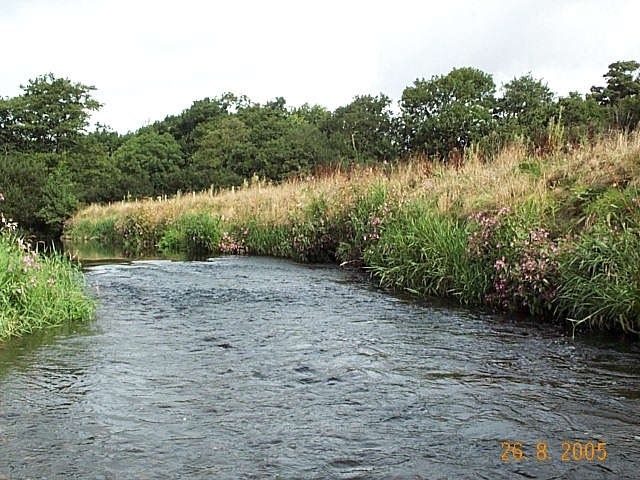
| 17:12, 3 July 2013 | HM2005 Before.JPG (file) |  |
247 KB | Darent at Hawley Manor before works (2005) ©Alconbury Environmental | 1 |
| 08:48, 17 May 2013 | Kennet Eddington.png (file) | 745 KB | 1 | ||
| 11:21, 10 May 2013 | WaterofDye.png (file) |  |
1.42 MB | 1 | |
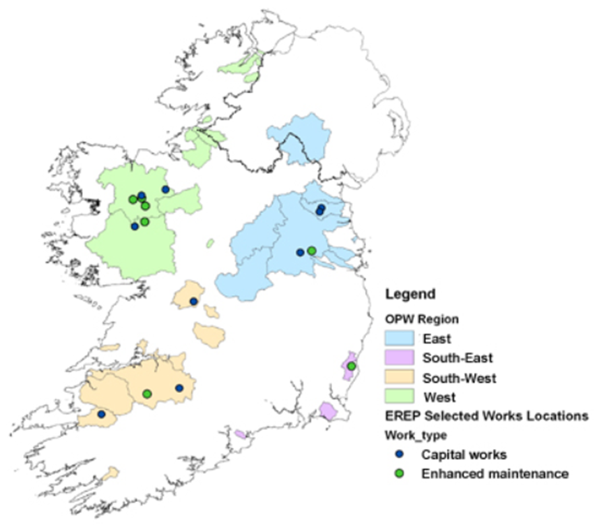
| 11:16, 10 May 2013 | Ire EREP.png (file) |  |
295 KB | 1 | |
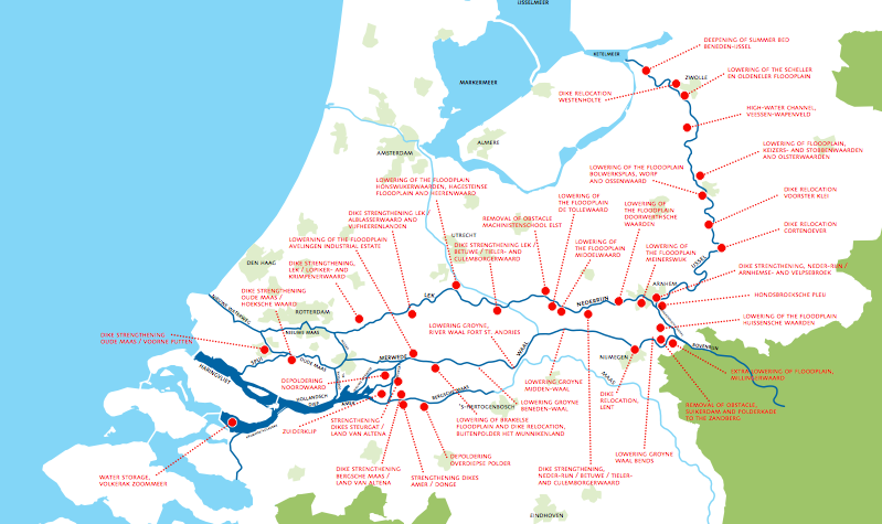
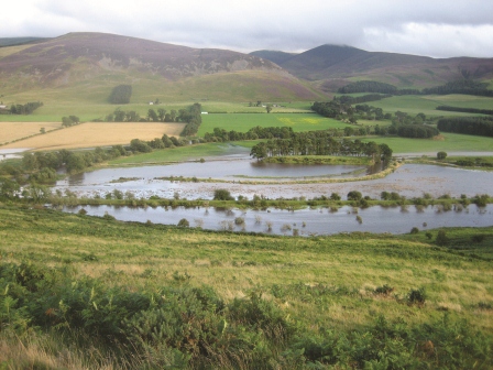
| 11:09, 10 May 2013 | Room for the River.png (file) |  |
183 KB | 1 | |
| 10:59, 10 May 2013 | Gelsa.png (file) |  |
4.03 MB | 1 | |
| 09:57, 10 May 2013 | Thames21 ManorPark, Lewisham.jpg (file) |  |
462 KB | 1 | |
| 09:35, 10 May 2013 | Ems LIFE.jpg (file) |  |
134 KB | 1 | |
| 09:12, 10 May 2013 | NarCastleAcre.JPG (file) |  |
4.02 MB | 1 | |
| 15:22, 31 January 2013 | 33.JPG (file) |  |
2.12 MB | 1 | |
| 15:22, 31 January 2013 | 33b.JPG (file) |  |
1.87 MB | 1 | |
| 13:19, 30 January 2013 | DSC02373.JPG (file) |  |
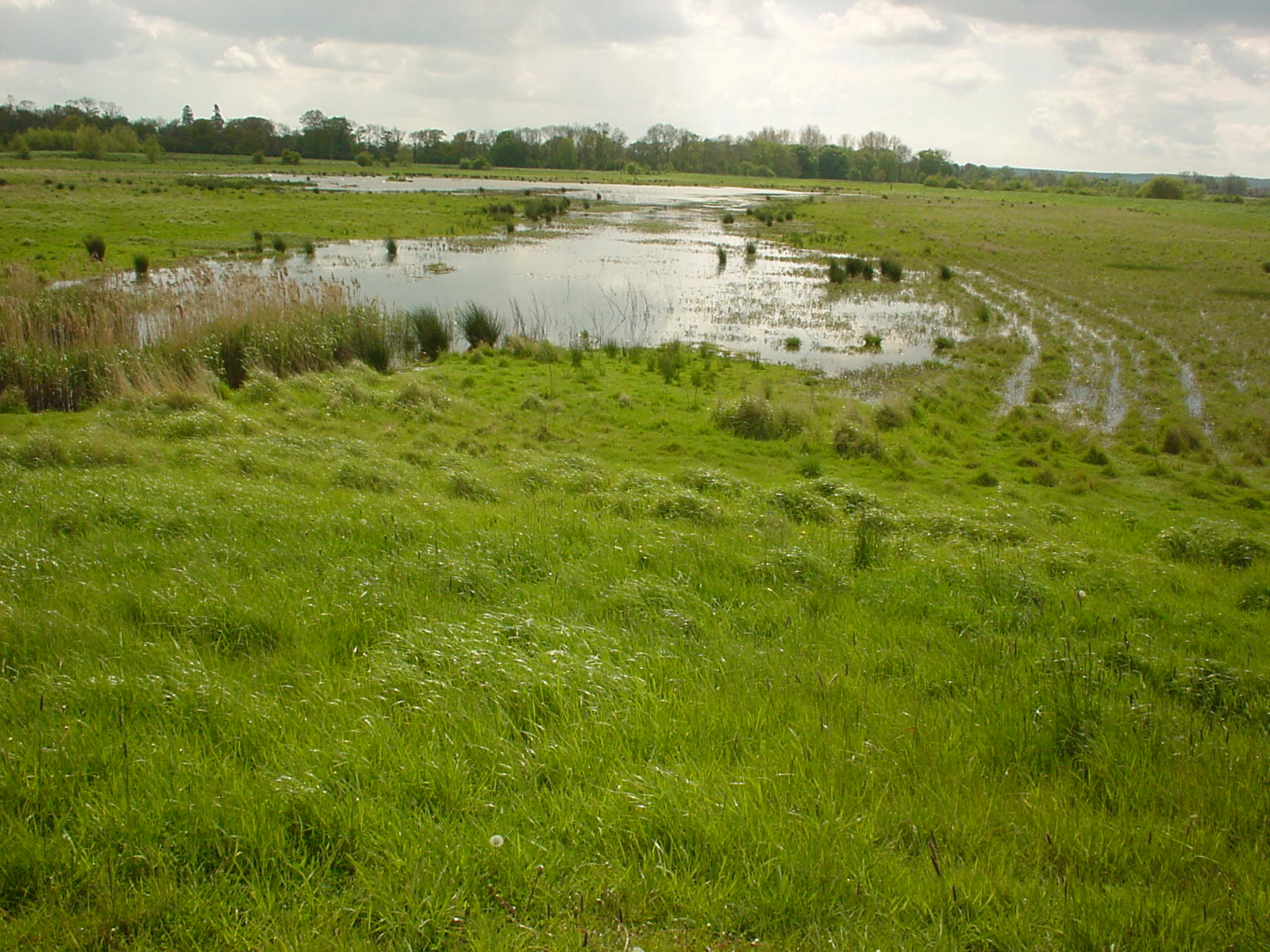
385 KB | Long Eau floodplain 2005 | 1 |
| 13:01, 28 January 2013 | MainsofDyce newlycompleted.jpg (file) |  |
162 KB | 1 | |
| 12:51, 28 January 2013 | Mill pool.png (file) |  |
1.25 MB | 1 | |
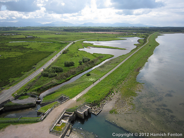
| 12:47, 28 January 2013 | Malltraeth Marsh.jpg (file) |  |
235 KB | 1 | |
| 12:44, 28 January 2013 | Hedleyhope Burn.png (file) |  |
395 KB | 1 | |
| 12:37, 28 January 2013 | Restoration 03.JPG (file) |  |
3.38 MB | 1 | |
| 12:27, 28 January 2013 | Eddleston Water catchment restoration.jpg (file) |  |
655 KB | 1 | |
| 11:29, 28 January 2013 | Abbeyweir.png (file) |  |
467 KB | 1 | |
| 11:25, 28 January 2013 | BLphoto.png (file) |  |
3.31 MB | 1 | |
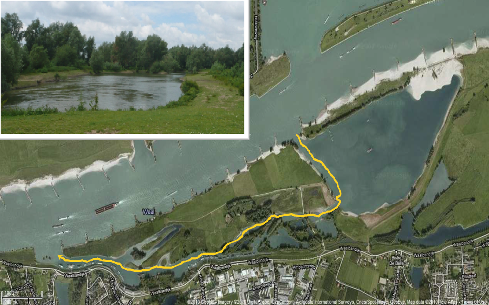
| 10:02, 28 January 2013 | Beneden Leeuwen.png (file) |  |
3.31 MB | Presentation - Ecological benefits of side channels in relation to their hydromorphological characteristics - Margriet Schoor | 1 |
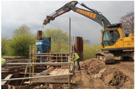
| 15:39, 23 January 2013 | Construction 3.jpg (file) |  |
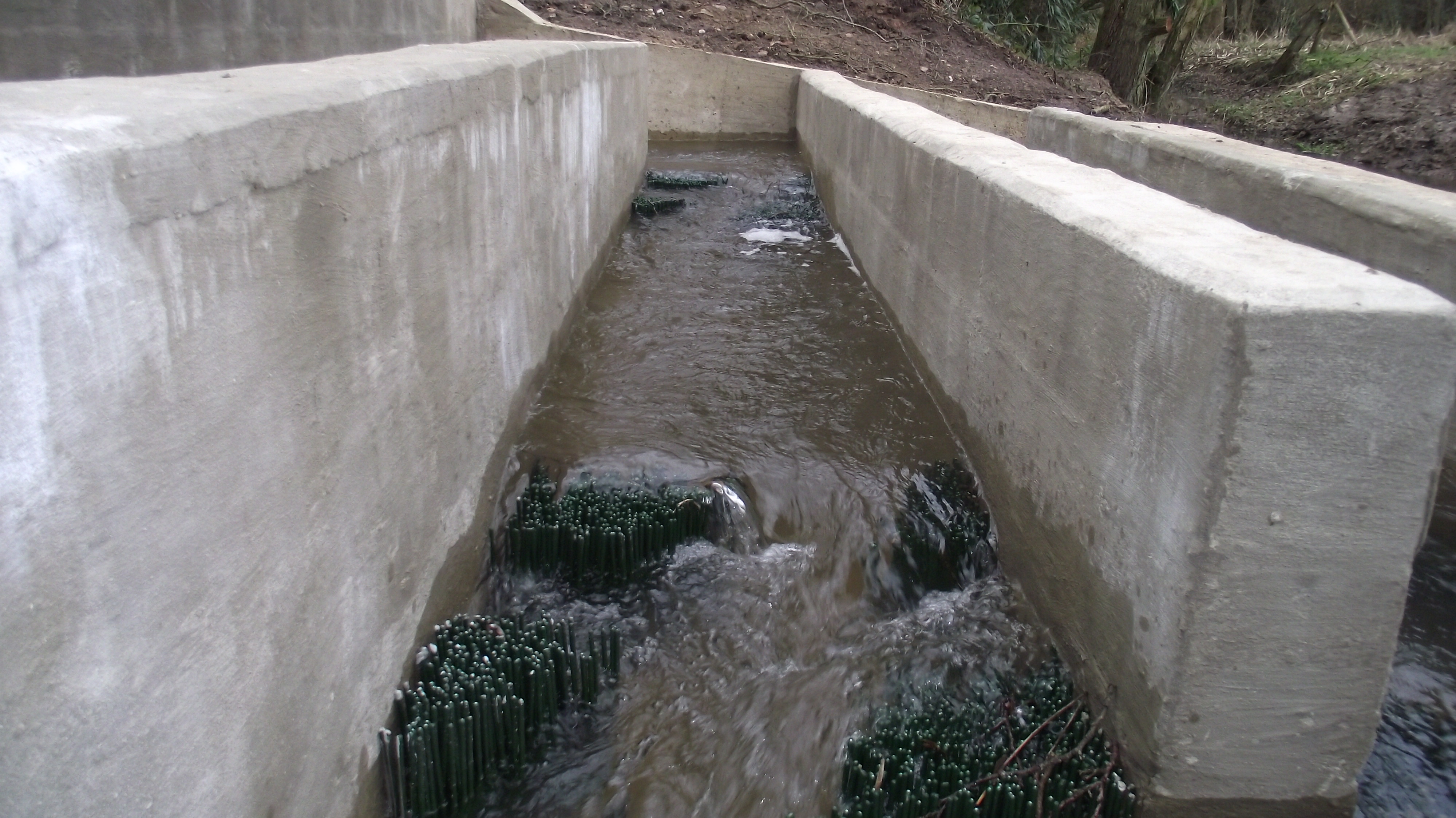
25 KB | fish pass (image courtesy of J.Finnegan at the Environment Agency) | 1 |
| 15:39, 23 January 2013 | Construction 2.jpg (file) |  |
27 KB | fish pass (image courtesy of J.Finnegan at the Environment Agency) | 1 |
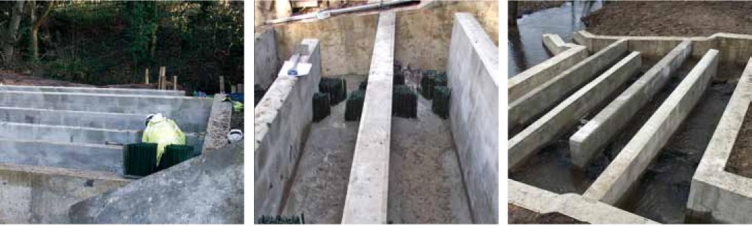
| 15:38, 23 January 2013 | Construction 1.jpg (file) |  |
27 KB | fish pass in construction (image courtesy of J.Finnegan at the Environment Agency) | 1 |
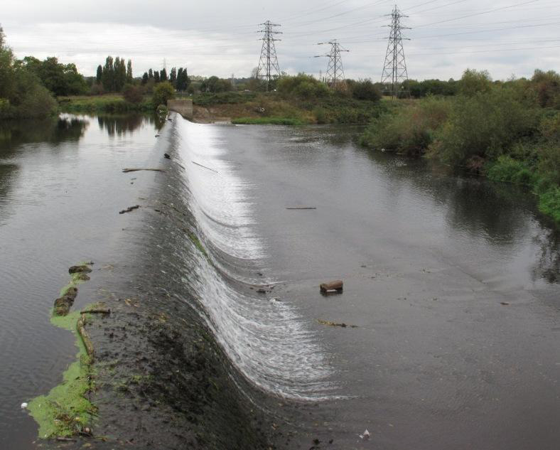
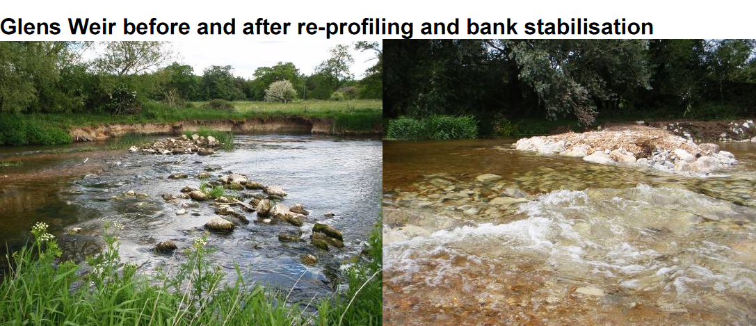
| 15:37, 23 January 2013 | Borrowash weir.png (file) |  |
709 KB | Borrowash weir 121m long (image courtesy of J.Finnegan at the Environment Agency) | 1 |
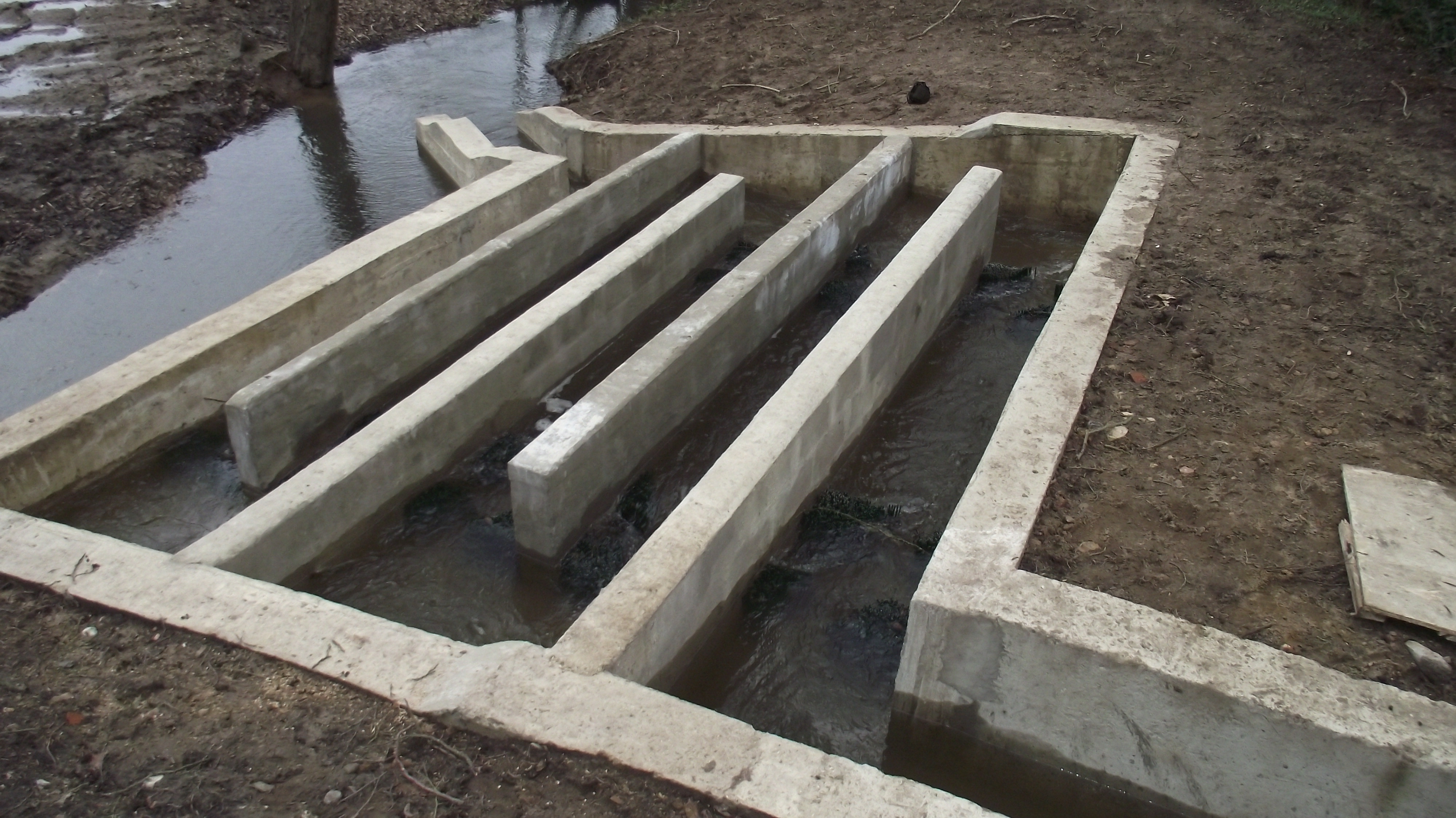
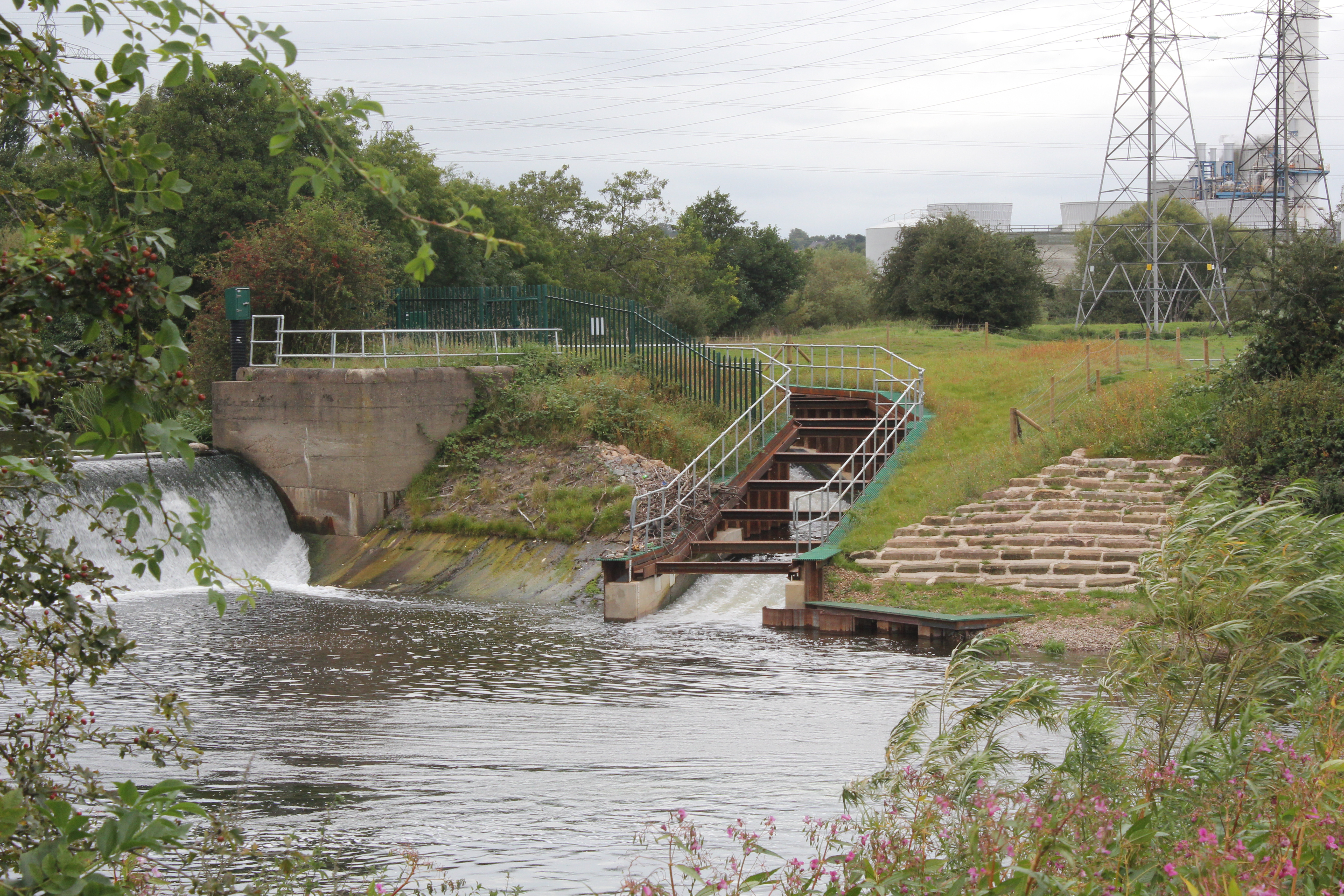
| 12:26, 23 January 2013 | Pass complete.jpg (file) |  |
9.11 MB | Larinier fish pass at Borrowash complete (image courtesy of J.Finnegan, the Environment Agency) | 1 |
| 17:32, 17 January 2013 | Before.jpg (file) |  |
1.46 MB | mill weir on the March Burn before fish pass installation (picture courtesy of P.Atkinson from the Tyne Rivers Trust) | 2 |
| 17:27, 16 January 2013 | Bioengineering2.jpg (file) |  |
67 KB | Bioengineering techniques used (image courtesy of A.Girdler at A.G.A Group) | 1 |
| 17:27, 16 January 2013 | Bioengineering.jpg (file) |  |
118 KB | Bioengineering techniques used (image courtesy of A.Girdler at A.G.A Group) | 1 |
| 17:26, 16 January 2013 | Fish pass.jpg (file) |  |
61 KB | Fish pass construction (image courtesy of A.Girdler at A.G.A Group) | 1 |
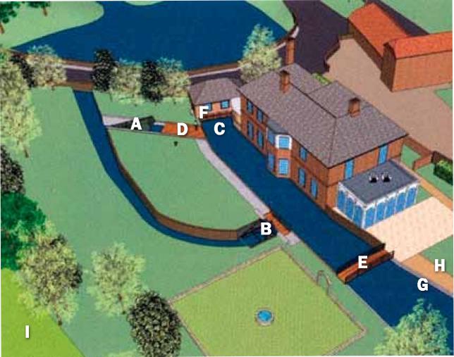
| 17:14, 16 January 2013 | Plan.jpg (file) |  |
51 KB | Plan of works at Mill House (image courtesy of A.Girdler of AGA Group) | 1 |
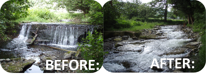
| 12:36, 14 January 2013 | Erft VI Before (left) and after (right) restoration.jpg (file) | _and_after_(right)_restoration.jpg) |
87 KB | Before (left) and after (right) restoration of the River Erft | 1 |
| 09:56, 14 January 2013 | Land use before restoration.jpeg (file) |  |
242 KB | Land use before restoration | 1 |
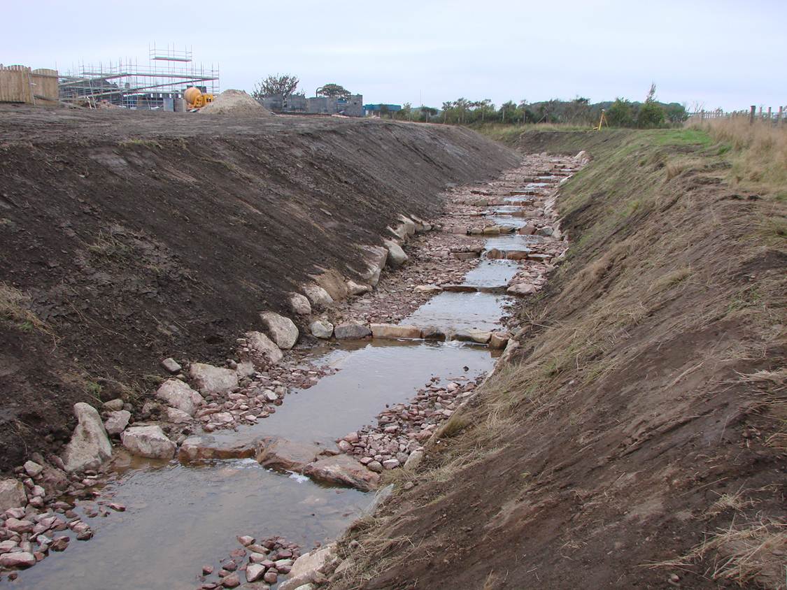
| 17:03, 7 January 2013 | P5150010.JPG (file) |  |
670 KB | An example of naturally occurring LWD that would have previously been removed | 1 |
| 15:41, 3 January 2013 | Upstream after.JPG (file) |  |
102 KB | Phase 2 site 1 after | 1 |
| 15:40, 3 January 2013 | Upstream during.JPG (file) |  |
1.74 MB | Phase 2 site 1 during | 1 |
| 15:39, 3 January 2013 | Upstream before.JPG (file) |  |
1.87 MB | Phase 2 site 1 before | 1 |
| 15:23, 3 January 2013 | After 2 .JPG (file) |  |
678 KB | Phase 1 site 2 after restoration | 1 |
| 15:22, 3 January 2013 | During 2 .JPG (file) |  |
656 KB | Phase 1 site 2 during restoration | 1 |
| 15:21, 3 January 2013 | Before 2 .JPG (file) |  |
692 KB | Phase 1 site 2 before restoration | 1 |
| 15:02, 2 January 2013 | Marginal habitat creation.jpg (file) |  |
199 KB | Marginal habitat creation (courtesy of Salix Water & Wetland Services Ltd) | 1 |
| 15:01, 2 January 2013 | Bank re-profiling.jpg (file) |  |
133 KB | bank re-profiling (courtesy of Salix Water & Wetland Services Ltd) | 1 |
| 14:50, 2 January 2013 | After 1.jpg (file) |  |
313 KB | Bank section after works complete 2005 (Salix Water & Wetland Services Ltd) | 1 |
| 14:48, 2 January 2013 | Before 1.jpg (file) |  |
2.35 MB | Bank section before works complete ( | 1 |
| 16:32, 18 December 2012 | Weir.png (file) |  |
1.04 MB | 1 |