File:Bijloop turfvaart Brabantse Delta.png: Difference between revisions
Jump to navigation
Jump to search
Bas Wullems (talk | contribs) (Map of the Bijloop/Turfvaart rivers. This case study takes place near the location marked Vloeiweide. Image source: Watersysteemanalyse Bijloop-Turfvaart, Waterschap Brabantse Delta. https://www.brabantsedelta.nl/_flysystem/media/watersysteemanalyse-b...) |
(No difference)
|
Latest revision as of 13:29, 23 November 2020
Map of the Bijloop/Turfvaart rivers. This case study takes place near the location marked Vloeiweide. Image source: Watersysteemanalyse Bijloop-Turfvaart, Waterschap Brabantse Delta. https://www.brabantsedelta.nl/_flysystem/media/watersysteemanalyse-bijloop-turfvaart.pdf
File history
Click on a date/time to view the file as it appeared at that time.
| Date/Time | Thumbnail | Dimensions | User | Comment | |
|---|---|---|---|---|---|
| current | 13:29, 23 November 2020 | 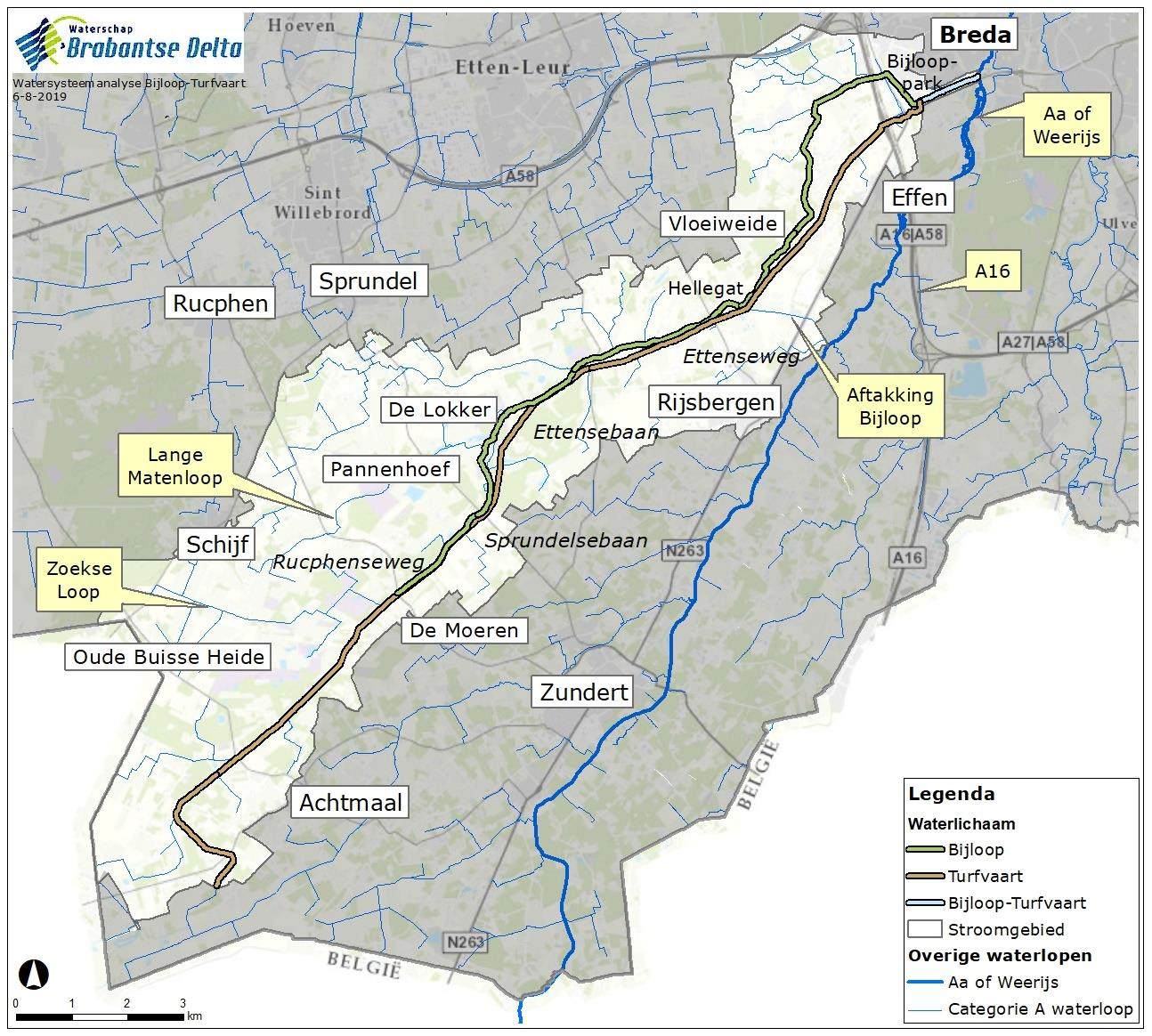 | 1,294 × 1,164 (2.14 MB) | Bas Wullems (talk | contribs) | Map of the Bijloop/Turfvaart rivers. This case study takes place near the location marked Vloeiweide. Image source: Watersysteemanalyse Bijloop-Turfvaart, Waterschap Brabantse Delta. https://www.brabantsedelta.nl/_flysystem/media/watersysteemanalyse-b... |
You cannot overwrite this file.
File usage
There are no pages that use this file.